Directions to Adriatico St (Manila) with public transportation
The following transit lines have routes that pass near Adriatico St
How to get to Adriatico St by bus?
Click on the bus route to see step by step directions with maps, line arrival times and updated time schedules.
How to get to Adriatico St by train?
Click on the train route to see step by step directions with maps, line arrival times and updated time schedules.
Bus stops near Adriatico St in Manila
- Malate Catholic School - Boys Department, Madre Ignacia, Manila, 4 min walk,
- Marcelo H. Del Pilar, Manila, 5 min walk,
- Hotel Victoria, M Adriatico, Manila, 5 min walk,
- Marcelo H. Del Pilar / Sinagoga Intersection, Manila, 8 min walk,
Bus lines to Adriatico St in Manila
- JEEP, N. S. Amoranto Sr. Avenue / Biak An Bato Intersection, Quezon City,
- JEEP, Pasay Rtda v Sta Cruz Blumentrit,
- JEEP, Baclaran - Blumentritt via Mabini, Sta. Cruz,
- JEEP, FRISCO-VITO CRUZvia MABINI,
- JEEP, Blumentrit Vito Cruz via L Guinto Sta C,
- JEEP, Escolta-MCU via GDelMundo,
- JEEP, Libertad Monumento via Mabini,
- JEEP, BACLARAN - DIVISORIA,
- JEEP, Blumentritt - Libertad via Sta. Cruz, Mabini,
- JEEP, PROJ 2&3-VITO CRUZ MABINI,
- JEEP, MCU LIBERTADvi MABINIF HARRISON,
- JEEP, LIBERTAD-PIER SOUTH,
- JEEP, Blumentritt - Pasay RTDA. via Sta. Cruz, Mabini,
- JEEP, Blumentritt - Libertad via Quiapo, Mabini,
- JEEP, Baclaran - Q.I.via Mabini,
- JEEP, Blumentrit Mabini via Quiapo,
- JEEP, Dapitan - Libertad via Mabini,
- JEEP, Blumentritt - Vito Cruz via Quiapo, Mabini,
- JEEP, Baclaran - P. Campa via Mabini,
- JEEP, Escolta-Libertad via Mabini,
What are the closest stations to Adriatico St?
The closest stations to Adriatico St are:
- Malate Catholic School - Boys Department, Madre Ignacia, Manila is 240 meters away, 4 min walk.
- Marcelo H. Del Pilar, Manila is 284 meters away, 5 min walk.
- Hotel Victoria, M Adriatico, Manila is 317 meters away, 5 min walk.
- Marcelo H. Del Pilar / Sinagoga Intersection, Manila is 560 meters away, 8 min walk.
Which bus lines stop near Adriatico St?
These bus lines stop near Adriatico St: BUS, JEEP.
Which train lines stop near Adriatico St?
These train lines stop near Adriatico St: LRT 1, PNR MC.
What’s the nearest bus stop to Adriatico St in Manila?
The nearest bus stop to Adriatico St in Manila is Malate Catholic School - Boys Department, Madre Ignacia, Manila. It’s a 4 min walk away.
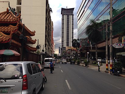
See Adriatico St, Manila, on the map
Public Transit to Adriatico St in Manila
Wondering how to get to Adriatico St in Manila, Philippines? Moovit helps you find the best way to get to Adriatico St with step-by-step directions from the nearest public transit station.
Moovit provides free maps and live directions to help you navigate through your city. View schedules, routes, timetables, and find out how long does it take to get to Adriatico St in real time.
Looking for the nearest stop or station to Adriatico St? Check out this list of stops closest to your destination: Malate Catholic School - Boys Department; Marcelo H. Del Pilar; Hotel Victoria; Marcelo H. Del Pilar / Sinagoga Intersection.
Bus: BUS, JEEP.Train: LRT 1, PNR MC.
Want to see if there’s another route that gets you there at an earlier time? Moovit helps you find alternative routes or times. Get directions from and directions to Adriatico St easily from the Moovit App or Website.
We make riding to Adriatico St easy, which is why over 1.5 million users, including users in Manila, trust Moovit as the best app for public transit. You don’t need to download an individual bus app or train app, Moovit is your all-in-one transit app that helps you find the best bus time or train time available.
For information on prices of bus and train, costs and ride fares to Adriatico St, please check the Moovit app.
Use the app to navigate to popular places including to the airport, hospital, stadium, grocery store, mall, coffee shop, school, college, and university.
Adriatico St Address: Barangay 702, Manila street in Manila
Attractions near Adriatico St
How to get to popular places in Manila with public transit
Get around Manila by public transit!
Traveling around Manila has never been so easy. See step by step directions as you travel to any attraction, street or major public transit station. View bus and train schedules, arrival times, service alerts and detailed routes on a map, so you know exactly how to get to anywhere in Manila.
When traveling to any destination around Manila use Moovit's Live Directions with Get Off Notifications to know exactly where and how far to walk, how long to wait for your line, and how many stops are left. Moovit will alert you when it's time to get off — no need to constantly re-check whether yours is the next stop.
Wondering how to use public transit in Manila or how to pay for public transit in Manila? Moovit public transit app can help you navigate your way with public transit easily, and at minimum cost. It includes public transit fees, ticket prices, and costs. Looking for a map of Manila public transit lines? Moovit public transit app shows all public transit maps in Manila with all bus or train routes and stops on an interactive map.
Manila has 2 transit type(s), including: bus or train, operated by several transit agencies, including MRTC, LRTA, PNR, LTFRB, BGC Bus, P2P and UV Express