See Aeropuerto Internacional De La Ciudad De México, Gustavo A. Madero, on the map
Directions to Aeropuerto Internacional De La Ciudad De México (Gustavo A. Madero) with public transportation
The following transit lines have routes that pass near Aeropuerto Internacional De La Ciudad De México
 Bus:
Bus: - Metro:
How to get to Aeropuerto Internacional De La Ciudad De México by bus?
Click on the bus route to see step by step directions with maps, line arrival times and updated time schedules.
How to get to Aeropuerto Internacional De La Ciudad De México by metro?
Click on the metro route to see step by step directions with maps, line arrival times and updated time schedules.
Metro stations near Aeropuerto Internacional De La Ciudad De México in Gustavo A. Madero
- Terminal Aérea,23 min walk,
- Oceanía,34 min walk,
Bus stations near Aeropuerto Internacional De La Ciudad De México in Gustavo A. Madero
- Calle Colones Peñón De Los Baños Venustiano Carranza Cdmx 15510 México,18 min walk,
- Calle Aguascalientes Peñón De Los Baños Venustiano Carranza Cdmx 15510 México,21 min walk,
- Calle 602 Vía Tapo, 3109,39 min walk,
Bus lines to Aeropuerto Internacional De La Ciudad De México in Gustavo A. Madero
- RUTA 3,Metro Moctezuma,
- 304,Pañón de Los Baños,
- 333,Orozco Y Berra,
- RUTA 3,Moctezuma,
- 6,Balbuena (Metro),
What are the closest stations to Aeropuerto Internacional De La Ciudad De México?
The closest stations to Aeropuerto Internacional De La Ciudad De México are:
- Terminal Aérea is 189 meters away, 23 min walk.
- Calle Colones Peñón De Los Baños Venustiano Carranza Cdmx 15510 México is 454 meters away, 18 min walk.
- Calle Aguascalientes Peñón De Los Baños Venustiano Carranza Cdmx 15510 México is 634 meters away, 21 min walk.
- Oceanía is 1671 meters away, 34 min walk.
- Calle 602 Vía Tapo, 3109 is 2104 meters away, 39 min walk.
Which bus lines stop near Aeropuerto Internacional De La Ciudad De México?
These bus lines stop near Aeropuerto Internacional De La Ciudad De México: 168, 200, 304, 4, 43, CONGESA.
Which metro line stops near Aeropuerto Internacional De La Ciudad De México?
5
What’s the nearest metro station to Aeropuerto Internacional De La Ciudad De México in Gustavo A. Madero?
The nearest metro station to Aeropuerto Internacional De La Ciudad De México in Gustavo A. Madero is Terminal Aérea. It’s a 23 min walk away.
See Aeropuerto Internacional De La Ciudad De México, Gustavo A. Madero, on the map
Public Transit to Aeropuerto Internacional De La Ciudad De México in Gustavo A. Madero
Wondering how to get to Aeropuerto Internacional De La Ciudad De México in Gustavo A. Madero, México? Moovit helps you find the best way to get to Aeropuerto Internacional De La Ciudad De México with step-by-step directions from the nearest public transit station.
Moovit provides free maps and live directions to help you navigate through your city. View schedules, routes, timetables, and find out how long does it take to get to Aeropuerto Internacional De La Ciudad De México in real time.
Looking for the nearest stop or station to Aeropuerto Internacional De La Ciudad De México? Check out this list of stops closest to your destination: Terminal Aérea; Calle Colones Peñón De Los Baños Venustiano Carranza Cdmx 15510 México; Calle Aguascalientes Peñón De Los Baños Venustiano Carranza Cdmx 15510 México; Oceanía; Calle 602 Vía Tapo.
Bus:Metro:
Want to see if there’s another route that gets you there at an earlier time? Moovit helps you find alternative routes or times. Get directions from and directions to Aeropuerto Internacional De La Ciudad De México easily from the Moovit App or Website.
We make riding to Aeropuerto Internacional De La Ciudad De México easy, which is why over 1.5 million users, including users in Gustavo A. Madero, trust Moovit as the best app for public transit. You don’t need to download an individual bus app or train app, Moovit is your all-in-one transit app that helps you find the best bus time or train time available.
For information on prices of bus and metro, costs and ride fares to Aeropuerto Internacional De La Ciudad De México, please check the Moovit app.
Use the app to navigate to popular places including to the airport, hospital, stadium, grocery store, mall, coffee shop, school, college, and university.
Location: Gustavo A. Madero, Ciudad de Mexico
Attractions near Aeropuerto Internacional De La Ciudad De México
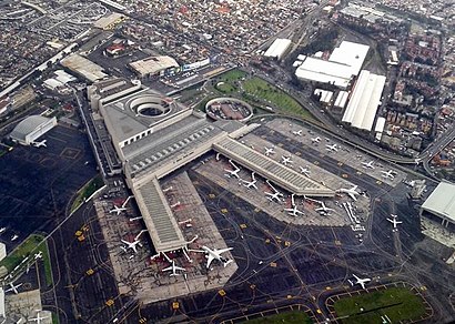
Mexico City International Airport (MEX),MMMX,Volaris vuelo Y4 926,Grupo Aduanal Mexicano GAMEX,Aeropuerto Internacional de la Ciudad de México,Peñón de los Baños Bodega 450 m2 a 3 Cuadras del Aeropuerto de la Ciudad de México Vigilancia 24,CALLE NTE 170 170,Mmtj Mexico Vor-Dme 115.60 Mhz,DSV Air & Sea,CREI (Cuerpo de Rescate y Extinción de Incendios),Aerocharter de Mexico SA de CV,MARTINAIR HOLLAND MMMX RAMP CARGO,Xocolia,centro cambiario tamibe,Autobuses México Puebla Estrella Roja,Krispy Kreme México,American Airlines Admirals Club,Bistrot Mosaico,Faramacias Benavides,AAADAM (Asociacion De Agentes Aduanales Del Aeropuerto De Mexico)How to get to popular attractions in Gustavo A. Madero with public transit
Corporativo Multiva, Naucalpan De Juárez,Centro de Distribucion Comex Crisol, Tepotzotlán,P.F. Chang's Asian Restaurant, Atizapán De Zaragoza,El Primo Pescados Fritos Y Mariscos, Cuautitlán Izcalli,Cisco Systems México, Naucalpan De Juárez,Pasteleria Esperanza, Alvaro Obregón,Pro México, Alvaro Obregón,Sección Amarilla México, Alvaro Obregón,Chedraui, Coyoacán,Sanborns, Cuajimalpa De Morelos,El Portón, Naucalpan De Juárez,Bar Casa De Piedra, Alvaro Obregón,Secretaría de Economía (picacho), Cuajimalpa De Morelos,Cielito Querido Café, Naucalpan De Juárez,Nokia Solutions & Networks, Cuautitlán Izcalli,Starbucks, Naucalpan De Juárez,ISSSTE Direccion De Administracion, Alvaro Obregón,Corporativo HP, Naucalpan De Juárez,MAPFRE, Naucalpan De Juárez,Starbucks, Cuautitlán IzcalliGet around Gustavo A. Madero by public transit!
Traveling around Gustavo A. Madero has never been so easy. See step by step directions as you travel to any attraction, street or major public transit station. View bus and train schedules, arrival times, service alerts and detailed routes on a map, so you know exactly how to get to anywhere in Gustavo A. Madero.
When traveling to any destination around Gustavo A. Madero use Moovit's Live Directions with Get Off Notifications to know exactly where and how far to walk, how long to wait for your line, and how many stops are left. Moovit will alert you when it's time to get off — no need to constantly re-check whether yours is the next stop.
Wondering how to use public transit in Gustavo A. Madero or how to pay for public transit in Gustavo A. Madero? Moovit public transit app can help you navigate your way with public transit easily, and at minimum cost. It includes public transit fees, ticket prices, and costs. Looking for a map of Gustavo A. Madero public transit lines? Moovit public transit app shows all public transit maps in Gustavo A. Madero with all bus or metro routes and stops on an interactive map.
Gustavo A. Madero has 2 transit type(s), including: bus or metro, operated by several transit agencies, including STC (Metro CDMX), Metrobús, RTP, Trolebús elevado, Trolebús, Tren Ligero, Corredores Concesionados, Ferrocarriles Suburbanos, Mexibus, Mexicable, Cablebús, Puma Bus, Peseros and Autobuses / Combis