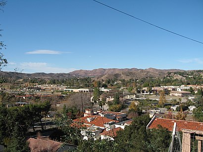
See Agoura Hills, California on the map
Directions to Agoura Hills, California with public transportation
The following transit lines have routes that pass near Agoura Hills, California
 Bus:
Bus:
How to get to Agoura Hills, California by bus?
Click on the bus route to see step by step directions with maps, line arrival times and updated time schedules.
Bus stations near Agoura Hills, California
- Thousand Oaks Blvd. & Forest Cove Ln.,28 min walk,
Bus lines to Agoura Hills, California
- CE422,Eastbound,
- CE423,423 Ce-Downtown /Usc,
- 161,Canoga Station via Warner Center,
What are the closest stations to Agoura Hills, California?
The closest stations to Agoura Hills, California are:
- Thousand Oaks Blvd. & Forest Cove Ln. is 2330 yards away, 28 min walk.
Which bus lines stop near Agoura Hills, California?
These bus lines stop near Agoura Hills, California: 161, CE422, CE423.
What time is the first bus to Agoura Hills, California?
The CE423 is the first bus that goes to Agoura Hills, California. It stops nearby at 5:14 AM.
What time is the last bus to Agoura Hills, California?
The 161 is the last bus that goes to Agoura Hills, California. It stops nearby at 8:10 PM.
How much is the bus fare to Agoura Hills, California?
The bus fare to Agoura Hills, California costs about $1.50 - $4.25.
See Agoura Hills, California on the map
Public Transportation to Agoura Hills, California
Wondering how to get to Agoura Hills, California, United States? Moovit helps you find the best way to get to Agoura Hills, California with step-by-step directions from the nearest public transit station.
Moovit provides free maps and live directions to help you navigate through your city. View schedules, routes, timetables, and find out how long does it take to get to Agoura Hills, California in real time.
Looking for the nearest stop or station to Agoura Hills, California? Check out this list of stops closest to your destination: Thousand Oaks Blvd. & Forest Cove Ln..
Bus:
Want to see if there’s another route that gets you there at an earlier time? Moovit helps you find alternative routes or times. Get directions from and directions to Agoura Hills, California easily from the Moovit App or Website.
We make riding to Agoura Hills, California easy, which is why over 1.5 million users, including users in Agoura Hills, trust Moovit as the best app for public transit. You don’t need to download an individual bus app or train app, Moovit is your all-in-one transit app that helps you find the best bus time or train time available.
For information on prices of bus, costs and ride fares to Agoura Hills, California, please check the Moovit app.
Use the app to navigate to popular places including to the airport, hospital, stadium, grocery store, mall, coffee shop, school, college, and university.
Agoura Hills, California Address: Los Angeles, CA street in Agoura Hills
Attractions near Agoura Hills, California
Missing Peace Center for Anxiety,Star Drywall,Yoga 4 the Soul,Z Tas,Platinum Salon International (Platinum Salon Intl in),Collette L. King, NP,Abrishamiderm,Thousand Oaks Blvd,Sec Filings,Vuong Trieu PHD,Sabron,Firecracker Jack,A/C Recharge Service,Christian Church of the Hills,A Bee Farms,New Rugs and Furniture,Lindero Canyon Middle School,Leap Payments Will Detterman,Agoura Deli & Mart,Tenderfix by Noah SchnappHow to get to popular attractions in Agoura Hills with public transit
City of Rancho Cucamonga, Rancho Cucamonga,Ball Cast Member Parking Lot (BCML), Anaheim,Fry's Electronics, Anaheim,The Hollywood Bowl, Hollywood Hills, La,Fontana, CA, Fontana,Disneyland Monorail, Anaheim,The Park at Irvine Spectrum Center, Irvine,Roscoe's House of Chicken and Waffles - Long Beach, Long Beach,Saddleback Community College, Mission Viejo,City of Laguna Beach, Laguna Beach,Diamond Bar, CA, Diamond Bar,City of Murrieta, Murrieta,The Boiling Crab, Koreatown, La,Pomona, CA, Pomona,Apple South Coast Plaza, Costa Mesa,AMC Promenade 16, Woodland Hills, La,Radiator Springs Racers, Anaheim,Placentia, CA, Fullerton,City of Anaheim, Anaheim,Upland, CA, UplandGet around Agoura Hills by public transit!
Traveling around Agoura Hills has never been so easy. See step by step directions as you travel to any attraction, street or major public transit station. View bus and train schedules, arrival times, service alerts and detailed routes on a map, so you know exactly how to get to anywhere in Agoura Hills.
When traveling to any destination around Agoura Hills use Moovit's Live Directions with Get Off Notifications to know exactly where and how far to walk, how long to wait for your line, and how many stops are left. Moovit will alert you when it's time to get off — no need to constantly re-check whether yours is the next stop.
Wondering how to use public transit in Agoura Hills or how to pay for public transit in Agoura Hills? Moovit public transit app can help you navigate your way with public transit easily, and at minimum cost. It includes public transit fees, ticket prices, and costs. Looking for a map of Agoura Hills public transit lines? Moovit public transit app shows all public transit maps in Agoura Hills with all bus routes and stops on an interactive map.
Agoura Hills has 1 transit type(s), including: bus, operated by several transit agencies, including Metro - Los Angeles, Metro - Los Angeles, Metrolink Trains, METRO, Long Beach Transit, LADOT, OCTA, Foothill Transit, Big Blue Bus, Riverside Transit Agency, LAX FlyAway, Airporter Shuttle, Playa Vista Shuttle, Amtrak and OMNITRANS