How to get to Aim Insurance by bus?
Click on the bus route to see step by step directions with maps, line arrival times and updated time schedules.
From Ikea, Edmonton
30 minFrom Peter Ivity Wholsale, Edmonton
58 minFrom Meadows Community Recreation Centre, Edmonton
53 minFrom Massage Therapeutics by Mhy, Edmonton
66 minFrom Grenco Industries, Edmonton
98 minFrom Rexall, Edmonton
72 minFrom Checkpoint Charlie Survival Supplies, Edmonton
50 minFrom The Derrick Golf & Country Club, Edmonton
54 minFrom Old Town Bookshop Stony Plain, Edmonton
54 minFrom Millwoods, Edmonton
47 min
Bus stops near Aim Insurance in Edmonton
Bus lines to Aim Insurance in Edmonton
What are the closest stations to Aim Insurance?
The closest stations to Aim Insurance are:
- 52 Street & 22 Avenue SW is 142 meters away, 2 min walk.
- Watt Promenade & Watt Drive SW is 832 meters away, 11 min walk.
Which bus lines stop near Aim Insurance?
These bus lines stop near Aim Insurance: 519, 521.
What’s the nearest bus station to Aim Insurance in Edmonton?
The nearest bus station to Aim Insurance in Edmonton is 52 Street & 22 Avenue SW. It’s a 2 min walk away.
What time is the first bus to Aim Insurance in Edmonton?
The 519 is the first bus that goes to Aim Insurance in Edmonton. It stops nearby at 5:55 AM.
What time is the last bus to Aim Insurance in Edmonton?
The 519 is the last bus that goes to Aim Insurance in Edmonton. It stops nearby at 12:10 AM.
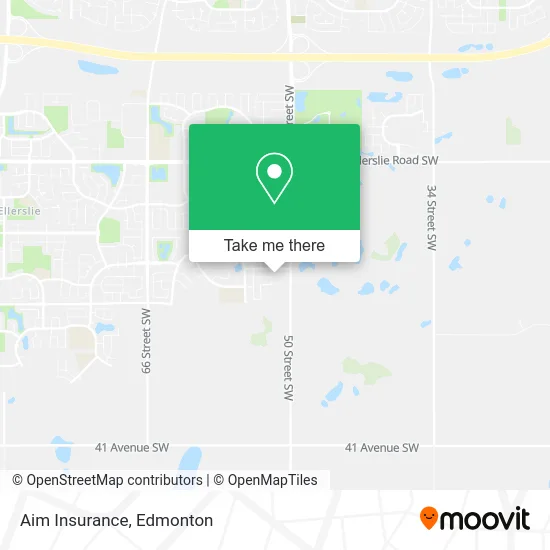
See Aim Insurance, Edmonton, on the map
Public Transit to Aim Insurance in Edmonton
Wondering how to get to Aim Insurance in Edmonton? Moovit helps you find the best way to get to Aim Insurance with step-by-step directions from the nearest public transit station.
Moovit provides free maps and live directions to help you navigate through your city. View schedules, routes, timetables, and find out how long does it take to get to Aim Insurance in real time.
Looking for the nearest stop or station to Aim Insurance? Check out this list of stops closest to your destination: 52 Street & 22 Avenue SW; Watt Promenade & Watt Drive SW.
Bus: 519, 521, 664.
Want to see if there’s another route that gets you there at an earlier time? Moovit helps you find alternative routes or times. Get directions from and directions to Aim Insurance easily from the Moovit App or Website.
We make riding to Aim Insurance easy, which is why over 1.5 million users, including users in Edmonton, trust Moovit as the best app for public transit. You don’t need to download an individual bus app or train app, Moovit is your all-in-one transit app that helps you find the best bus time or train time available.
For information on prices of bus, costs and ride fares to Aim Insurance, please check the Moovit app.
Use the app to navigate to popular places including to the airport, hospital, stadium, grocery store, mall, coffee shop, school, college, and university.
Aim Insurance Address: 5119 22 Ave SW Edmonton, AB T6X 2N4 street in Edmonton
- Fargo Immigration Consultancy,
- Maggo and Associates,
- NC Barbershop,
- My Radio 580am,
- Heroes Taekwondo Academy,
- Walkerlake Daycare & Osc,
- Walker Lake Family Clinic,
- Annys Hair & Beauty Salon,
- Orange Megamart,
- Chicken Chemistry,
- Montano Plumbing & Contracting,
- Royal Sweets and Restaurants,
- Sculpt,
- Mad Science of Northern Alberta,
- Purple Line Cleaning,
- Green Team Contracting,
- Amazing Blinds & Shades,
- Fix and Wellness,
- Visible Beauty Works,
- River City Floors
Places Near Aim Insurance (Edmonton)
- Canada Place Service Canada Centre, Edmonton,
- Northgate Centre, Edmonton,
- Kingsway Mall, Edmonton,
- Rogers Place, Edmonton,
- Royal Alexandra Hospital, Edmonton,
- West Edmonton Mall, Edmonton,
- Alberta Legislature Building, Edmonton,
- Fort Edmonton Park, Edmonton,
- Whyte Avenue, Edmonton,
- Grey Nuns Community Hospital, Edmonton,
- Borden Park, Edmonton,
- University of Alberta, Edmonton,
- Edmonton Valley Zoo, Edmonton,
- MacEwan University, Edmonton,
- Londonderry Mall, Edmonton,
- Edmonton Commonwealth Stadium, Edmonton,
- Kaye Edmonton Clinic, Edmonton,
- Cross Cancer Institute, Edmonton,
- Edmonton VIA Rail Station, Edmonton,
- Edmonton EXPO Centre, Edmonton
How to get to popular places in Edmonton with public transit
Get around Edmonton by public transit!
Traveling around Edmonton has never been so easy. See step by step directions as you travel to any attraction, street or major public transit station. View bus and train schedules, arrival times, service alerts and detailed routes on a map, so you know exactly how to get to anywhere in Edmonton.
When traveling to any destination around Edmonton use Moovit's Live Directions with Get Off Notifications to know exactly where and how far to walk, how long to wait for your line, and how many stops are left. Moovit will alert you when it's time to get off — no need to constantly re-check whether yours is the next stop.
Wondering how to use public transit in Edmonton or how to pay for public transit in Edmonton? Moovit public transit app can help you navigate your way with public transit easily, and at minimum cost. It includes public transit fees, ticket prices, and costs. Looking for a map of Edmonton public transit lines? Moovit public transit app shows all public transit maps in Edmonton with all Bus and Light Rail routes and stops on an interactive map.
Edmonton has 2 transit type(s), including: Bus and Light Rail, operated by several transit agencies, including ETS LRT, ETS, Strathcona County Transit, St. Albert Transit, Spruce Grove Transit, Fort Saskatchewan Transit, Beaumont Transit and Leduc Transit