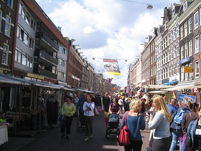
See Albert Cuyp Market, Amsterdam, on the map
Directions to Albert Cuyp Market (Amsterdam) with public transportation
The following transit lines have routes that pass near Albert Cuyp Market
 Bus:
Bus: - Train:
- Metro:
How to get to Albert Cuyp Market by bus?
Click on the bus route to see step by step directions with maps, line arrival times and updated time schedules.
How to get to Albert Cuyp Market by train?
Click on the train route to see step by step directions with maps, line arrival times and updated time schedules.
How to get to Albert Cuyp Market by metro?
Click on the metro route to see step by step directions with maps, line arrival times and updated time schedules.
Light Rail stations near Albert Cuyp Market in Amsterdam
- Albert Cuypstraat,5 min walk,
- Marie Heinekenplein,7 min walk,
Bus stations near Albert Cuyp Market in Amsterdam
- Van Woustraat,6 min walk,
- 2e Van Der Helststraat,6 min walk,
- 2e V.D.Helststraat,6 min walk,
- Vijzelgracht,9 min walk,
Bus lines to Albert Cuyp Market in Amsterdam
- N85,Gein,
- 3,Westergasfabriek,
- 246,Schiphol Airport/Plaza,
- N84,A'Veen Busstation,
- N82,Geuzenveld,
- N83,Osdorp De Aker,
- N88,Centraal Station,
What are the closest stations to Albert Cuyp Market?
The closest stations to Albert Cuyp Market are:
- Albert Cuypstraat is 336 meters away, 5 min walk.
- Van Woustraat is 406 meters away, 6 min walk.
- 2e Van Der Helststraat is 446 meters away, 6 min walk.
- 2e V.D.Helststraat is 452 meters away, 6 min walk.
- Marie Heinekenplein is 478 meters away, 7 min walk.
- Vijzelgracht is 626 meters away, 9 min walk.
Which bus lines stop near Albert Cuyp Market?
These bus lines stop near Albert Cuyp Market: 321, 347, 357, 397, 62.
Which train lines stop near Albert Cuyp Market?
These train lines stop near Albert Cuyp Market: IC, SPR.
Which metro line stops near Albert Cuyp Market?
52
What’s the nearest light rail station to Albert Cuyp Market in Amsterdam?
The nearest light rail station to Albert Cuyp Market in Amsterdam is Albert Cuypstraat. It’s a 5 min walk away.
What’s the nearest bus stop to Albert Cuyp Market in Amsterdam?
The nearest bus stops to Albert Cuyp Market in Amsterdam are Van Woustraat, 2e Van Der Helststraat and 2e V.D.Helststraat. The closest one is a 6 min walk away.
What time is the first light rail to Albert Cuyp Market in Amsterdam?
The 24 is the first light rail that goes to Albert Cuyp Market in Amsterdam. It stops nearby at 5:56 AM.
What time is the last light rail to Albert Cuyp Market in Amsterdam?
The 4 is the last light rail that goes to Albert Cuyp Market in Amsterdam. It stops nearby at 12:45 AM.
What time is the first bus to Albert Cuyp Market in Amsterdam?
The N85 is the first bus that goes to Albert Cuyp Market in Amsterdam. It stops nearby at 4:02 AM.
What time is the last bus to Albert Cuyp Market in Amsterdam?
The N85 is the last bus that goes to Albert Cuyp Market in Amsterdam. It stops nearby at 2:58 AM.
See Albert Cuyp Market, Amsterdam, on the map
Public Transit to Albert Cuyp Market in Amsterdam
Wondering how to get to Albert Cuyp Market in Amsterdam, Netherlands? Moovit helps you find the best way to get to Albert Cuyp Market with step-by-step directions from the nearest public transit station.
Moovit provides free maps and live directions to help you navigate through your city. View schedules, routes, timetables, and find out how long does it take to get to Albert Cuyp Market in real time.
Looking for the nearest stop or station to Albert Cuyp Market? Check out this list of stops closest to your destination: Albert Cuypstraat; Van Woustraat; 2e Van Der Helststraat; 2e V.D.Helststraat; Marie Heinekenplein; Vijzelgracht.
Bus:Train:Metro:
Want to see if there’s another route that gets you there at an earlier time? Moovit helps you find alternative routes or times. Get directions from and directions to Albert Cuyp Market easily from the Moovit App or Website.
We make riding to Albert Cuyp Market easy, which is why over 1.5 million users, including users in Amsterdam, trust Moovit as the best app for public transit. You don’t need to download an individual bus app or train app, Moovit is your all-in-one transit app that helps you find the best bus time or train time available.
For information on prices of bus, metro and train, costs and ride fares to Albert Cuyp Market, please check the Moovit app.
Use the app to navigate to popular places including to the airport, hospital, stadium, grocery store, mall, coffee shop, school, college, and university.
Location: Amsterdam, Netherlands
Popular routes to Albert Cuyp Market, Amsterdam
Popular routes from Albert Cuyp Market, Amsterdam
Attractions near Albert Cuyp Market
Rudi's Original Stroopwafels,Govert Flinckstraat,Albert Cuypmarkt,Govert Flinckstraat 231-1,Albert Cuyp Markt,Albertcuypmarkt (Albert Cuyp Market),Amsterdam Japanese Takoyaki Ya,André Hazes Standbeeld,HANK,Tweede Jacob van Campenstraat,Albert Cuypstraat Eerste van der Helststraat,Noor Amsterdam,Sarphatipark,Gerard Doustraat,Gerard Douplein,Katsu,Sarphatipark,Brut De Mer,Albert Cuypstraat,Helst AmsterdamHow to get to popular attractions in Amsterdam with public transit
Stadion Galgenwaard, Utrecht,IKEA, Heerlen,IKEA, Breda,Belgisch Biercafé Olivier, Utrecht,TESO-Veerboot Den Helder → Texel, Den Helder,Scheveningse Strand, 'S-Gravenhage,Apple Amsterdam, Amsterdam,Maastricht Centrum, Maastricht,Winkelcentrum In de Bogaard, Rijswijk,Rotterdam Ahoy, Rotterdam,NHL Hogeschool, Leeuwarden,Nijmegen, Nijmegen,Pathé Schouwburgplein, Rotterdam,Station Meppel, Meppel,High Tech Campus, Eindhoven,SnowWorld, Landgraaf,Burgers' Zoo, Arnhem,Safaripark Beekse Bergen, Hilvarenbeek,Station Ede-Wageningen, Ede,Den Haag Centrum, 'S-GravenhageGet around Amsterdam by public transit!
Traveling around Amsterdam has never been so easy. See step by step directions as you travel to any attraction, street or major public transit station. View bus and train schedules, arrival times, service alerts and detailed routes on a map, so you know exactly how to get to anywhere in Amsterdam.
When traveling to any destination around Amsterdam use Moovit's Live Directions with Get Off Notifications to know exactly where and how far to walk, how long to wait for your line, and how many stops are left. Moovit will alert you when it's time to get off — no need to constantly re-check whether yours is the next stop.
Wondering how to use public transit in Amsterdam or how to pay for public transit in Amsterdam? Moovit public transit app can help you navigate your way with public transit easily, and at minimum cost. It includes public transit fees, ticket prices, and costs. Looking for a map of Amsterdam public transit lines? Moovit public transit app shows all public transit maps in Amsterdam with all bus, metro or train routes and stops on an interactive map.
Amsterdam has 3 transit type(s), including: bus, metro or train, operated by several transit agencies, including NS, NS International, GVB, GVB, GVB, GVB, U-OV, U-OV, Overal, HTM, R-net, RET, RET, De Lijn and Connexxion