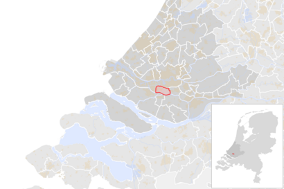
See Albrandswaard on the map
Directions to Albrandswaard with public transportation
The following transit lines have routes that pass near Albrandswaard
 Bus:
Bus: - Metro:
How to get to Albrandswaard by bus?
Click on the bus route to see step by step directions with maps, line arrival times and updated time schedules.
How to get to Albrandswaard by metro?
Click on the metro route to see step by step directions with maps, line arrival times and updated time schedules.
Which bus line stops near Albrandswaard?
602
Which metro line stops near Albrandswaard?
D
See Albrandswaard on the map
Public Transportation to Albrandswaard
Wondering how to get to Albrandswaard, Netherlands? Moovit helps you find the best way to get to Albrandswaard with step-by-step directions from the nearest public transit station.
Moovit provides free maps and live directions to help you navigate through your city. View schedules, routes, timetables, and find out how long does it take to get to Albrandswaard in real time.
Bus:Metro:
Want to see if there’s another route that gets you there at an earlier time? Moovit helps you find alternative routes or times. Get directions from and directions to Albrandswaard easily from the Moovit App or Website.
We make riding to Albrandswaard easy, which is why over 1.5 million users, including users in Albrandswaard, trust Moovit as the best app for public transit. You don’t need to download an individual bus app or train app, Moovit is your all-in-one transit app that helps you find the best bus time or train time available.
For information on prices of metro, bus and light rail, costs and ride fares to Albrandswaard, please check the Moovit app.
Use the app to navigate to popular places including to the airport, hospital, stadium, grocery store, mall, coffee shop, school, college, and university.
Location: Albrandswaard, Netherlands
Attractions near Albrandswaard
Signore, Den,Molenaar 32,Junior,Obm Vof,Elsen,Optifin,C. Noordijk Pernis Bv,van Meybeek fysiotherapie,Jolanda,Poortugaal, Meidoorn,Poortugaal, Meidoorn,Vt&B,Rijn & Vaessen, Van,Klei, M A Van,Stuer Projekten,Hw,Meidoorn 37,Have, Van Der,Poortugaal, Linnaeusstraat,Poortugaal, LinnaeusstraatHow to get to popular attractions in Albrandswaard with public transit
Apeldoorn, Apeldoorn,Veerdienst Schoonhoven - Gelkenes, Schoonhoven,azM/Maastricht UMC+, Maastricht,Hanzehogeschool Groningen, Groningen,Stadion Feijenoord, Rotterdam,IKEA, Amersfoort,Pathé, Breda,Station Bergen op Zoom, Bergen Op Zoom,Escape, Amsterdam,Station Meppel, Meppel,Scheveningen, 'S-Gravenhage,Koopgoot, Rotterdam,Dordrecht, Dordrecht,ANWB Hoofdkantoor, Wassenaar,Belgisch Biercafé Olivier, Utrecht,Busstation Zuidplein, Rotterdam,Station Amersfoort Schothorst, Amersfoort,Albert Heijn XL, Eindhoven,De Grolsch Veste, Enschede,The Bulldog Palace, AmsterdamGet around Albrandswaard by public transit!
Traveling around Albrandswaard has never been so easy. See step by step directions as you travel to any attraction, street or major public transit station. View bus and train schedules, arrival times, service alerts and detailed routes on a map, so you know exactly how to get to anywhere in Albrandswaard.
When traveling to any destination around Albrandswaard use Moovit's Live Directions with Get Off Notifications to know exactly where and how far to walk, how long to wait for your line, and how many stops are left. Moovit will alert you when it's time to get off — no need to constantly re-check whether yours is the next stop.
Wondering how to use public transit in Albrandswaard or how to pay for public transit in Albrandswaard? Moovit public transit app can help you navigate your way with public transit easily, and at minimum cost. It includes public transit fees, ticket prices, and costs. Looking for a map of Albrandswaard public transit lines? Moovit public transit app shows all public transit maps in Albrandswaard with all metro, bus or light rail routes and stops on an interactive map.
Albrandswaard has 3 transit type(s), including: metro, bus or light rail, operated by several transit agencies, including NS, NS International, GVB, GVB, GVB, GVB, U-OV, U-OV, Overal, HTM, R-net, RET, RET, De Lijn and Connexxion