See Alewife Greenway, Somerville, on the map
Directions to Alewife Greenway (Somerville) with public transportation
The following transit lines have routes that pass near Alewife Greenway
 Bus:
Bus: - Train:
- Subway:
How to get to Alewife Greenway by bus?
Click on the bus route to see step by step directions with maps, line arrival times and updated time schedules.
How to get to Alewife Greenway by train?
Click on the train route to see step by step directions with maps, line arrival times and updated time schedules.
How to get to Alewife Greenway by subway?
Click on the subway route to see step by step directions with maps, line arrival times and updated time schedules.
Bus stations near Alewife Greenway in Somerville
- Broadway Opp Sunnyside Ave,6 min walk,
Bus lines to Alewife Greenway in Somerville
- 87,Arlington Center,
What are the closest stations to Alewife Greenway?
The closest stations to Alewife Greenway are:
- Broadway Opp Sunnyside Ave is 502 yards away, 6 min walk.
Which bus lines stop near Alewife Greenway?
These bus lines stop near Alewife Greenway: 77, 83, 87, 88.
Which train line stops near Alewife Greenway?
LOWELL LINE
Which subway line stops near Alewife Greenway?
RED LINE
What’s the nearest bus stop to Alewife Greenway in Somerville?
The nearest bus stop to Alewife Greenway in Somerville is Broadway Opp Sunnyside Ave. It’s a 6 min walk away.
See Alewife Greenway, Somerville, on the map
Public Transit to Alewife Greenway in Somerville
Wondering how to get to Alewife Greenway in Somerville, United States? Moovit helps you find the best way to get to Alewife Greenway with step-by-step directions from the nearest public transit station.
Moovit provides free maps and live directions to help you navigate through your city. View schedules, routes, timetables, and find out how long does it take to get to Alewife Greenway in real time.
Looking for the nearest stop or station to Alewife Greenway? Check out this list of stops closest to your destination: Broadway Opp Sunnyside Ave.
Bus:Train:Subway:
Want to see if there’s another route that gets you there at an earlier time? Moovit helps you find alternative routes or times. Get directions from and directions to Alewife Greenway easily from the Moovit App or Website.
We make riding to Alewife Greenway easy, which is why over 1.5 million users, including users in Somerville, trust Moovit as the best app for public transit. You don’t need to download an individual bus app or train app, Moovit is your all-in-one transit app that helps you find the best bus time or train time available.
For information on prices of bus, subway and train, costs and ride fares to Alewife Greenway, please check the Moovit app.
Use the app to navigate to popular places including to the airport, hospital, stadium, grocery store, mall, coffee shop, school, college, and university.
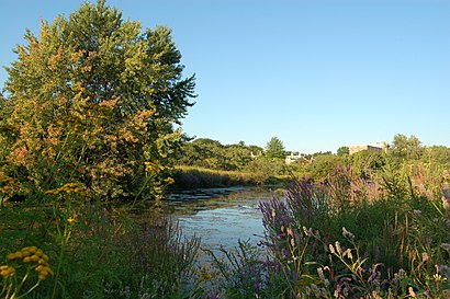
Alewife Greenway Address: Somerville, MA 02144 street in Somerville
Attractions near Alewife Greenway
75 Sunnyside Ave,Dilboy Pool,Dilboy Memorial Swimming and Wading Pool,Alewife Brook Parkway Rotary,Airport Cab of Arlington,Doucette's Gas,Alewife Brook Greenway,Bolduc Charlotte CPA,Alewife Brook Reservation,LENSCRAFTERS,Dilboy Field,Joseph Parse,East Coast Chip Keys,Boston Breakers,Menotomy Manor,Dilboy Memorial Stadium,Sunnyside Avenue,Dilboy Field,Dilboy Softball Field,90 Sterling StHow to get to popular attractions in Somerville with public transit
The Phoenix Landing, Cambridge,Windsor Village at Waltham, Waltham,Neptune Oyster, Boston,Staples Corporate HQ, Framingham,BJ's Wholesale Club, Haverhill,Brown University,Barrington, RI,Mike's Food and Spirits, Somerville,The Lenox Hotel, Boston,Hooters, Saugus,Maggiano's Little Italy, Boston,Dillon's, Boston,Union Station (WOR), Worcester,Wilmington, MA, Wilmington,Newton, MA, Newton,Everett, Everett,Night Shift Brewing, Inc., Everett,FiRE + iCE Boston, Boston,Five Horses Tavern, Somerville,The Salty Pig, BostonGet around Somerville by public transit!
Traveling around Somerville has never been so easy. See step by step directions as you travel to any attraction, street or major public transit station. View bus and train schedules, arrival times, service alerts and detailed routes on a map, so you know exactly how to get to anywhere in Somerville.
When traveling to any destination around Somerville use Moovit's Live Directions with Get Off Notifications to know exactly where and how far to walk, how long to wait for your line, and how many stops are left. Moovit will alert you when it's time to get off — no need to constantly re-check whether yours is the next stop.
Wondering how to use public transit in Somerville or how to pay for public transit in Somerville? Moovit public transit app can help you navigate your way with public transit easily, and at minimum cost. It includes public transit fees, ticket prices, and costs. Looking for a map of Somerville public transit lines? Moovit public transit app shows all public transit maps in Somerville with all bus, subway or train routes and stops on an interactive map.
Somerville has 3 transit type(s), including: bus, subway or train, operated by several transit agencies, including MBTA, MBTA, MBTA, Southeastern Regional Transit Authority, MetroWest Regional Transit Authority, Rhode Island Public Transit Authority, WRTA, Lowell Regional Transit Authority, Merrimack Valley Transit, Montachusett Regional Transit Authority, Cape Cod Regional Transit Authority, Brockton Area Transit Authority, Cape Cod Regional Transit Authority, Martha's Vineyard Transit Authority and the WAVE - Nantucket Regional Transit Authority