Directions to Algés (Lisboa) with public transportation
The following transit lines have routes that pass near Algés
How to get to Algés by bus?
Click on the bus route to see step by step directions with maps, line arrival times and updated time schedules.
How to get to Algés by train?
Click on the train route to see step by step directions with maps, line arrival times and updated time schedules.
How to get to Algés by ferry?
Click on the ferry route to see step by step directions with maps, line arrival times and updated time schedules.
Bus stations near Algés in Lisboa
- Algés,1 min walk,
- Algés (Estação) P3,1 min walk,
- Algés (Estação) P4,1 min walk,
- Algés (Estação) P2,1 min walk,
- Algés (Estação) P1,2 min walk,
- Algés (Estação) P13,5 min walk,
- Algés (Estação) P12,5 min walk,
- Algés (Estação) P11,5 min walk,
- Algés (Estação) P10,5 min walk,
- Algés (Estação) P9,5 min walk,
Train stations near Algés in Lisboa
- Belém,18 min walk,
Ferry stations near Algés in Lisboa
- Belém,21 min walk,
Bus lines to Algés in Lisboa
- 723,Algés,
- 79B,Algés,
- 201,Linda-a-Velha,
- 751,Estação Campolide,
- 1712,Algés (Estação) - Amadora (Estação Sul),
- 1713,Algés (Estação) - Amadora Este (Metro),
- 1713,Algés (Estação) - Damaia (Estação Norte),
- 1520,Algés (Estação),
- 1521,Agualva - Cacém (Estação),
- 1715,Belém (Estação),
- 1731,Hospital S Francisco Xavier,
- 3701,Almada (Hosp. Particular),
- 1105,Algés (Estação) - Queluz Baixo (Centro Comercial),
- 1503,Algés (Estação) - Alfragide (Zona Industrial) via Miraflores,
- 1503,Algés (Estação) - Bº Zambujal,
- 1522,Algés (Estação) - Monte Abraão (Estação),
- 729,Pontinha (Metro),
- 1113,Algés (Estação) via Cruz Quebrada e Linda-a-Velha | Circular,
- 1114,Algés (Estação) via Linda-a-Velha e Miraflores | Circular,
- 776,Algés,
What are the closest stations to Algés?
The closest stations to Algés are:
- Algés is 38 meters away, 1 min walk.
- Algés (Estação) P3 is 54 meters away, 1 min walk.
- Algés (Estação) P4 is 63 meters away, 1 min walk.
- Algés (Estação) P2 is 63 meters away, 1 min walk.
- Algés (Estação) P1 is 72 meters away, 2 min walk.
- Algés (Estação) P13 is 326 meters away, 5 min walk.
- Algés (Estação) P12 is 335 meters away, 5 min walk.
- Algés (Estação) P11 is 344 meters away, 5 min walk.
- Algés (Estação) P10 is 352 meters away, 5 min walk.
- Algés (Estação) P9 is 361 meters away, 5 min walk.
- Belém is 1341 meters away, 18 min walk.
Which bus lines stop near Algés?
These bus lines stop near Algés: 1103, 15E, 1712, 3701, 723, 729, 750, 751.
Which train line stops near Algés?
L. CASCAIS
Which ferry line stops near Algés?
YB
What’s the nearest train station to Algés in Lisboa?
The nearest train station to Algés in Lisboa is Belém. It’s a 18 min walk away.
What’s the nearest bus stop to Algés in Lisboa?
The nearest bus stops to Algés in Lisboa are Algés, Algés (Estação) P3, Algés (Estação) P4 and Algés (Estação) P2. The closest one is a 1 min walk away.
What’s the nearest ferry station to Algés in Lisboa?
The nearest ferry station to Algés in Lisboa is Belém. It’s a 21 min walk away.
What time is the first train to Algés in Lisboa?
The L. CASCAIS is the first train that goes to Algés in Lisboa. It stops nearby at 5:38 AM.
What time is the last train to Algés in Lisboa?
The L. CASCAIS is the last train that goes to Algés in Lisboa. It stops nearby at 2:26 AM.
What time is the first bus to Algés in Lisboa?
The 201 is the first bus that goes to Algés in Lisboa. It stops nearby at 3:06 AM.
What time is the last bus to Algés in Lisboa?
The 201 is the last bus that goes to Algés in Lisboa. It stops nearby at 2:49 AM.
What time is the first ferry to Algés in Lisboa?
The TRAFARIA – PORTO BRANDÃO – BELÉM is the first ferry that goes to Algés in Lisboa. It stops nearby at 6:55 AM.
What time is the last ferry to Algés in Lisboa?
The TRAFARIA – PORTO BRANDÃO – BELÉM is the last ferry that goes to Algés in Lisboa. It stops nearby at 10:00 PM.
See Algés, Lisboa, on the map
Public Transit to Algés in Lisboa
Wondering how to get to Algés in Lisboa, Portugal? Moovit helps you find the best way to get to Algés with step-by-step directions from the nearest public transit station.
Moovit provides free maps and live directions to help you navigate through your city. View schedules, routes, timetables, and find out how long does it take to get to Algés in real time.
Looking for the nearest stop or station to Algés? Check out this list of stops closest to your destination: Algés; Algés (Estação) P3; Algés (Estação) P4; Algés (Estação) P2; Algés (Estação) P1; Algés (Estação) P13; Algés (Estação) P12; Algés (Estação) P11; Algés (Estação) P10; Algés (Estação) P9; Belém.
Bus:110315E1712370172372975075179B201171317131520152117151731Train:L. CASCAISFerry:YBTRAFARIA – PORTO BRANDÃO – BELÉM
Want to see if there’s another route that gets you there at an earlier time? Moovit helps you find alternative routes or times. Get directions from and directions to Algés easily from the Moovit App or Website.
We make riding to Algés easy, which is why over 1.5 million users, including users in Lisboa, trust Moovit as the best app for public transit. You don’t need to download an individual bus app or train app, Moovit is your all-in-one transit app that helps you find the best bus time or train time available.
For information on prices of bus, train, metro and ferry, costs and ride fares to Algés, please check the Moovit app.
Use the app to navigate to popular places including to the airport, hospital, stadium, grocery store, mall, coffee shop, school, college, and university.
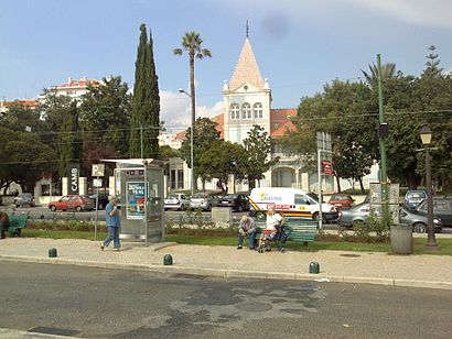
Algés Address: Largo Dom Manuel I street in Lisboa
Attractions near Algés
Terminal Rodoviário de Algés,Terminal Rodoviário de Algés,Paragem 149 Vimeca - Algés,Paragem 149 Vimeca - Algés,Terminal De Algés,1400-371,Rua Major Afonso Palla 5,Praça de Táxis de Algés,Paulo José Gonçalves - Construção Civil UNIP,Clínica Rebalance,rua Damião de Góis,Rua Fernão Mendes Pinto 56,Extensão de Algés - Centro de Saúde de Carnaxide,Barrelas,Estação Ferroviária de Algés,Rua Fernão Mendes Pinto,Algés - Praça Dom Manuel I,Avenida Brasília,Estação Ferroviária de Algés,IPMAHow to get to popular attractions in Lisboa with public transit
Cristo-Rei, Almada,Cidade Universitária, Lisboa,Museu Calouste Gulbenkian, Lisboa,Empreendimento Praça de Entrecampos, Lisboa,Outurela, Oeiras,Cais Do Sodré, Lisboa,AXA Portugal, Lisboa,LeYa - Alfragide, Amadora,Cotovia, Sesimbra,Sapadores, Lisboa,Rato, Lisboa,Avenida Miguel Bombarda (Iscal), Lisboa,Torre Amoreiras 2, Lisboa,Praça Paiva Couceiro, Lisboa,Metro Odivelas, Odivelas,Piriquita II, Sintra,Museu Nacional Do Azulejo, Lisboa,Hospital São Francisco Xavier, Lisboa,Ubbo, Amadora,El Corte Inglés, LisboaGet around Lisboa by public transit!
Traveling around Lisboa has never been so easy. See step by step directions as you travel to any attraction, street or major public transit station. View bus and train schedules, arrival times, service alerts and detailed routes on a map, so you know exactly how to get to anywhere in Lisboa.
When traveling to any destination around Lisboa use Moovit's Live Directions with Get Off Notifications to know exactly where and how far to walk, how long to wait for your line, and how many stops are left. Moovit will alert you when it's time to get off — no need to constantly re-check whether yours is the next stop.
Wondering how to use public transit in Lisboa or how to pay for public transit in Lisboa? Moovit public transit app can help you navigate your way with public transit easily, and at minimum cost. It includes public transit fees, ticket prices, and costs. Looking for a map of Lisboa public transit lines? Moovit public transit app shows all public transit maps in Lisboa with all bus, train, metro or ferry routes and stops on an interactive map.
Lisboa has 4 transit type(s), including: bus, train, metro or ferry, operated by several transit agencies, including Metropolitano de Lisboa, MTS, CP - Comboios de Portugal, CP - Comboios de Portugal, Fertagus, Transtejo Soflusa, Aeroporto de Lisboa, Empresa Municipal de Mobilidade e Estacionamento de Lisboa, Carris, Carris Metropolitana, Cascais Próxima, TCB - Transportes Colectivos do Barreiro, Barraqueiro Oeste, Boa Viagem and Scotturb