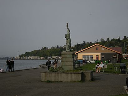
Directions to Alki Beach (Seattle) with public transportation
The following transit lines have routes that pass near Alki Beach
How to get to Alki Beach by bus?
Click on the bus route to see step by step directions with maps, line arrival times and updated time schedules.
Bus stops near Alki Beach in Seattle
- Alki Ave Sw & 1000 Blk, 1 min walk,
Bus lines to Alki Beach in Seattle
- 775, Seacrest Marina,
What are the closest stations to Alki Beach?
The closest stations to Alki Beach are:
- Alki Ave Sw & 1000 Blk is 58 yards away, 1 min walk.
Which bus lines stop near Alki Beach?
These bus lines stop near Alki Beach: 128, 775.
What’s the nearest bus stop to Alki Beach in Seattle?
The nearest bus stop to Alki Beach in Seattle is Alki Ave Sw & 1000 Blk. It’s a 1 min walk away.
See Alki Beach, Seattle, on the map
Public Transit to Alki Beach in Seattle
Wondering how to get to Alki Beach in Seattle, United States? Moovit helps you find the best way to get to Alki Beach with step-by-step directions from the nearest public transit station.
Moovit provides free maps and live directions to help you navigate through your city. View schedules, routes, timetables, and find out how long does it take to get to Alki Beach in real time.
Looking for the nearest stop or station to Alki Beach? Check out this list of stops closest to your destination: Alki Ave Sw & 1000 Blk.
Bus: 128, 775.
Want to see if there’s another route that gets you there at an earlier time? Moovit helps you find alternative routes or times. Get directions from and directions to Alki Beach easily from the Moovit App or Website.
We make riding to Alki Beach easy, which is why over 1.5 million users, including users in Seattle, trust Moovit as the best app for public transit. You don’t need to download an individual bus app or train app, Moovit is your all-in-one transit app that helps you find the best bus time or train time available.
For information on prices of bus, costs and ride fares to Alki Beach, please check the Moovit app.
Use the app to navigate to popular places including to the airport, hospital, stadium, grocery store, mall, coffee shop, school, college, and university.
Location: Seattle, Seattle - Tacoma, WA
Attractions near Alki Beach
Duwamish Head Greenbelt,Duwamish Head Condominium,Afterasm Clothing Company,Diana Yarborough Court RE,Interwest Financial Corp,Kurt Burgan Inc,Dangerfield,Tats Delicatessen LLC,Older Americans Assoc Wash,Randys Remodeling,Anderson Family Trust 12,Spengarr Consulting Services,Viewers,Organized Armoire,1,Sqw-ed-qs,Lamb's Point,Zumba Beach House @ Alki,Luna Park,Inset-Anchor (Park) On AlkiHow to get to popular attractions in Seattle with public transit
PCC Community Markets - Edmonds, Edmonds,PCC Community Markets - Issaquah, Issaquah,Sea Airport, Seatac,Tacoma Dome - Transit Center, Tacoma,Downtown Tacoma, Tacoma,Washington State Fair & Events Center, Puyallup,Green River College, Auburn,Pike Place Market, Seattle,Lake Stevens, Lake Stevens,Tavolàta, Seattle,QFC, Edmonds,The Boeing Co., Everett,Alaska Airlines' McGee Building, Seatac,VA Hospital American Lake, North Fort Lewis,Seattle Central College, Seattle,Phinney Ridge Neighborhood, Seattle,Everett, WA, Everett,Club Silverstone, Tacoma,North Bend, WA, North Bend,Alderwood Mall, LynnwoodGet around Seattle - Tacoma, WA by public transit!
Traveling around Seattle - Tacoma, WA has never been so easy. See step by step directions as you travel to any attraction, street or major public transit station. View bus and train schedules, arrival times, service alerts and detailed routes on a map, so you know exactly how to get to anywhere in Seattle - Tacoma, WA.
When traveling to any destination around Seattle - Tacoma, WA use Moovit's Live Directions with Get Off Notifications to know exactly where and how far to walk, how long to wait for your line, and how many stops are left. Moovit will alert you when it's time to get off — no need to constantly re-check whether yours is the next stop.
Wondering how to use public transit in Seattle - Tacoma, WA or how to pay for public transit in Seattle - Tacoma, WA? Moovit public transit app can help you navigate your way with public transit easily, and at minimum cost. It includes public transit fees, ticket prices, and costs. Looking for a map of Seattle - Tacoma, WA public transit lines? Moovit public transit app shows all public transit maps in Seattle - Tacoma, WA with all Bus, Train, Light Rail and Ferry routes and stops on an interactive map.
Seattle - Tacoma, WA has 4 transit type(s), including: Bus, Train, Light Rail and Ferry, operated by several transit agencies, including Sound Transit, Seattle Streetcar, Metro Transit, Whatcom Transportation Authority, Mason Transit Authority, Snoqualmie Valley Transportation (SVT), Snoqualmie Valley Transportation, Amtrak, Island Transit, Kitsap Transit, Intercity Transit, Everett Transit, Community Transit, Skagit Transit, Pierce Transit