Directions to Alt-Hohenschönhausen with public transportation
The following transit lines have routes that pass near Alt-Hohenschönhausen
How to get to Alt-Hohenschönhausen by bus?
Click on the bus route to see step by step directions with maps, line arrival times and updated time schedules.
How to get to Alt-Hohenschönhausen by train?
Click on the train route to see step by step directions with maps, line arrival times and updated time schedules.
Bus stations near Alt-Hohenschönhausen
- Alt-Hohenschönhausen, 1 min walk,
Light Rail stations near Alt-Hohenschönhausen
- Gehrenseestr., 6 min walk,
- Degnerstr./Suermondtstr., 7 min walk,
Bus lines to Alt-Hohenschönhausen
- N56, U Magdalenenstr./Buchberger Str.,
- 256, Zentralfriedhof,
- 294, Marzahner Str.,
What are the closest stations to Alt-Hohenschönhausen?
The closest stations to Alt-Hohenschönhausen are:
- Alt-Hohenschönhausen is 62 meters away, 1 min walk.
- Gehrenseestr. is 388 meters away, 6 min walk.
- Degnerstr./Suermondtstr. is 485 meters away, 7 min walk.
Which train lines stop near Alt-Hohenschönhausen?
These train lines stop near Alt-Hohenschönhausen: RB12, RB32.
Which light rail line stops near Alt-Hohenschönhausen?
M5
Which bus lines stop near Alt-Hohenschönhausen?
These bus lines stop near Alt-Hohenschönhausen: 154, 256.
What’s the nearest light rail station to Alt-Hohenschönhausen?
The nearest light rail station to Alt-Hohenschönhausen is Gehrenseestr.. It’s a 6 min walk away.
What’s the nearest bus stop to Alt-Hohenschönhausen?
The nearest bus stop to Alt-Hohenschönhausen is Alt-Hohenschönhausen. It’s a 1 min walk away.
What time is the first light rail to Alt-Hohenschönhausen?
The M5 is the first light rail that goes to Alt-Hohenschönhausen. It stops nearby at 3:01 AM.
What time is the last light rail to Alt-Hohenschönhausen?
The M5 is the last light rail that goes to Alt-Hohenschönhausen. It stops nearby at 3:31 AM.
What time is the first bus to Alt-Hohenschönhausen?
The N56 is the first bus that goes to Alt-Hohenschönhausen. It stops nearby at 3:18 AM.
What time is the last bus to Alt-Hohenschönhausen?
The N56 is the last bus that goes to Alt-Hohenschönhausen. It stops nearby at 3:21 AM.
How much is the bus fare to Alt-Hohenschönhausen?
The bus fare to Alt-Hohenschönhausen costs about €2.00 - €3.00.
How much is the light rail fare to Alt-Hohenschönhausen?
The light rail fare to Alt-Hohenschönhausen costs about €2.00 - €3.00.
How much is the subway fare to Alt-Hohenschönhausen?
The subway fare to Alt-Hohenschönhausen costs about €2.00 - €3.00.
How much is the train fare to Alt-Hohenschönhausen?
The train fare to Alt-Hohenschönhausen costs about €3.50 - €3.80.
How much is the {{TRANSIT_TYPE}} fare to Alt-Hohenschönhausen?
The {{TRANSIT_TYPE}} fare to Alt-Hohenschönhausen costs about €2.00 - €3.80.
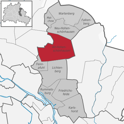
See Alt-Hohenschönhausen on the map
Public Transportation to Alt-Hohenschönhausen
Wondering how to get to Alt-Hohenschönhausen, Germany? Moovit helps you find the best way to get to Alt-Hohenschönhausen with step-by-step directions from the nearest public transit station.
Moovit provides free maps and live directions to help you navigate through your city. View schedules, routes, timetables, and find out how long does it take to get to Alt-Hohenschönhausen in real time.
Looking for the nearest stop or station to Alt-Hohenschönhausen? Check out this list of stops closest to your destination: Alt-Hohenschönhausen; Gehrenseestr.; Degnerstr./Suermondtstr..
Train: RB12, RB32.Light Rail: M5.Bus: 154, 256, N56, 294.
Want to see if there’s another route that gets you there at an earlier time? Moovit helps you find alternative routes or times. Get directions from and directions to Alt-Hohenschönhausen easily from the Moovit App or Website.
We make riding to Alt-Hohenschönhausen easy, which is why over 1.5 million users, including users in Alt-Hohenschönhausen, trust Moovit as the best app for public transit. You don’t need to download an individual bus app or train app, Moovit is your all-in-one transit app that helps you find the best bus time or train time available.
For information on prices of bus, light rail, subway and train, costs and ride fares to Alt-Hohenschönhausen, please check the Moovit app.
Use the app to navigate to popular places including to the airport, hospital, stadium, grocery store, mall, coffee shop, school, college, and university.
Alt-Hohenschönhausen Address: Hauptstraße street in Alt-Hohenschönhausen
Attractions near Alt-Hohenschönhausen
Alt-Hohenschönhausen,Augenoptik Conrad,Kaufland,Ohn,Action,Berliner Volksbank,Storchenhof,Deutsche Post,Juvit Natur,Storchenhof,Storchenhof-Center,Oskar Freiwilligenagentur Lichtenberg,Wolfgang Stämmler,Kallus Christian Bodenleger,Glockenhaus,Seefelder Straße 48,Fairmonta,Matrjoschka Kindergarten,Kindertagesstätte Kita Mitra Rechter Gebäudeteil,Kita Heckelberger Ring Kindergärten Nordost Eigenbetrieb von BerlinHow to get to popular attractions in Alt-Hohenschönhausen with public transit
Flughafen Berlin Brandenburg Willy Brandt (BER), Schönefeld,Alte Jakobstraße, Berlin Mitte,St. Gertrauden Krankenhaus, Wilmersdorf,Pfaueninsel, Wannsee,Alexianer St. Hedwig-Krankenhaus, Berlin Mitte,Brandenburger Tor (Brandenburg Gate), Berlin Mitte,FKK Artemis, Grunewald,Sisyphos Club, Rummelsburg,Tierheim Berlin, Falkenberg,Krankenhaus Waldfriede e. V., Zehlendorf,Konzerthaus, Berlin Mitte,Kadewe, Schöneberg,S-Bahn-Westend (S-Bahnhof Westend), Charlottenburg,Union Berlin Alte Försterei, Köpenick,A10 Center, Wildau,Volkspark Friedrichshain, Friedrichshain,Ernst von Bergmann Klinikum, Potsdam,Friedrichstadt-Passagen (Q 207), Berlin Mitte,Würth Haus Berlin / Repräsentanz der Würth-Gruppe, Nikolassee,Pestalozzistraße, CharlottenburgGet around Berlin - Brandenburg by public transit!
Traveling around Berlin - Brandenburg has never been so easy. See step by step directions as you travel to any attraction, street or major public transit station. View bus and train schedules, arrival times, service alerts and detailed routes on a map, so you know exactly how to get to anywhere in Berlin - Brandenburg.
When traveling to any destination around Berlin - Brandenburg use Moovit's Live Directions with Get Off Notifications to know exactly where and how far to walk, how long to wait for your line, and how many stops are left. Moovit will alert you when it's time to get off — no need to constantly re-check whether yours is the next stop.
Wondering how to use public transit in Berlin - Brandenburg or how to pay for public transit in Berlin - Brandenburg? Moovit public transit app can help you navigate your way with public transit easily, and at minimum cost. It includes public transit fees, ticket prices, and costs. Looking for a map of Berlin - Brandenburg public transit lines? Moovit public transit app shows all public transit maps in Berlin - Brandenburg with all Bus, Train, Subway, Light Rail and Ferry routes and stops on an interactive map.
Berlin - Brandenburg has 5 transit type(s), including: Bus, Train, Subway, Light Rail and Ferry, operated by several transit agencies, including BVG, VBB, S-Bahn, Cottbusverkehr, Schöneicher Rüdersdorfer Straßenbahn, Strausberger Eisenbahn GmbH, Stadtverkehrsgesellschaft Tram, Verkehrsbetriebe Brandenburg, Verkehrsverbund Potsdam, DB Regio Bus, Barnimer Busgesellschaft, Busverkehr Oder-Spree GmbH, A. Reich, ANG, Busverkehr Gerd Schmidt