Directions to Amalgamated Warbasse Houses 3 (Brooklyn) with public transportation
The following transit lines have routes that pass near Amalgamated Warbasse Houses 3
How to get to Amalgamated Warbasse Houses 3 by bus?
Click on the bus route to see step by step directions with maps, line arrival times and updated time schedules.
How to get to Amalgamated Warbasse Houses 3 by subway?
Click on the subway route to see step by step directions with maps, line arrival times and updated time schedules.
Bus stations near Amalgamated Warbasse Houses 3 in Brooklyn
- Neptune Av/W 5 St,4 min walk,
- W 5 St/Neptune Av,4 min walk,
- Ocean Py/Neptune Av,5 min walk,
- Neptune Av/Ocean Py,6 min walk,
Subway stations near Amalgamated Warbasse Houses 3 in Brooklyn
- Neptune Av [F],6 min walk,
- Ocean Pkwy [Q],11 min walk,
- Brighton Beach [B,Q],16 min walk,
Bus lines to Amalgamated Warbasse Houses 3 in Brooklyn
- B68,Windsor Terr Pritchard Sq Via C I Av,
- B36,Sheepshead Bay Avenue U,
- B1,Bay Ridge 4 Av,
- B4,Sheepshead Bay Knapp St,
What are the closest stations to Amalgamated Warbasse Houses 3?
The closest stations to Amalgamated Warbasse Houses 3 are:
- Neptune Av/W 5 St is 287 yards away, 4 min walk.
- W 5 St/Neptune Av is 302 yards away, 4 min walk.
- Ocean Py/Neptune Av is 405 yards away, 5 min walk.
- Neptune Av/Ocean Py is 447 yards away, 6 min walk.
- Neptune Av [F] is 455 yards away, 6 min walk.
- Ocean Pkwy [Q] is 899 yards away, 11 min walk.
- Brighton Beach [B,Q] is 1332 yards away, 16 min walk.
Which bus lines stop near Amalgamated Warbasse Houses 3?
These bus lines stop near Amalgamated Warbasse Houses 3: B1, B68.
Which subway lines stop near Amalgamated Warbasse Houses 3?
These subway lines stop near Amalgamated Warbasse Houses 3: F, Q.
What’s the nearest subway station to Amalgamated Warbasse Houses 3 in Brooklyn?
The nearest subway station to Amalgamated Warbasse Houses 3 in Brooklyn is Neptune Av [F]. It’s a 6 min walk away.
What’s the nearest bus stop to Amalgamated Warbasse Houses 3 in Brooklyn?
The nearest bus stops to Amalgamated Warbasse Houses 3 in Brooklyn are Neptune Av/W 5 St and W 5 St/Neptune Av. The closest one is a 4 min walk away.
See Amalgamated Warbasse Houses 3, Brooklyn, on the map
Public Transit to Amalgamated Warbasse Houses 3 in Brooklyn
Wondering how to get to Amalgamated Warbasse Houses 3 in Brooklyn, United States? Moovit helps you find the best way to get to Amalgamated Warbasse Houses 3 with step-by-step directions from the nearest public transit station.
Moovit provides free maps and live directions to help you navigate through your city. View schedules, routes, timetables, and find out how long does it take to get to Amalgamated Warbasse Houses 3 in real time.
Looking for the nearest stop or station to Amalgamated Warbasse Houses 3? Check out this list of stops closest to your destination: Neptune Av/W 5 St; W 5 St/Neptune Av; Ocean Py/Neptune Av; Neptune Av/Ocean Py; Neptune Av [F]; Ocean Pkwy [Q]; Brighton Beach [B,Q].
Bus:B1B68B36Subway:FQFXB
Want to see if there’s another route that gets you there at an earlier time? Moovit helps you find alternative routes or times. Get directions from and directions to Amalgamated Warbasse Houses 3 easily from the Moovit App or Website.
We make riding to Amalgamated Warbasse Houses 3 easy, which is why over 1.5 million users, including users in Brooklyn, trust Moovit as the best app for public transit. You don’t need to download an individual bus app or train app, Moovit is your all-in-one transit app that helps you find the best bus time or train time available.
For information on prices of subway and bus, costs and ride fares to Amalgamated Warbasse Houses 3, please check the Moovit app.
Use the app to navigate to popular places including to the airport, hospital, stadium, grocery store, mall, coffee shop, school, college, and university.
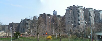
Amalgamated Warbasse Houses 3 Address: West 5th Street street in Brooklyn
Attractions near Amalgamated Warbasse Houses 3
Apt. 14 B,5th Sidney Jonas Walk,W St Sidney Walk,W 5th St & Sidney Walk,Sidney Jonas 5th St,W 5th Mitchell Wesson Pl,West 5th & Neptune,FedEx,United States Government House of Representatives,W 5th St (west 5th street and Neptune Ave),5th St and Neptune Ave,W 5th St Neptu,5th St & Nept,458 Neptune Avenue,435 Neptune Ave,Neptune Ave & Sidney,2915 Marsha Rapaport Way,Apple Bank,Brothers Bagels,545 Neptune AvenueHow to get to popular attractions in Brooklyn with public transit
Red Rooster, Manhattan,The Standard Grill, Manhattan,MTA Subway - 30th Ave (N/W), Queens,24 Hour Fitness, Manhattan,Stamford Transportation Center : Bus / Train (STM) Metro North & Amtrak, Stamford, Ct,Food Gallery 32, Manhattan,Nan Xiang Xiao Long Bao, Queens,Grimaldi's Pizzeria,Hill Country Chicken, Manhattan,The Stumble Inn, Manhattan,Joe's Shanghai 鹿嗚春, Manhattan,Stamford, CT, Stamford, Ct,Lombardi's Coal Oven Pizza, Manhattan,The Kunjip, Manhattan,The Grey Dog, Manhattan,Jersey Shore University Medical Center, Neptune, Nj,Mission Dolores,Planet Fitness, Queens,Tom & Jerry's, Manhattan,Ritz Bar & Lounge, ManhattanGet around Brooklyn by public transit!
Traveling around Brooklyn has never been so easy. See step by step directions as you travel to any attraction, street or major public transit station. View bus and train schedules, arrival times, service alerts and detailed routes on a map, so you know exactly how to get to anywhere in Brooklyn.
When traveling to any destination around Brooklyn use Moovit's Live Directions with Get Off Notifications to know exactly where and how far to walk, how long to wait for your line, and how many stops are left. Moovit will alert you when it's time to get off — no need to constantly re-check whether yours is the next stop.
Wondering how to use public transit in Brooklyn or how to pay for public transit in Brooklyn? Moovit public transit app can help you navigate your way with public transit easily, and at minimum cost. It includes public transit fees, ticket prices, and costs. Looking for a map of Brooklyn public transit lines? Moovit public transit app shows all public transit maps in Brooklyn with all subway or bus routes and stops on an interactive map.
Brooklyn has 2 transit type(s), including: subway or bus, operated by several transit agencies, including MTA Subway, Metro-North Railroad, LIRR, PATH, Shore Line East, MTA Bus Company, MTA New York City Transit - Express routes, MTA Bus, NJ Transit, NYC Ferry, NICE bus, Bee-Line Bus, NJ Transit Rail, NJ Transit Rail and Norwalk Transit District