How to get to Amazon@CollegePark by bus?
Click on the bus route to see step by step directions with maps, line arrival times and updated time schedules.
From H St NE (7th & H St NE), Washington
62 minFrom Coolidge High School, Washington
53 minFrom Rock Creek Park, Washington
91 minFrom Children's National - Main Hospital (Children's National Medical Center), Washington
55 minFrom Walmart, Washington
43 minFrom 8th St NE (8th st and h st ne), Washington
61 minFrom 645 H Street NE Service Center, Washington
62 minFrom Prince George's Sports and Learning Complex, Prince George's County
82 minFrom DC9 Nightclub, Washington
72 minFrom Throw Social, Washington
44 min
How to get to Amazon@CollegePark by train?
Click on the train route to see step by step directions with maps, line arrival times and updated time schedules.
How to get to Amazon@CollegePark by metro?
Click on the metro route to see step by step directions with maps, line arrival times and updated time schedules.
From H St NE (7th & H St NE), Washington
50 minFrom Coolidge High School, Washington
51 minFrom Children's National - Main Hospital (Children's National Medical Center), Washington
52 minFrom Walmart, Washington
38 minFrom 8th St NE (8th st and h st ne), Washington
51 minFrom 645 H Street NE Service Center, Washington
50 minFrom DC9 Nightclub, Washington
38 min
Train station near Amazon@CollegePark in Prince George's County
- Riverdale Marc Nb, 3 min walk,VIEW
Bus stops near Amazon@CollegePark in Prince George's County
Metro station near Amazon@CollegePark in Prince George's County
- College Park-U Of Md, 25 min walk,VIEW
Bus lines to Amazon@CollegePark in Prince George's County
What are the closest stations to Amazon@CollegePark?
The closest stations to Amazon@CollegePark are:
- Riverdale Marc Nb is 201 yards away, 3 min walk.
- Baltimore Ave & Hartwick Rd is 428 yards away, 6 min walk.
- Montgomery Hall (Outbound) is 603 yards away, 8 min walk.
- College Park-U Of Md is 2147 yards away, 25 min walk.
Which bus lines stop near Amazon@CollegePark?
These bus lines stop near Amazon@CollegePark: P10, P1X.
Which train line stops near Amazon@CollegePark?
MARC (Inbound - Camden)
Which metro lines stop near Amazon@CollegePark?
These metro lines stop near Amazon@CollegePark: GREEN, YELLOW.
What’s the nearest metro station to Amazon@CollegePark in Prince George's County?
The nearest metro station to Amazon@CollegePark in Prince George's County is College Park-U Of Md. It’s a 25 min walk away.
What’s the nearest train station to Amazon@CollegePark in Prince George's County?
The nearest train station to Amazon@CollegePark in Prince George's County is Riverdale Marc Nb. It’s a 3 min walk away.
What’s the nearest bus station to Amazon@CollegePark in Prince George's County?
The nearest bus station to Amazon@CollegePark in Prince George's County is Baltimore Ave & Hartwick Rd. It’s a 6 min walk away.
What time is the first metro to Amazon@CollegePark in Prince George's County?
The GREEN is the first metro that goes to Amazon@CollegePark in Prince George's County. It stops nearby at 5:03 AM.
What time is the last metro to Amazon@CollegePark in Prince George's County?
The GREEN is the last metro that goes to Amazon@CollegePark in Prince George's County. It stops nearby at 12:39 AM.
What time is the first train to Amazon@CollegePark in Prince George's County?
The MARC is the first train that goes to Amazon@CollegePark in Prince George's County. It stops nearby at 5:43 AM.
What time is the last train to Amazon@CollegePark in Prince George's County?
The MARC is the last train that goes to Amazon@CollegePark in Prince George's County. It stops nearby at 7:57 PM.
What time is the first bus to Amazon@CollegePark in Prince George's County?
The P10 is the first bus that goes to Amazon@CollegePark in Prince George's County. It stops nearby at 5:02 AM.
What time is the last bus to Amazon@CollegePark in Prince George's County?
The 118 is the last bus that goes to Amazon@CollegePark in Prince George's County. It stops nearby at 2:50 AM.
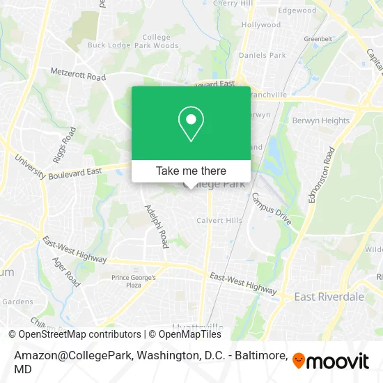
See Amazon@CollegePark, Prince George's County, on the map
Public Transit to Amazon@CollegePark in Prince George's County
Wondering how to get to Amazon@CollegePark in Prince George's County? Moovit helps you find the best way to get to Amazon@CollegePark with step-by-step directions from the nearest public transit station.
Moovit provides free maps and live directions to help you navigate through your city. View schedules, routes, timetables, and find out how long does it take to get to Amazon@CollegePark in real time.
Looking for the nearest stop or station to Amazon@CollegePark? Check out this list of stops closest to your destination: Riverdale Marc Nb; Baltimore Ave & Hartwick Rd; Montgomery Hall (Outbound); College Park-U Of Md.
Bus: P10, P1X, M44, NHD RH, 104.Train: MARC.Metro: GREEN, YELLOW.
Want to see if there’s another route that gets you there at an earlier time? Moovit helps you find alternative routes or times. Get directions from and directions to Amazon@CollegePark easily from the Moovit App or Website.
We make riding to Amazon@CollegePark easy, which is why over 1.5 million users, including users in Prince George's County, trust Moovit as the best app for public transit. You don’t need to download an individual bus app or train app, Moovit is your all-in-one transit app that helps you find the best bus time or train time available.
For information on prices of bus, metro and train, costs and ride fares to Amazon@CollegePark, please check the Moovit app.
Use the app to navigate to popular places including to the airport, hospital, stadium, grocery store, mall, coffee shop, school, college, and university.
Amazon@CollegePark Address: Terrapin Row street in Prince George's County
- Terrapin Row,
- Pickup and Returns at College Park,
- Amazon Locker,
- D.P. Dough,
- Living Water Adventist Church,
- Hub on Campus College Park,
- Dorie Glass,
- South Campus Commons 1,
- Standard at College Park,
- Blink Charging,
- Graduate Gardens Apartments,
- Sports Medicine,
- STARBUCKS,
- Boston Market,
- Ken Pharmacy,
- COLD STONE CREAMERY,
- F45 Training,
- Trinity Consulting Group,
- Crunch Fitness,
- T-Rex Consulting Corporation
Places Near Amazon@CollegePark (Prince George's County)
- Westfield Montgomery Mall, Montgomery County,
- Pennsylvania Ave NW (3rd st and pennsylvania), Washington,
- M&T Bank Stadium, Baltimore,
- Georgetown, Washington,
- Museum Of The Bible, Washington,
- Amazon Hq2, Arlington County,
- Basilica of the National Shrine, Washington,
- Sibley Memorial Hospital, Washington,
- Warner Theatre, Washington,
- Capital One Arena, Washington,
- Rock Creek Tennis Center, Washington,
- National Zoo, Washington,
- Marriott Marquis Washington, DC, Washington,
- Washington National Cathedral, Washington,
- The Anthem, Washington,
- PG Mall, Prince George's County,
- Washington DC VA Medical Center, Washington,
- National Museum of African American History and Culture, Washington,
- National Mall, Washington,
- Camden Yards, Baltimore
How to get to popular places in Washington, D.C. - Baltimore, MD with public transit
Get around Prince George's County by public transit!
Traveling around Prince George's County has never been so easy. See step by step directions as you travel to any attraction, street or major public transit station. View bus and train schedules, arrival times, service alerts and detailed routes on a map, so you know exactly how to get to anywhere in Prince George's County.
When traveling to any destination around Prince George's County use Moovit's Live Directions with Get Off Notifications to know exactly where and how far to walk, how long to wait for your line, and how many stops are left. Moovit will alert you when it's time to get off — no need to constantly re-check whether yours is the next stop.
Wondering how to use public transit in Prince George's County or how to pay for public transit in Prince George's County? Moovit public transit app can help you navigate your way with public transit easily, and at minimum cost. It includes public transit fees, ticket prices, and costs. Looking for a map of Prince George's County public transit lines? Moovit public transit app shows all public transit maps in Prince George's County with all Bus, Train, Metro, Light Rail and Ferry routes and stops on an interactive map.
Washington, D.C. - Baltimore, MD has 5 transit type(s), including: Bus, Train, Metro, Light Rail and Ferry, operated by several transit agencies, including WMATA, Montgomery County Ride On, Fairfax Connector, TheBus, PRTC, DASH - Alexandria, Arlington Transit (ART), RTA of Central Maryland, MDOT MTA, MDOT MTA Light RailLink, MDOT MTA Commuter Bus, MDOT MTA Local Bus, FXBGO!, Virginia Railway Express (VRE) and MARC