How to get to Amazon Locker-Stoique by bus?
Click on the bus route to see step by step directions with maps, line arrival times and updated time schedules.
From SW 184 St & US 1, Kendall-Palmetto Bay
73 minFrom Coral Reef Senior High School, Kendall-Palmetto Bay
58 minFrom SW 72nd St / US-1, Miami
64 minFrom SW 104th St / US-1, Kendall-Palmetto Bay
45 minFrom Miami Palmetto Senior High School, Kendall-Palmetto Bay
73 minFrom Walmart (Walmart Supercenter Miami - W Flagler Street), North Westside
74 minFrom Rodeway Inn South Miami - Coral Gables, Miami
65 minFrom West Kendall Baptist Hospital, Kendale Lakes-Tamiami
36 minFrom Eureka Drive & U.S. 1, Kendall-Palmetto Bay
61 minFrom Miami-Dade County Fair and Exposition, South Westside
65 min
Bus stop near Amazon Locker-Stoique in Kendale Lakes-Tamiami
- Sw 88 St@sw 117 Av, 7 min walk,VIEW
Bus lines to Amazon Locker-Stoique in Kendale Lakes-Tamiami
What are the closest stations to Amazon Locker-Stoique?
The closest stations to Amazon Locker-Stoique are:
- Sw 88 St@sw 117 Av is 527 yards away, 7 min walk.
Which bus lines stop near Amazon Locker-Stoique?
These bus lines stop near Amazon Locker-Stoique: 288, 88.
What’s the nearest bus station to Amazon Locker-Stoique in Kendale Lakes-Tamiami?
The nearest bus station to Amazon Locker-Stoique in Kendale Lakes-Tamiami is Sw 88 St@sw 117 Av. It’s a 7 min walk away.
What time is the first bus to Amazon Locker-Stoique in Kendale Lakes-Tamiami?
The 88 is the first bus that goes to Amazon Locker-Stoique in Kendale Lakes-Tamiami. It stops nearby at 5:28 AM.
What time is the last bus to Amazon Locker-Stoique in Kendale Lakes-Tamiami?
The 88 is the last bus that goes to Amazon Locker-Stoique in Kendale Lakes-Tamiami. It stops nearby at 1:18 AM.
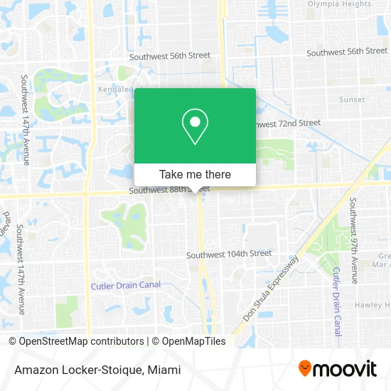
See Amazon Locker-Stoique, Kendale Lakes-Tamiami, on the map
Public Transit to Amazon Locker-Stoique in Kendale Lakes-Tamiami
Wondering how to get to Amazon Locker-Stoique in Kendale Lakes-Tamiami? Moovit helps you find the best way to get to Amazon Locker-Stoique with step-by-step directions from the nearest public transit station.
Moovit provides free maps and live directions to help you navigate through your city. View schedules, routes, timetables, and find out how long does it take to get to Amazon Locker-Stoique in real time.
Looking for the nearest stop or station to Amazon Locker-Stoique? Check out this list of stops closest to your destination: Sw 88 St@sw 117 Av.
Bus: 288, 88.
Want to see if there’s another route that gets you there at an earlier time? Moovit helps you find alternative routes or times. Get directions from and directions to Amazon Locker-Stoique easily from the Moovit App or Website.
We make riding to Amazon Locker-Stoique easy, which is why over 1.5 million users, including users in Kendale Lakes-Tamiami, trust Moovit as the best app for public transit. You don’t need to download an individual bus app or train app, Moovit is your all-in-one transit app that helps you find the best bus time or train time available.
For information on prices of bus and train, costs and ride fares to Amazon Locker-Stoique, please check the Moovit app.
Use the app to navigate to popular places including to the airport, hospital, stadium, grocery store, mall, coffee shop, school, college, and university.
Amazon Locker-Stoique Address: 11910 SW 88th St Miami, FL 33186 street in Kendale Lakes-Tamiami
- Chili's Grill & Bar,
- Herbert Murillo DDS,
- Florida's Tpke S Entrance Hialeah,
- Bed Bath & Beyond,
- Trim Appliance Repair,
- Maute Grill,
- Charlotte Tilbury,
- Florida's Tpke N Exit Hialeah,
- Espinoza Lori Od,
- Turnpike North @ SW 88 St. Entrance,
- Foot Locker,
- Ocean2fish Seafood Market,
- Cesar E Ceballos MD,
- Alejandro Pino MD,
- Mivip Surgery Center,
- Eric J Balaguer, MD Board Certified,
- Surgery Partners,
- West Kendall Medical Pavilion,
- J.Crew Factory,
- Iglesia Vida Y Esperanza Miami
Places Near Amazon Locker-Stoique (Kendale Lakes-Tamiami)
- Dolphin Mall Bus, Miami,
- Hard Rock Stadium, Miami Gardens,
- Little Havana, Miami,
- Zoo Miami, Miami,
- Miami Freedom Park, Miami,
- Aventura Mall, Miami,
- Miami VA Hospital, Miami,
- Aventura Mall, Miami Beach,
- Bayside Marketplace, Miami,
- Richard E. Gerstein Justice Building, Miami,
- Sawgrass Mall, Miami,
- Dolphin Mall, Miami,
- Keiser University Flagship Campus, West Palm Beach,
- Brickell City Centre, Miami,
- Sawgrass mall ( FL ), Miami Beach,
- Wynwood, Miami,
- Port of Miami Cruise Terminal, Miami,
- Miami-Dade County Courthouse, Miami,
- Miami Design District, Miami,
- Marlins Park, Miami
How to get to popular places in Miami with public transit
Get around Kendale Lakes-Tamiami by public transit!
Traveling around Kendale Lakes-Tamiami has never been so easy. See step by step directions as you travel to any attraction, street or major public transit station. View bus and train schedules, arrival times, service alerts and detailed routes on a map, so you know exactly how to get to anywhere in Kendale Lakes-Tamiami.
When traveling to any destination around Kendale Lakes-Tamiami use Moovit's Live Directions with Get Off Notifications to know exactly where and how far to walk, how long to wait for your line, and how many stops are left. Moovit will alert you when it's time to get off — no need to constantly re-check whether yours is the next stop.
Wondering how to use public transit in Kendale Lakes-Tamiami or how to pay for public transit in Kendale Lakes-Tamiami? Moovit public transit app can help you navigate your way with public transit easily, and at minimum cost. It includes public transit fees, ticket prices, and costs. Looking for a map of Kendale Lakes-Tamiami public transit lines? Moovit public transit app shows all public transit maps in Kendale Lakes-Tamiami with all Bus, Train, Light Rail and Ferry routes and stops on an interactive map.
Miami has 4 transit type(s), including: Bus, Train, Light Rail and Ferry, operated by several transit agencies, including Broward County Transit, Miami-Dade Transit, Metrorail, Palm Tran, Tri-Rail, Brightline, MARTY, City of Homestead Trolley, Key West Transit, Treasure Coast Connector, GoLine IRT, Amtrak, Greyhound-us, FlixBus-us and Aventura Express Shuttle Bus