How to get to Amoco by bus?
Click on the bus route to see step by step directions with maps, line arrival times and updated time schedules.
From Bepxxx, Fort Lauderdale
74 minFrom Broward College North Campus Bldg. 48, Pompano Beach
32 minFrom Mizner Park, Boca Raton
82 minFrom W Commercial Blvd & 441 (SR 7), Fort Lauderdale
77 minFrom Tri-Rail-Deerfield Beach Station, Deerfield Beach
44 minFrom Trapeze Swing Club, Fort Lauderdale
75 minFrom Wilton Manors, Fort Lauderdale
48 minFrom City of Oakland Park, Fort Lauderdale
34 minFrom Amerant Bank, Fort Lauderdale
49 minFrom Sensual Asian Massage, Boca Raton
99 min
Bus stops near Amoco in Pompano Beach
Train station near Amoco in Pompano Beach
- Pompano Beach Station, 43 min walk,VIEW
Bus lines to Amoco in Pompano Beach
What are the closest stations to Amoco?
The closest stations to Amoco are:
- Dixie Highway/Northeast 17th Court is 118 yards away, 2 min walk.
- Northwest 3rd Avenue/Northwest 18th Court is 857 yards away, 11 min walk.
- Pompano Beach Station is 3666 yards away, 43 min walk.
Which bus lines stop near Amoco?
These bus lines stop near Amoco: 50, 83.
What’s the nearest bus station to Amoco in Pompano Beach?
The nearest bus station to Amoco in Pompano Beach is Dixie Highway/Northeast 17th Court. It’s a 2 min walk away.
What time is the first train to Amoco in Pompano Beach?
The TRIRAIL is the first train that goes to Amoco in Pompano Beach. It stops nearby at 4:41 AM.
What time is the last train to Amoco in Pompano Beach?
The TRIRAIL is the last train that goes to Amoco in Pompano Beach. It stops nearby at 10:50 PM.
What time is the first bus to Amoco in Pompano Beach?
The 20 is the first bus that goes to Amoco in Pompano Beach. It stops nearby at 4:52 AM.
What time is the last bus to Amoco in Pompano Beach?
The 50 is the last bus that goes to Amoco in Pompano Beach. It stops nearby at 11:55 PM.
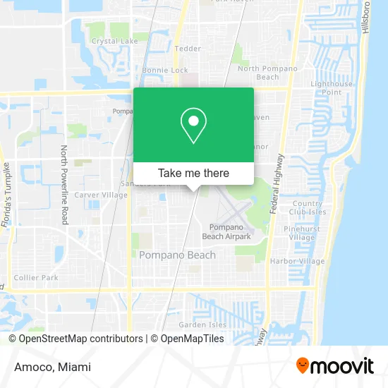
See Amoco, Pompano Beach, on the map
Public Transit to Amoco in Pompano Beach
Wondering how to get to Amoco in Pompano Beach? Moovit helps you find the best way to get to Amoco with step-by-step directions from the nearest public transit station.
Moovit provides free maps and live directions to help you navigate through your city. View schedules, routes, timetables, and find out how long does it take to get to Amoco in real time.
Looking for the nearest stop or station to Amoco? Check out this list of stops closest to your destination: Dixie Highway/Northeast 17th Court; Northwest 3rd Avenue/Northwest 18th Court; Pompano Beach Station.
Bus: 50, 83, 20.Train: TRIRAIL.
Want to see if there’s another route that gets you there at an earlier time? Moovit helps you find alternative routes or times. Get directions from and directions to Amoco easily from the Moovit App or Website.
We make riding to Amoco easy, which is why over 1.5 million users, including users in Pompano Beach, trust Moovit as the best app for public transit. You don’t need to download an individual bus app or train app, Moovit is your all-in-one transit app that helps you find the best bus time or train time available.
For information on prices of bus, costs and ride fares to Amoco, please check the Moovit app.
Use the app to navigate to popular places including to the airport, hospital, stadium, grocery store, mall, coffee shop, school, college, and university.
Amoco Address: 1741 N Dixie Hwy Pompano Beach, FL 33060 street in Pompano Beach
- Iglesia la Nueva Jerusalen Ad,
- Budget Car Rental,
- Jimenez Tires,
- J & B Lakay Takeout,
- Ifrolix,
- Executive Motor Sales,
- Custom Wheels,
- Clean Machine,
- Novelty Park,
- 24 Hours Locksmith In Broward,
- Exotic Automotive,
- Pompano Beach One Storage,
- Carefree Marine Group South Florida,
- Family Tax,
- Louis & Matthews Investment,
- Lovely Park,
- Kendall Green, Florida,
- Leos Auto Shop,
- 4riders Garage,
- Pollo National
Places Near Amoco (Pompano Beach)
- Miami VA Hospital, Miami,
- Brickell City Centre, Miami,
- Little Havana, Miami,
- Aventura Mall, Miami Beach,
- Aventura Mall, Miami,
- Port of Miami Cruise Terminal, Miami,
- Sawgrass Mall, Miami,
- Bayside Marketplace, Miami,
- Miami-Dade County Courthouse, Miami,
- Miami Design District, Miami,
- Dolphin Mall Bus, Miami,
- Sawgrass mall ( FL ), Miami Beach,
- Miami Freedom Park, Miami,
- Keiser University Flagship Campus, West Palm Beach,
- Dolphin Mall, Miami,
- Zoo Miami, Miami,
- Marlins Park, Miami,
- Hard Rock Stadium, Miami Gardens,
- Wynwood, Miami,
- Richard E. Gerstein Justice Building, Miami
How to get to popular places in Miami with public transit
Get around Pompano Beach by public transit!
Traveling around Pompano Beach has never been so easy. See step by step directions as you travel to any attraction, street or major public transit station. View bus and train schedules, arrival times, service alerts and detailed routes on a map, so you know exactly how to get to anywhere in Pompano Beach.
When traveling to any destination around Pompano Beach use Moovit's Live Directions with Get Off Notifications to know exactly where and how far to walk, how long to wait for your line, and how many stops are left. Moovit will alert you when it's time to get off — no need to constantly re-check whether yours is the next stop.
Wondering how to use public transit in Pompano Beach or how to pay for public transit in Pompano Beach? Moovit public transit app can help you navigate your way with public transit easily, and at minimum cost. It includes public transit fees, ticket prices, and costs. Looking for a map of Pompano Beach public transit lines? Moovit public transit app shows all public transit maps in Pompano Beach with all Bus, Train, Light Rail and Ferry routes and stops on an interactive map.
Miami has 4 transit type(s), including: Bus, Train, Light Rail and Ferry, operated by several transit agencies, including Broward County Transit, Miami-Dade Transit, Metrorail, Palm Tran, Tri-Rail, Brightline, MARTY, City of Homestead Trolley, Key West Transit, Treasure Coast Connector, GoLine IRT, Amtrak, Greyhound-us, FlixBus-us and Aventura Express Shuttle Bus