Directions to Ampang Jaya (Hulu Langat) with public transportation
The following transit lines have routes that pass near Ampang Jaya
How to get to Ampang Jaya by bus?
Click on the bus route to see step by step directions with maps, line arrival times and updated time schedules.
How to get to Ampang Jaya by MRT & LRT?
Click on the MRT & LRT route to see step by step directions with maps, line arrival times and updated time schedules.
Bus stops near Ampang Jaya in Hulu Langat
- Midpoint, 6 min walk,
- Balai Polis Pandan Indah, 8 min walk,
- Taman Lembah Maju (Utara), 10 min walk,
- Flat Sri Merpati, 12 min walk,
- Pandan Indah Auto City, 13 min walk,
- Hospital Besar Ampang (Barat), 18 min walk,
- Axis Atrium, 26 min walk,
Mrt & lrt stations near Ampang Jaya in Hulu Langat
- Cahaya, 26 min walk,
- Maluri, 57 min walk,
Bus lines to Ampang Jaya in Hulu Langat
- AJ03, LRT Cempaka ↺ Taman Bukit Teratai,
- AJ04, Pandan Perdana ↺ Hospital Besar Ampang,
- T351, LRT Cempaka ↺ Taman Bukit Permai,
- T305, MRT Taman Midah ↺ Bandar Baru Ampang,
- T350, LRT Cempaka ↺ Taman Mawar,
- 300, Lebuh Ampang,
- 420, Menara Maybank,
- AJ2B, Hab Bandar Baru Ampang / Sri Nilam ↺ Taman Putra Ampang,
- T303, Ampang Point ↺ LRT Pandan Indah,
What are the closest stations to Ampang Jaya?
The closest stations to Ampang Jaya are:
- Midpoint is 437 meters away, 6 min walk.
- Balai Polis Pandan Indah is 533 meters away, 8 min walk.
- Taman Lembah Maju (Utara) is 699 meters away, 10 min walk.
- Flat Sri Merpati is 906 meters away, 12 min walk.
- Pandan Indah Auto City is 941 meters away, 13 min walk.
- Hospital Besar Ampang (Barat) is 1367 meters away, 18 min walk.
- Axis Atrium is 1959 meters away, 26 min walk.
- Cahaya is 2003 meters away, 26 min walk.
- Maluri is 4387 meters away, 57 min walk.
Which bus lines stop near Ampang Jaya?
These bus lines stop near Ampang Jaya: 300, 420, T351.
Which MRT & LRT line stops near Ampang Jaya?
3
What’s the nearest MRT & LRT station to Ampang Jaya in Hulu Langat?
The nearest MRT & LRT station to Ampang Jaya in Hulu Langat is Cahaya. It’s a 26 min walk away.
What’s the nearest bus stop to Ampang Jaya in Hulu Langat?
The nearest bus stop to Ampang Jaya in Hulu Langat is Midpoint. It’s a 6 min walk away.
See Ampang Jaya, Hulu Langat, on the map
Public Transit to Ampang Jaya in Hulu Langat
Wondering how to get to Ampang Jaya in Hulu Langat, Malaysia? Moovit helps you find the best way to get to Ampang Jaya with step-by-step directions from the nearest public transit station.
Moovit provides free maps and live directions to help you navigate through your city. View schedules, routes, timetables, and find out how long does it take to get to Ampang Jaya in real time.
Looking for the nearest stop or station to Ampang Jaya? Check out this list of stops closest to your destination: Midpoint; Balai Polis Pandan Indah; Taman Lembah Maju (Utara); Flat Sri Merpati; Pandan Indah Auto City; Hospital Besar Ampang (Barat); Axis Atrium; Cahaya; Maluri.
Bus: 300, 420, T351, AJ03, AJ04, T305, T350.MRT & LRT: 3, 9.
Want to see if there’s another route that gets you there at an earlier time? Moovit helps you find alternative routes or times. Get directions from and directions to Ampang Jaya easily from the Moovit App or Website.
We make riding to Ampang Jaya easy, which is why over 1.5 million users, including users in Hulu Langat, trust Moovit as the best app for public transit. You don’t need to download an individual bus app or train app, Moovit is your all-in-one transit app that helps you find the best bus time or train time available.
For information on prices of bus and MRT & LRT, costs and ride fares to Ampang Jaya, please check the Moovit app.
Use the app to navigate to popular places including to the airport, hospital, stadium, grocery store, mall, coffee shop, school, college, and university.
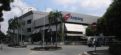
Ampang Jaya Address: Jalan Pandan Indah 5/2 street in Hulu Langat
Attractions near Ampang Jaya
Weng San Glass & Frames,Yt Super Shine Car Beauty House,Safrina Trading,Restoran Kg Pandan,Texton Communication,Lanfar (M) Sdn. Bhd.,Europlus Construction Sdn. Bhd.,Tourism Publications Corporation Sdn. Bhd.,Maybank - ATM,Agensi Anti Dadah Kebangsaan Daerah Hulu Langat (Ampang),Damai Bistari Sdn. Bhd.,NG Keng Chuan Associates,Agrocon (M) Sdn. Bhd.,Winning Auto Sdn Bhd,Kadkahwinmu Sdn. Bhd.,Bukit Beruntung Nurseries Sdn. Bhd.,Kumpulan Europlus Berhad,Shir Khan Construction & Trading,Nazri Aziz & Wong,Cempaka Home Hardware Electrical TradingHow to get to popular attractions in Hulu Langat with public transit
Bukit Jelutong Residential, Shah Alam,Terminal Bersepadu Selatan (Tbs), Kuala Lumpur,D' Banana Leaf, Sepang,Warung Cikgu, Puchong,Maths Pro Tuition Center (Luke Tan), Petaling Jaya,Sri Pentas TV3, Petaling Jaya,Kompleks Sukan Pandamaran, Klang,Restoran Original Penang Kayu Nasi Kandar, Petaling Jaya,Firezone Family KTV, Petaling Jaya,Tune Hotel, Sepang,Presint 5 (Precinct), Sepang,IBM Malaysia Sdn. Bhd., Petaling Jaya,KFC Dengkil, Sepang,Restoran Arafah, Petaling Jaya,San Francisco Pizza, Shah Alam,Guthrie Corridor Expressway (GCE), Petaling Jaya,Score, Petaling Jaya,Masjid Bandar Diraja, Klang,Subway, Seremban,Seksyen 24, KlangGet around Kuala Lumpur by public transit!
Traveling around Kuala Lumpur has never been so easy. See step by step directions as you travel to any attraction, street or major public transit station. View bus and train schedules, arrival times, service alerts and detailed routes on a map, so you know exactly how to get to anywhere in Kuala Lumpur.
When traveling to any destination around Kuala Lumpur use Moovit's Live Directions with Get Off Notifications to know exactly where and how far to walk, how long to wait for your line, and how many stops are left. Moovit will alert you when it's time to get off — no need to constantly re-check whether yours is the next stop.
Wondering how to use public transit in Kuala Lumpur or how to pay for public transit in Kuala Lumpur? Moovit public transit app can help you navigate your way with public transit easily, and at minimum cost. It includes public transit fees, ticket prices, and costs. Looking for a map of Kuala Lumpur public transit lines? Moovit public transit app shows all public transit maps in Kuala Lumpur with all Bus, Train, MRT & LRT, Monorail, Ferry and Cable Car routes and stops on an interactive map.
Kuala Lumpur has 6 transit type(s), including: Bus, Train, MRT & LRT, Monorail, Ferry and Cable Car, operated by several transit agencies, including rapidKL, rapidKL MRT, Express Rail Link - ERL, Keretapi Tanah Melayu - KTM, rapidKL BRT, rapidKL Bus, MRT Feeder Bus (Operated by RapidKL), GOKL City Bus, PJ City Bus (operated by rapidKL), Smart Selangor (operated by rapidKL), Smart Selangor, Nadiputra (Operated by RapidKL), Free Shuttle Service, Causeway Link (Handal Ceria Sdn Bhd), Universiti Malaya