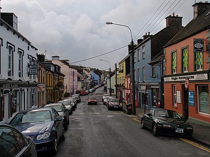
See An Daingean, Dingle, on the map
Directions to An Daingean (Dingle) with public transportation
The following transit lines have routes that pass near An Daingean
 Bus:
Bus:
How to get to An Daingean by bus?
Click on the bus route to see step by step directions with maps, line arrival times and updated time schedules.
Bus stations near An Daingean in Dingle
- Dingle Dingle,5 min walk,
Bus lines to An Daingean in Dingle
- 275,Dingle,
What are the closest stations to An Daingean?
The closest stations to An Daingean are:
- Dingle Dingle is 319 meters away, 5 min walk.
Which bus line stops near An Daingean?
275
What’s the nearest bus stop to An Daingean in Dingle?
The nearest bus stop to An Daingean in Dingle is Dingle Dingle. It’s a 5 min walk away.
See An Daingean, Dingle, on the map
Public Transit to An Daingean in Dingle
Wondering how to get to An Daingean in Dingle, Ireland? Moovit helps you find the best way to get to An Daingean with step-by-step directions from the nearest public transit station.
Moovit provides free maps and live directions to help you navigate through your city. View schedules, routes, timetables, and find out how long does it take to get to An Daingean in real time.
Looking for the nearest stop or station to An Daingean? Check out this list of stops closest to your destination: Dingle Dingle.
Bus:
Want to see if there’s another route that gets you there at an earlier time? Moovit helps you find alternative routes or times. Get directions from and directions to An Daingean easily from the Moovit App or Website.
We make riding to An Daingean easy, which is why over 1.5 million users, including users in Dingle, trust Moovit as the best app for public transit. You don’t need to download an individual bus app or train app, Moovit is your all-in-one transit app that helps you find the best bus time or train time available.
For information on prices of bus, costs and ride fares to An Daingean, please check the Moovit app.
Use the app to navigate to popular places including to the airport, hospital, stadium, grocery store, mall, coffee shop, school, college, and university.
Location: Dingle, Ireland
Attractions near An Daingean
Yn Dein,دینگل,Dinglis,ディングル,Daingean Uí Chuis,Дингл,Dingle,Jerry Kennedy,Orchard Lane,An Café Liteartha,Hideout Hostel,Co. Kerry,Main Street,The Hideout Hostel,Penney's,Paddy Macs Pub,The Orchard, Dingle Town Park,Post Office,Geaney'S Bar,Dingle Music ShopHow to get to popular attractions in Dingle with public transit
St. James's Hospital, Dublin,Kildare Village, Kildare,The Brazen Head, Dublin,Connolly Train Station, Dublin,Apple,Blanchardstown Shopping Centre, Blanchardstown,Irish Museum of Modern Art, Dublin,St. Stephen's Green East, Dublin,Red Cow Luas, Clondalkin,Waterford / Port Láirge, Waterford,Phoenix Park Visitors' Centre, Dublin,Bray, Bray,Dublin City University (DCU), Dublin,Griffith College Dublin, Dublin,Galway / An Gaillimh, Galway,Rds Main Arena, Dublin,IKEA, Dubber,Dcu, Dublin,The Square Shopping Centre, Tallaght,Swords Pavilions Shopping Centre, Swords VillageGet around Dingle by public transit!
Traveling around Dingle has never been so easy. See step by step directions as you travel to any attraction, street or major public transit station. View bus and train schedules, arrival times, service alerts and detailed routes on a map, so you know exactly how to get to anywhere in Dingle.
When traveling to any destination around Dingle use Moovit's Live Directions with Get Off Notifications to know exactly where and how far to walk, how long to wait for your line, and how many stops are left. Moovit will alert you when it's time to get off — no need to constantly re-check whether yours is the next stop.
Wondering how to use public transit in Dingle or how to pay for public transit in Dingle? Moovit public transit app can help you navigate your way with public transit easily, and at minimum cost. It includes public transit fees, ticket prices, and costs. Looking for a map of Dingle public transit lines? Moovit public transit app shows all public transit maps in Dingle with all bus routes and stops on an interactive map.
Dingle has 1 transit type(s), including: bus, operated by several transit agencies, including Luas, Bus Átha Cliath – Dublin Bus, Bus Éireann, Go-Ahead Ireland, Nitelink, Dublin Bus, Citylink, Kenneally's Bus Service, Aircoach, TFI Local Link Mayo, Irish Rail, Express Bus, JJ/Bernard Kavanagh, Dublin Coach, Kearns Transport and Matthews Coach Hire