Directions to Anda Circle station (Manila) with public transit
The following transit lines have routes that pass near Anda Circle
How to get to Anda Circle station by bus?
Click on the bus route to see step by step directions with maps, line arrival times and updated time schedules.
How to get to Anda Circle station by train?
Click on the train route to see step by step directions with maps, line arrival times and updated time schedules.
Bus stops near Anda Circle in Manila
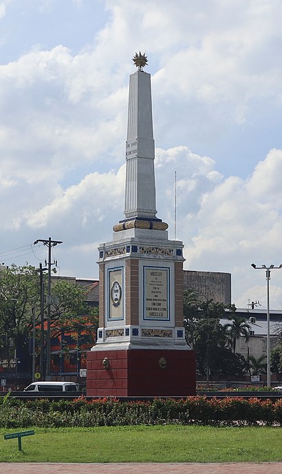
- Anda Circle, 1 min walk,
- Railroad Dr / 13th St Intersection, Manila, 2 min walk,
- Bonifacio Drive, Manila, 2 min walk,
- Andres Soriano Jr Ave / Muralla Intersection, Manila, 8 min walk,
Train stations near Anda Circle in Manila
- Recto Lrt, 12 min walk,
- Carriedo Lrt, 13 min walk,
Bus lines to Anda Circle station in Manila
- JEEP, Jetti Petrol Station, Tanding Sora Avenue, Quezon City,
- JEEP, West Avenue, Quezon City,
- JEEP, Cubao - Pier South via Espana,
- JEEP, MONUMENTO-PIER,
- JEEP, Paco - Pier South,
- JEEP, Monumento - Pier South via Rizal Ave.,
- JEEP, PIER SOUTH-PACO PALENGKE,
- JEEP, LIBERTAD-PIER SOUTH,
- JEEP, BLUMENTRITT - PIER SOUTH via STA CRUZ,
- JEEP, Pier South - Sta. Ana via Padre Faura,
- JEEP, DAPITAN - PIER SOUTH,
- JEEP, Pier South - Proj. 2 & 3 via Timog,
- JEEP, Pier South - Proj. 2 & 3 via E. Rodriguez,
- JEEP, PIER-MALANDAY,
- JEEP, Pier South - Proj. 4 via Espana,
- JEEP, PIER-DELPAN ZARAGOSA,
- JEEP, Malanday - Pier South via Rizal Ave., P. Burgos,
- JEEP, Frisco - Pier South via Sta. Cruz,
- JEEP, Pier South - Proj. 7 via Espana, Roosevelt,
- JEEP, PIER-PASAY LIBERTAD,
What are the closest stations to Anda Circle?
The closest stations to Anda Circle are:
- Anda Circle is 70 meters away, 1 min walk.
- Railroad Dr / 13th St Intersection, Manila is 78 meters away, 2 min walk.
- Bonifacio Drive, Manila is 132 meters away, 2 min walk.
- Andres Soriano Jr Ave / Muralla Intersection, Manila is 563 meters away, 8 min walk.
- Recto Lrt is 914 meters away, 12 min walk.
- Carriedo Lrt is 1008 meters away, 13 min walk.
Which bus line stops near Anda Circle?
JEEP (Angel Linao / Pedro Gil→Railroad Dr / 13th St Intersection, Manila)
Which train line stops near Anda Circle?
LRT 1 (Roosevelt)
What’s the nearest train station to Anda Circle in Manila?
The nearest train station to Anda Circle in Manila is Recto Lrt. It’s a 12 min walk away.
What’s the nearest bus stop to Anda Circle in Manila?
The nearest bus stop to Anda Circle in Manila is Anda Circle. It’s a 1 min walk away.
What time is the first train to Anda Circle in Manila?
The LRT 2 is the first train that goes to Anda Circle in Manila. It stops nearby at 5:00 AM.
What time is the last train to Anda Circle in Manila?
The LRT 1 is the last train that goes to Anda Circle in Manila. It stops nearby at 10:34 PM.
What time is the first bus to Anda Circle in Manila?
The BUS is the first bus that goes to Anda Circle in Manila. It stops nearby at 3:35 AM.
What time is the last bus to Anda Circle in Manila?
The BUS is the last bus that goes to Anda Circle in Manila. It stops nearby at 3:35 AM.
See Anda Circle, Manila, on the map
Public Transit to Anda Circle in Manila
How to get to Anda Circle in Manila, Philippines?
It’s easy with Moovit. Type in your street address and Moovit’s route finder will locate the fastest way to get you there! Not sure where to get off on the street? Download the Moovit App to find live directions (including where to get off on Anda Circle), see timetables and get the estimated arrival times for your favorite bus or train lines.
Looking for the nearest stop or station to Anda Circle? Check out this list of closest stops available to your destination: Anda Circle; Railroad Dr / 13th St Intersection; Bonifacio Drive; Andres Soriano Jr Ave / Muralla Intersection; Recto Lrt; Carriedo Lrt.
Bus: JEEP, BUS, BUS.Train: LRT 1, LRT 2.
Download the Moovit App to see the current schedule and routes available for Manila. No need to install a special bus app to check the bus time or a train app to get train time. Moovit is the only all-in-one transit app that helps you get where you need to go.
We make riding on public transit to Anda Circle easy, which is why over 1.5 million users, including users in Manila trust Moovit as the best app for public transit.
Use the app to navigate to popular places including to the airport, hospital, stadium, grocery store, mall, coffee shop, school, college, and university.
Location: Manila
Streets near Anda Circle, Manila
Get around Manila by public transit!
Traveling around Manila has never been so easy. See step by step directions as you travel to any attraction, street or major public transit station. View bus and train schedules, arrival times, service alerts and detailed routes on a map, so you know exactly how to get to anywhere in Manila.
When traveling to any destination around Manila use Moovit's Live Directions with Get Off Notifications to know exactly where and how far to walk, how long to wait for your line, and how many stops are left. Moovit will alert you when it's time to get off — no need to constantly re-check whether yours is the next stop.
Wondering how to use public transit in Manila or how to pay for public transit in Manila? Moovit public transit app can help you navigate your way with public transit easily, and at minimum cost. It includes public transit fees, ticket prices, and costs. Looking for a map of Manila public transit lines? Moovit public transit app shows all public transit maps in Manila with all Bus and Train routes and stops on an interactive map.
Manila has 2 transit type(s), including: Bus and Train, operated by several transit agencies, including LRTA, LTFRB, MRTC, PNR, P2P, UV Express and BGC Bus