Directions to Anderson Ave (Drexel Hill) with public transportation
The following transit lines have routes that pass near Anderson Ave
How to get to Anderson Ave by bus?
Click on the bus route to see step by step directions with maps, line arrival times and updated time schedules.
How to get to Anderson Ave by train?
Click on the train route to see step by step directions with maps, line arrival times and updated time schedules.
How to get to Anderson Ave by subway?
Click on the subway route to see step by step directions with maps, line arrival times and updated time schedules.
Bus stations near Anderson Ave in Drexel Hill
- State Rd & Anderson Av, 1 min walk,
Light Rail stations near Anderson Ave in Drexel Hill
- Anderson Av Station, 4 min walk,
Bus lines to Anderson Ave in Drexel Hill
- 111, Fair Acres,
What are the closest stations to Anderson Ave?
The closest stations to Anderson Ave are:
- State Rd & Anderson Av is 28 yards away, 1 min walk.
- Anderson Av Station is 290 yards away, 4 min walk.
Which bus line stops near Anderson Ave?
111
Which train line stops near Anderson Ave?
MEDIA/ELWYN LINE
Which subway line stops near Anderson Ave?
NHSL
What’s the nearest light rail station to Anderson Ave in Drexel Hill?
The nearest light rail station to Anderson Ave in Drexel Hill is Anderson Av Station. It’s a 4 min walk away.
What’s the nearest bus stop to Anderson Ave in Drexel Hill?
The nearest bus stop to Anderson Ave in Drexel Hill is State Rd & Anderson Av. It’s a 1 min walk away.
See Anderson Ave, Drexel Hill, on the map
Public Transit to Anderson Ave in Drexel Hill
Wondering how to get to Anderson Ave in Drexel Hill, United States? Moovit helps you find the best way to get to Anderson Ave with step-by-step directions from the nearest public transit station.
Moovit provides free maps and live directions to help you navigate through your city. View schedules, routes, timetables, and find out how long does it take to get to Anderson Ave in real time.
Looking for the nearest stop or station to Anderson Ave? Check out this list of stops closest to your destination: State Rd & Anderson Av; Anderson Av Station.
Bus: 111.Train: MEDIA/ELWYN LINE.Subway: NHSL.
Want to see if there’s another route that gets you there at an earlier time? Moovit helps you find alternative routes or times. Get directions from and directions to Anderson Ave easily from the Moovit App or Website.
We make riding to Anderson Ave easy, which is why over 1.5 million users, including users in Drexel Hill, trust Moovit as the best app for public transit. You don’t need to download an individual bus app or train app, Moovit is your all-in-one transit app that helps you find the best bus time or train time available.
For information on prices of bus, subway and train, costs and ride fares to Anderson Ave, please check the Moovit app.
Use the app to navigate to popular places including to the airport, hospital, stadium, grocery store, mall, coffee shop, school, college, and university.
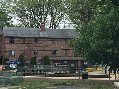
Anderson Ave Address: Drexel Hill, PA 19026 street in Drexel Hill
Attractions near Anderson Ave
Vera's Pizza,Wawa,State Rd / Anderson Ave,State Rd (state rd anderson),State Rd,Rita's Water Ice,RFC II,Practical Shooter LLC,Educational Student Tours,Premier Electricians,Marian Anderson Historical Residence & Museum,The Porsche Specialist,728 Roberts Avenue,USA Roofing and Waterproofing Crop,760 Alexander Ave,alexander ave,Edward A Kelly MD,Nicholsons TV Service,Penn State Sports Marketing,J R Cras IncHow to get to popular attractions in Drexel Hill with public transit
Cuba Libre Restaurant & Rum Bar, Philadelphia,Lansdowne, PA, Lansdowne,RWJ Fitness & Wellness Center,Moriarty's Restaurant & Irish Pub, Philadelphia,Varga Bar, Philadelphia,Palmyra, NJ, Palmyra,SEI Investments, Upper Providence,Ambler, PA, Ambler,Wawa, Pottstown,Spring Valley YMCA, Limerick,Philadelphia Premium Outlets, Limerick,Continental Restaurant & Martini Bar, Philadelphia,NJT - Hamilton Station (NEC),NJT - Princeton Junction Station (NEC), Princeton Junction,Hard Rock Cafe Philadelphia, Philadelphia,Adelphia Restaurant,King Of Prussia Mall, King Of Prussia,4701 League Island, Philadelphia,QVC Studio Park, West Goshen,Pennsauken, NJ, PennsaukenGet around Philadelphia by public transit!
Traveling around Philadelphia has never been so easy. See step by step directions as you travel to any attraction, street or major public transit station. View bus and train schedules, arrival times, service alerts and detailed routes on a map, so you know exactly how to get to anywhere in Philadelphia.
When traveling to any destination around Philadelphia use Moovit's Live Directions with Get Off Notifications to know exactly where and how far to walk, how long to wait for your line, and how many stops are left. Moovit will alert you when it's time to get off — no need to constantly re-check whether yours is the next stop.
Wondering how to use public transit in Philadelphia or how to pay for public transit in Philadelphia? Moovit public transit app can help you navigate your way with public transit easily, and at minimum cost. It includes public transit fees, ticket prices, and costs. Looking for a map of Philadelphia public transit lines? Moovit public transit app shows all public transit maps in Philadelphia with all Bus, Train, Subway, Light Rail and Cable Car routes and stops on an interactive map.
Philadelphia has 5 transit type(s), including: Bus, Train, Subway, Light Rail and Cable Car, operated by several transit agencies, including SEPTA Subway, SEPTA Trolley, SEPTA Rail, SEPTA, NJ TRANSIT RAIL-Rail, NJ TRANSIT RAIL-Tram, NJ TRANSIT BUS, Port Authority Transit Corporation, Navy Yard, Penn Transit, Drexel University, Pottstown Area Rapid Transit (PART), Fullington Tours, Chescobus, Amtrak