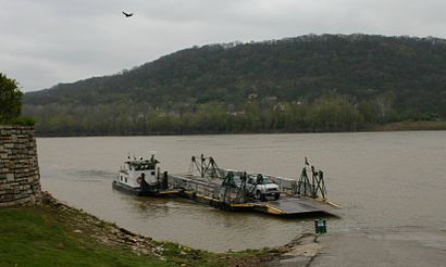
See Anderson Ferry, Cincinnati, on the map
Directions to Anderson Ferry (Cincinnati) with public transportation
The following transit lines have routes that pass near Anderson Ferry
 Bus:
Bus:
How to get to Anderson Ferry by bus?
Click on the bus route to see step by step directions with maps, line arrival times and updated time schedules.
Bus stations near Anderson Ferry in Cincinnati
- Delhi Rd 5314,2 min walk,
- Delhi Rd & Anderson Ferry Rd,3 min walk,
Bus lines to Anderson Ferry in Cincinnati
- 32,West 8th Street - To Downtown,
- 36,Price Hill / Uptown - To Norwood,
- 77,Delhi To Sayler Park,
- 77,Delhi Commuter - To Downtown,
What are the closest stations to Anderson Ferry?
The closest stations to Anderson Ferry are:
- Delhi Rd 5314 is 115 yards away, 2 min walk.
- Delhi Rd & Anderson Ferry Rd is 174 yards away, 3 min walk.
Which bus lines stop near Anderson Ferry?
These bus lines stop near Anderson Ferry: 32, 36.
What’s the nearest bus stop to Anderson Ferry in Cincinnati?
The nearest bus stop to Anderson Ferry in Cincinnati is Delhi Rd 5314. It’s a 2 min walk away.
What time is the first bus to Anderson Ferry in Cincinnati?
The 32 is the first bus that goes to Anderson Ferry in Cincinnati. It stops nearby at 4:30 AM.
What time is the last bus to Anderson Ferry in Cincinnati?
The 32 is the last bus that goes to Anderson Ferry in Cincinnati. It stops nearby at 11:04 PM.
How much is the bus fare to Anderson Ferry?
The bus fare to Anderson Ferry costs about $0.50.
See Anderson Ferry, Cincinnati, on the map
Public Transit to Anderson Ferry in Cincinnati
Wondering how to get to Anderson Ferry in Cincinnati, United States? Moovit helps you find the best way to get to Anderson Ferry with step-by-step directions from the nearest public transit station.
Moovit provides free maps and live directions to help you navigate through your city. View schedules, routes, timetables, and find out how long does it take to get to Anderson Ferry in real time.
Looking for the nearest stop or station to Anderson Ferry? Check out this list of stops closest to your destination: Delhi Rd 5314; Delhi Rd & Anderson Ferry Rd.
Bus:
Want to see if there’s another route that gets you there at an earlier time? Moovit helps you find alternative routes or times. Get directions from and directions to Anderson Ferry easily from the Moovit App or Website.
We make riding to Anderson Ferry easy, which is why over 1.5 million users, including users in Cincinnati, trust Moovit as the best app for public transit. You don’t need to download an individual bus app or train app, Moovit is your all-in-one transit app that helps you find the best bus time or train time available.
For information on prices of bus, costs and ride fares to Anderson Ferry, please check the Moovit app.
Get to Anderson Ferry with public transit and pay for the ride in the Moovit app. In addition to all info you may need for your trip to Anderson Ferry, including live directions, real-time arrivals and fare prices, you can also buy public transit passes for your rides. No need for cash or paper tickets to get to Anderson Ferry - everything you need is accessible in the app with a click of the button.
Use the app to navigate to popular places including to the airport, hospital, stadium, grocery store, mall, coffee shop, school, college, and university.
Anderson Ferry Address: Anderson Ferry Rd street in Cincinnati
Attractions near Anderson Ferry
Honest Locksmith,Fleet Carrier Hvac Systems,Fifth Third Bank,Grey Street Company,McCabe do Cpu It Center,O2 Urban Farms,PNC Mortgage,Salvation Army,Richard Corwin, DDS,Coinstar - Bitcoin ATM,Coinstar,Starbucks,DUNKIN',Dianne Michael Agency,Noodoe EV,Speed Queen Factory Certified Appliance Repair,My Image Barber Studio,Bob Sumerel Tire & Service,GOODYEAR,Biggby CoffeeHow to get to popular attractions in Cincinnati with public transit
City Gospel Mission, Cincinnati,Hamilton County Justice Center, Cincinnati,University Of Cincinnati Victory Parkway Campus, Cincinnati,Witler On The 8's, Cincinnati,iCracked, Cincinnati,Metro 42X West Chester Express, Cincinnati,Beekman. Ave @ Hopple St, Cincinnati,Procter & Gamble Gardens, Cincinnati,Hamilton County Courthouse, Cincinnati,Reed Hartman Hwy, Blue Ash,Corryville, Cincinnati,Little Flower Sledding Hill, Northbrook,Ohio PARK, Cincinnati,The Jewish Hospital, Kenwood,John Casablancas/MTM Agency, Blue Ash,Cintas Center, Cincinnati,CVG KCM Line,National Underground Railroad Freedom Center, Cincinnati,Florence, Kentucky, Florence,Cincinnati ohio, Blue AshGet around Cincinnati by public transit!
Traveling around Cincinnati has never been so easy. See step by step directions as you travel to any attraction, street or major public transit station. View bus and train schedules, arrival times, service alerts and detailed routes on a map, so you know exactly how to get to anywhere in Cincinnati.
When traveling to any destination around Cincinnati use Moovit's Live Directions with Get Off Notifications to know exactly where and how far to walk, how long to wait for your line, and how many stops are left. Moovit will alert you when it's time to get off — no need to constantly re-check whether yours is the next stop.
Wondering how to use public transit in Cincinnati or how to pay for public transit in Cincinnati? Moovit public transit app can help you navigate your way with public transit easily, and at minimum cost. It includes public transit fees, ticket prices, and costs. Looking for a map of Cincinnati public transit lines? Moovit public transit app shows all public transit maps in Cincinnati with all bus routes and stops on an interactive map.
Cincinnati has 1 transit type(s), including: bus, operated by several transit agencies, including SORTA, SORTA, TANK, BCRTA, Greyhound-us and FlixBus-us