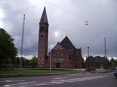
Ansgars Kirke (Odense Kommune) stop - Saturday schedule
| Line | Direction | Time |
|---|---|---|
| 152 | Assens | 06:24 |
| 100A | Assens | 06:54 |
| 100A | Assens | 07:30 |
| 100A | Assens | 08:02 |
| 152 | Assens | 08:32 |
| 100A | Assens | 09:02 |
| 100A | Assens | 09:29 |
| 100A | Assens | 09:59 |
| 152 | Assens | 10:25 |
| 100A | Assens | 10:51 |
| 100A | Assens | 11:21 |
| 100A | Assens | 11:51 |
| 152 | Assens | 12:21 |
| 100A | Assens | 12:51 |
| 100A | Assens | 13:21 |
| 100A | Assens | 13:51 |
| 152 | Assens | 14:21 |
| 100A | Assens | 14:51 |
| 100A | Assens | 15:25 |
| 100A | Assens | 15:59 |
| 152 | Assens | 16:29 |
| 100A | Assens | 16:59 |
| 100A | Assens | 17:29 |
| 100A | Assens | 17:59 |
| 152 | Assens | 18:31 |
Directions to Ansgars Kirke (Odense Kommune) stop with public transit
The following transit lines have routes that pass near Ansgars Kirke (Odense Kommune)
How to get to Ansgars Kirke (Odense Kommune) stop by bus?
Click on the bus route to see step by step directions with maps, line arrival times and updated time schedules.
How to get to Ansgars Kirke (Odense Kommune) stop by train?
Click on the train route to see step by step directions with maps, line arrival times and updated time schedules.
Bus stops near Ansgars Kirke (Odense Kommune) stop
- Ansgars Kirke (Odense Kommune), 2 min walk,
- Søndergade, 3 min walk,
- Søndergade / Vestergade (Odense Kommune), 4 min walk,
- Føtex / Vesterbro (Odense Kommune), 5 min walk,
Light Rail stations near Ansgars Kirke (Odense Kommune) station
- Vestre Stationsvej (Odense Letbane), 11 min walk,
Bus lines to Ansgars Kirke (Odense Kommune) stop
- 55, Agedrup,
- 55A, Bellinge,
- 56, Bullerup,
- 56A, Bullerup,
- 100A, Kerteminde,
- 152, Odense,
- 152N, Kerteminde,
- 10, Citybus,
- 10C, Citybus,
- 85, Højby,
- 153, Glamsbjerg,
What are the closest stations to Ansgars Kirke (Odense Kommune)?
The closest stations to Ansgars Kirke (Odense Kommune) are:
- Ansgars Kirke (Odense Kommune) is 136 meters away, 2 min walk.
- Søndergade is 224 meters away, 3 min walk.
- Søndergade / Vestergade (Odense Kommune) is 275 meters away, 4 min walk.
- Føtex / Vesterbro (Odense Kommune) is 371 meters away, 5 min walk.
- Vestre Stationsvej (Odense Letbane) is 840 meters away, 11 min walk.
Which bus lines stop near Ansgars Kirke (Odense Kommune)?
These bus lines stop near Ansgars Kirke (Odense Kommune): 100A, 153, 55, 56, 85.
Which train lines stop near Ansgars Kirke (Odense Kommune)?
These train lines stop near Ansgars Kirke (Odense Kommune): 030, IC.
What’s the nearest light rail station to Ansgars Kirke (Odense Kommune)?
The nearest light rail station to Ansgars Kirke (Odense Kommune) is Vestre Stationsvej (Odense Letbane). It’s a 11 min walk away.
What’s the nearest bus station to Ansgars Kirke (Odense Kommune)?
The nearest bus station to Ansgars Kirke (Odense Kommune) is Ansgars Kirke (Odense Kommune). It’s a 2 min walk away.
What time is the first light rail to Ansgars Kirke (Odense Kommune)?
The L is the first light rail that goes to Ansgars Kirke (Odense Kommune). It stops nearby at 4:49 AM.
What time is the last light rail to Ansgars Kirke (Odense Kommune)?
The L is the last light rail that goes to Ansgars Kirke (Odense Kommune). It stops nearby at 12:40 AM.
What time is the first bus to Ansgars Kirke (Odense Kommune)?
The 100A is the first bus that goes to Ansgars Kirke (Odense Kommune). It stops nearby at 5:18 AM.
What time is the last bus to Ansgars Kirke (Odense Kommune)?
The 55 is the last bus that goes to Ansgars Kirke (Odense Kommune). It stops nearby at 11:57 PM.
See Ansgars Kirke (Odense Kommune) stop on the map
Public transit to Ansgars Kirke (Odense Kommune) stop
Looking for directions to Ansgars Kirke (Odense Kommune) in Odense, Denmark?
Download the Moovit App to find the current schedule and step-by-step directions for Bus or Train routes that pass through Ansgars Kirke (Odense Kommune).
Looking for the nearest stops closest to Ansgars Kirke (Odense Kommune) ? Check out this list of closest stops to your destination: Ansgars Kirke (Odense Kommune); Søndergade; Søndergade / Vestergade (Odense Kommune); Føtex / Vesterbro (Odense Kommune); Vestre Stationsvej (Odense Letbane).
Bus: 100A, 153, 55, 56, 85, 55A, 56A, 10, 10C.Train: 030, IC.
We make riding on public transit to Ansgars Kirke (Odense Kommune) easy, which is why over 1.5 million users, including users in Odense trust Moovit as the best app for public transit.
Use the app to navigate to popular places including to the airport, hospital, stadium, grocery store, mall, coffee shop, school, college, and university.
The first line to this stop is 152, at 06:24, and the last line is 152N at 02:56.
O1, Odense, Denmark
This stop serves FYNBUS’s lines
Bus stops near Ansgars Kirke (Odense Kommune) stop
Light Rail station near Ansgars Kirke (Odense Kommune) station
Popular public transit stations in Odense
Get around Odense by public transit!
Traveling around Odense has never been so easy. See step by step directions as you travel to any attraction, street or major public transit station. View bus and train schedules, arrival times, service alerts and detailed routes on a map, so you know exactly how to get to anywhere in Odense.
When traveling to any destination around Odense use Moovit's Live Directions with Get Off Notifications to know exactly where and how far to walk, how long to wait for your line, and how many stops are left. Moovit will alert you when it's time to get off — no need to constantly re-check whether yours is the next stop.
Wondering how to use public transit in Odense or how to pay for public transit in Odense? Moovit public transit app can help you navigate your way with public transit easily, and at minimum cost. It includes public transit fees, ticket prices, and costs. Looking for a map of Odense public transit lines? Moovit public transit app shows all public transit maps in Odense with all Bus, Train, Metro, Light Rail and Ferry routes and stops on an interactive map.
Denmark has 5 transit type(s), including: Bus, Train, Metro, Light Rail and Ferry, operated by several transit agencies, including Metroselskabet, DSB S-tog, Lokaltog A/S, Midttrafik, Odense Letbane, DSB, NT, GoCollective, Skånetrafiken, Movia, FYNBUS, Sydtrafik, Bornholms Trafik, Citybus and Ærø Kommune