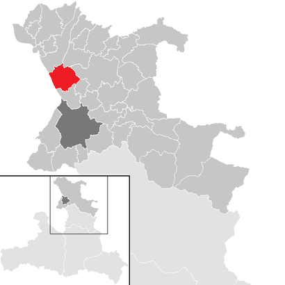
See Anthering on the map
Directions to Anthering with public transportation
The following transit lines have routes that pass near Anthering
 Train:
 - Bus:
How to get to Anthering by train?
Click on the train route to see step by step directions with maps, line arrival times and updated time schedules.
Bus stations near Anthering
- Anthering Kleinlehen,11 min walk,
Train stations near Anthering
- Anthering S-Bahn,13 min walk,
Bus lines to Anthering
- 111,Feldkirchen Via Nussdorf - Michaelbeuern,
- SEV,Bergheim S-Bahn,
What are the closest stations to Anthering?
The closest stations to Anthering are:
- Anthering Kleinlehen is 780 meters away, 11 min walk.
- Anthering S-Bahn is 956 meters away, 13 min walk.
Which train line stops near Anthering?
S1
What’s the nearest train station to Anthering?
The nearest train station to Anthering is Anthering S-Bahn. It’s a 13 min walk away.
What’s the nearest bus stop to Anthering?
The nearest bus stop to Anthering is Anthering Kleinlehen. It’s a 11 min walk away.
What time is the first train to Anthering?
The S1 is the first train that goes to Anthering. It stops nearby at 4:58 AM.
What time is the last train to Anthering?
The S1 is the last train that goes to Anthering. It stops nearby at 2:35 AM.
How much is the light rail fare to Anthering?
The light rail fare to Anthering costs about €2.40.
How much is the train fare to Anthering?
The train fare to Anthering costs about €2.40.
See Anthering on the map
Public Transportation to Anthering
Wondering how to get to Anthering, Austria? Moovit helps you find the best way to get to Anthering with step-by-step directions from the nearest public transit station.
Moovit provides free maps and live directions to help you navigate through your city. View schedules, routes, timetables, and find out how long does it take to get to Anthering in real time.
Looking for the nearest stop or station to Anthering? Check out this list of stops closest to your destination: Anthering Kleinlehen; Anthering S-Bahn.
Train:Bus:
Want to see if there’s another route that gets you there at an earlier time? Moovit helps you find alternative routes or times. Get directions from and directions to Anthering easily from the Moovit App or Website.
We make riding to Anthering easy, which is why over 1.5 million users, including users in Anthering, trust Moovit as the best app for public transit. You don’t need to download an individual bus app or train app, Moovit is your all-in-one transit app that helps you find the best bus time or train time available.
For information on prices of train, light rail and bus, costs and ride fares to Anthering, please check the Moovit app.
Use the app to navigate to popular places including to the airport, hospital, stadium, grocery store, mall, coffee shop, school, college, and university.
Anthering Address: Salzburgerstraße street in Anthering
Anthering is a municipality in the district of Salzburg-Umgebung in the state of Salzburg in Austria.Wiki
Attractions near Anthering
Anthering Ortsmitte,Bella Mare,Wolfgang Vogl,Hammerschmiede,Gasthaus Voglwirt,Die Antheringer au,Antheringer Au,Öffentlicher Spielplatz,Melanie's Friseursalon,Raiffeisenbank Anthering-Elixhausen,Gemeindeamt,Post- Und Geschenkeshop,Kunden Post,Friedhof,Hotel Ammerhauser,Freiwillige Feuerwehr,Dr. Thomas Offner,Brix Alu Vertriebs Gmbh,Volksschule,Schwimmbad AntheringHow to get to popular attractions in Anthering with public transit
Hohe Warte Bad/Döblinger Bad, Döbling,Freizeitgebiet Löwygrube, Favoriten,Möbelix Service-Center, Meidling,Weinbau - Heuriger Kierlinger, Döbling,Krapfenwaldgasse, Döbling,Conrad Megastore Wien, Gemeinde Vösendorf,S-Bahn Zentralfriedhof, Simmering,Romawiese, Floridsdorf,Café Central, 1., Innere Stadt,S Speising, Hietzing,Aida Café-Konditorei Wien, Floridsdorf,AUVA, Brigittenau,Krämer Pferdesport, Liesing,Schwarzenbergpark, Hernals,BILLA, Favoriten,Bahnsteig 2, Brigittenau,Park + Ride U4 Hütteldorf, Penzing,EKZ Hietzing, Hietzing,Schönbrunn Zoo, Hietzing,AMS Hietzing, HietzingGet around Anthering by public transit!
Traveling around Anthering has never been so easy. See step by step directions as you travel to any attraction, street or major public transit station. View bus and train schedules, arrival times, service alerts and detailed routes on a map, so you know exactly how to get to anywhere in Anthering.
When traveling to any destination around Anthering use Moovit's Live Directions with Get Off Notifications to know exactly where and how far to walk, how long to wait for your line, and how many stops are left. Moovit will alert you when it's time to get off — no need to constantly re-check whether yours is the next stop.
Wondering how to use public transit in Anthering or how to pay for public transit in Anthering? Moovit public transit app can help you navigate your way with public transit easily, and at minimum cost. It includes public transit fees, ticket prices, and costs. Looking for a map of Anthering public transit lines? Moovit public transit app shows all public transit maps in Anthering with all train, light rail or bus routes and stops on an interactive map.
Anthering has 3 transit type(s), including: train, light rail or bus, operated by several transit agencies, including Wiener Linien GmbH & Co KG, Wiener Linien GmbH & Co KG, Wiener Linien GmbH & Co KG, Vienna Airport Lines, OEBB Personenverkehr AG Kundenservice, OEBB Personenverkehr AG Kundenservice, WESTbahn Management GmbH, City Air Terminal Betriebsgesellschaft m.b.H., CAT, Österreichische Postbus AG, Wiener Lokalbahnen GmbH, Wiener Lokalbahnen GmbH, Graz Linien, Graz Linien and Graz-Köflacher Bahn und Busbetrieb GmbH