The Most Popular Urban Mobility App in Antioch.
All local mobility options in one app
| Line | Direction | Time |
|---|---|---|
| SAN JOAQUINS | Bakersfield | 8:50 AM |
| SAN JOAQUINS | Oakland | 9:08 AM |
| SAN JOAQUINS | Bakersfield | 10:50 AM |
| SAN JOAQUINS | Bakersfield | 12:50 PM |
| SAN JOAQUINS | Oakland | 1:08 PM |
| SAN JOAQUINS | Bakersfield | 2:50 PM |
| SAN JOAQUINS | Oakland | 5:09 PM |
| SAN JOAQUINS | Bakersfield | 6:50 PM |
| SAN JOAQUINS | Oakland | 7:08 PM |
| SAN JOAQUINS | Oakland | 9:08 PM |
The following transit lines have routes that pass near Antioch-Pittsburg Station
Click on the bus route to see step by step directions with maps, line arrival times and updated time schedules.
The closest stations to Antioch-Pittsburg Station are:
These bus lines stop near Antioch-Pittsburg Station: 387, 388.
The nearest bus stops to Antioch-Pittsburg Station are West 4th St & H St and West 2nd St & Waldie Plz. The closest one is a 3 min walk away.
The 387 is the first bus that goes to Antioch-Pittsburg Station. It stops nearby at 4:56 AM.
The 387 is the last bus that goes to Antioch-Pittsburg Station. It stops nearby at 12:01 AM.
The BART fare to Antioch-Pittsburg Station costs about $2.30 - $10.05.
The bus fare to Antioch-Pittsburg Station costs about $2.00.
Looking for directions to Antioch-Pittsburg Station in Antioch, United States?
Download the Moovit App to find the current schedule and step-by-step directions for Bus or BART routes that pass through Antioch-Pittsburg Station.
Looking for the nearest stops closest to Antioch-Pittsburg Station ? Check out this list of closest stops to your destination: West 4th St & H St; West 2nd St & Waldie Plz.
Bus:
We make riding on public transit to Antioch-Pittsburg Station easy, which is why over 1.5 million users, including users in Antioch trust Moovit as the best app for public transit.
Use the app to navigate to popular places including to the airport, hospital, stadium, grocery store, mall, coffee shop, school, college, and university.
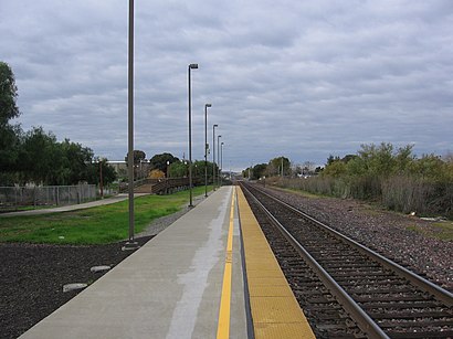
The station has the following entrances: Antioch-Pittsburg Entrance and City of Antioch War Dog Memorial
The first line to this station is SAN JOAQUINS, at 8:50 AM, and the last line is SAN JOAQUINS at 9:08 PM.
112 I St, Antioch, CA, USA
This station serves Amtrak’s lines
Traveling around Antioch has never been so easy. See step by step directions as you travel to any attraction, street or major public transit station. View bus and train schedules, arrival times, service alerts and detailed routes on a map, so you know exactly how to get to anywhere in Antioch.
When traveling to any destination around Antioch use Moovit's Live Directions with Get Off Notifications to know exactly where and how far to walk, how long to wait for your line, and how many stops are left. Moovit will alert you when it's time to get off — no need to constantly re-check whether yours is the next stop.
Wondering how to use public transit in Antioch or how to pay for public transit in Antioch? Moovit public transit app can help you navigate your way with public transit easily, and at minimum cost. It includes public transit fees, ticket prices, and costs. Looking for a map of Antioch public transit lines? Moovit public transit app shows all public transit maps in Antioch with all bus or BART routes and stops on an interactive map.
Antioch has 2 transit type(s), including: bus or BART, operated by several transit agencies, including BART, Bay Area Rapid Transit, Muni Metro, Caltrain, VTA, Capitol Corridor, Sonoma Marin Area Rail Transit, MUNI, VTA, SF Cable Car, AC Transit, Dumbarton Express, Golden Gate Transit, County Connection and SamTrans