Directions to Aquebogue (Aquebogue, Ny) with public transportation
The following transit lines have routes that pass near Aquebogue
 Bus:
Bus: - Train:
How to get to Aquebogue by bus?
Click on the bus route to see step by step directions with maps, line arrival times and updated time schedules.
How to get to Aquebogue by train?
Click on the train route to see step by step directions with maps, line arrival times and updated time schedules.
Bus stations near Aquebogue in Aquebogue, Ny
- Aquebogue Westbound, 1 min walk,
Bus lines to Aquebogue in Aquebogue, Ny
- HAMPTON JITNEY NORTH FORK, Greenport-Manhattan,
What are the closest stations to Aquebogue?
The closest stations to Aquebogue are:
- Aquebogue Westbound is 40 yards away, 1 min walk.
Which bus lines stop near Aquebogue?
These bus lines stop near Aquebogue: HAMPTON JITNEY NORTH FORK, S92.
Which train line stops near Aquebogue?
RONKONKOMA
What’s the nearest bus stop to Aquebogue in Aquebogue, Ny?
The nearest bus stop to Aquebogue in Aquebogue, Ny is Aquebogue Westbound. It’s a 1 min walk away.
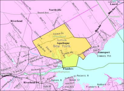
See Aquebogue, Aquebogue, Ny, on the map
Public Transit to Aquebogue in Aquebogue, Ny
Wondering how to get to Aquebogue in Aquebogue, Ny, United States? Moovit helps you find the best way to get to Aquebogue with step-by-step directions from the nearest public transit station.
Moovit provides free maps and live directions to help you navigate through your city. View schedules, routes, timetables, and find out how long does it take to get to Aquebogue in real time.
Looking for the nearest stop or station to Aquebogue? Check out this list of stops closest to your destination: Aquebogue Westbound.
Bus:Train:
Want to see if there’s another route that gets you there at an earlier time? Moovit helps you find alternative routes or times. Get directions from and directions to Aquebogue easily from the Moovit App or Website.
We make riding to Aquebogue easy, which is why over 1.5 million users, including users in Aquebogue, Ny, trust Moovit as the best app for public transit. You don’t need to download an individual bus app or train app, Moovit is your all-in-one transit app that helps you find the best bus time or train time available.
For information on prices of bus and train, costs and ride fares to Aquebogue, please check the Moovit app.
Get to Aquebogue with public transit and pay for the ride in the Moovit app. In addition to all info you may need for your trip to Aquebogue, including live directions, real-time arrivals and fare prices, you can also buy public transit passes for your rides. No need for cash or paper tickets to get to Aquebogue - everything you need is accessible in the app with a click of the button.
Use the app to navigate to popular places including to the airport, hospital, stadium, grocery store, mall, coffee shop, school, college, and university.
Aquebogue Address: Main Road street in Aquebogue, Ny
Attractions near Aquebogue
11931,Main Edgar,25 Edgar,RT-25,Interiors by Dan,Ashley McGraw Architects PC,Aquebogue Elementary School,Dr Richard Fishler,Alternatives Counseling Center,Little Lucharitos,Aquebogue, NY,Lucharitos,North Fork Tobacco,Annex Gen Contracti,479 Main Rd,Anti-Aging & Family Wellness Group,Verderber's Landscape,4 Southfields Rd,Skelly's Farm,A Cut AboveHow to get to popular attractions in Aquebogue, Ny with public transit
Brass Monkey, Manhattan,Newark Liberty International Airport (EWR), Newark, Nj,Ferrara Bakery, Manhattan,Food Gallery 32, Manhattan,Wingate by Wyndham Manhattan Midtown, Manhattan,Caesars Atlantic City Hotel and Casino, Atlantic City, Nj,Barrage, Manhattan,Virgin America Ticket Counter, Elizabeth, Nj,The Dead Rabbit, Manhattan,Avenue, Manhattan,Red Rooster, Manhattan,The Original Chinatown Ice Cream Factory, Manhattan,LIRR - Huntington Station, Huntington Station, Ny,Long Island, NY, Huntington Station, Ny,Ritz Bar & Lounge, Manhattan,The Biergarten at The Standard, Manhattan,Stout, Manhattan,MTA Subway - 30th Ave (N/W), Queens,Atlantic City, NJ, Atlantic City, Nj,Nathan's FamousGet around Aquebogue, Ny by public transit!
Traveling around Aquebogue, Ny has never been so easy. See step by step directions as you travel to any attraction, street or major public transit station. View bus and train schedules, arrival times, service alerts and detailed routes on a map, so you know exactly how to get to anywhere in Aquebogue, Ny.
When traveling to any destination around Aquebogue, Ny use Moovit's Live Directions with Get Off Notifications to know exactly where and how far to walk, how long to wait for your line, and how many stops are left. Moovit will alert you when it's time to get off — no need to constantly re-check whether yours is the next stop.
Wondering how to use public transit in Aquebogue, Ny or how to pay for public transit in Aquebogue, Ny? Moovit public transit app can help you navigate your way with public transit easily, and at minimum cost. It includes public transit fees, ticket prices, and costs. Looking for a map of Aquebogue, Ny public transit lines? Moovit public transit app shows all public transit maps in Aquebogue, Ny with all bus or train routes and stops on an interactive map.
Aquebogue, Ny has 2 transit type(s), including: bus or train, operated by several transit agencies, including MTA Subway, Metro-North Railroad, LIRR, PATH, Shore Line East, MTA Bus Company, MTA New York City Transit - Express routes, MTA Bus, NJ Transit, NYC Ferry, NICE bus, Bee-Line Bus, NJ Transit Rail, NJ Transit Rail and Norwalk Transit District