Directions to Arlington Mountain (El Sobrante) with public transportation
The following transit lines have routes that pass near Arlington Mountain
How to get to Arlington Mountain by bus?
Click on the bus route to see step by step directions with maps, line arrival times and updated time schedules.
Which bus line stops near Arlington Mountain?
1
See Arlington Mountain, El Sobrante, on the map
- ETOPO1 for relief and bathymetry using GMT package
- File:USA California location map.svg for borders, rivers, lakes, coastline
- Own work using
Public Transit to Arlington Mountain in El Sobrante
Wondering how to get to Arlington Mountain in El Sobrante, United States? Moovit helps you find the best way to get to Arlington Mountain with step-by-step directions from the nearest public transit station.
Moovit provides free maps and live directions to help you navigate through your city. View schedules, routes, timetables, and find out how long does it take to get to Arlington Mountain in real time.
Bus: 1.
Want to see if there’s another route that gets you there at an earlier time? Moovit helps you find alternative routes or times. Get directions from and directions to Arlington Mountain easily from the Moovit App or Website.
We make riding to Arlington Mountain easy, which is why over 1.5 million users, including users in El Sobrante, trust Moovit as the best app for public transit. You don’t need to download an individual bus app or train app, Moovit is your all-in-one transit app that helps you find the best bus time or train time available.
For information on prices of bus, costs and ride fares to Arlington Mountain, please check the Moovit app.
Use the app to navigate to popular places including to the airport, hospital, stadium, grocery store, mall, coffee shop, school, college, and university.
Arlington Mountain Address: Old Lake Road street in El Sobrante
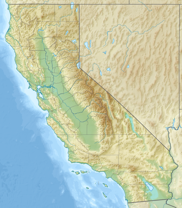
Arlington Mountain, a 1857 ft. peak, in the northern Temescal Mountains. It is located northwest of nearby Lake Mathews, overlooking western Riverside, in Riverside County, California.Wiki
- ETOPO1 for relief and bathymetry using GMT package
- File:USA California location map.svg for borders, rivers, lakes, coastline
- Own work using
Attractions near Arlington Mountain
1 Stop Real Estate Services,16724 Golden Bluff Loop,Golden Bluff Loop,7539 Morning Mist Ct,Dove Hill Dr,Sky Land Ct,Lake Knoll Pkwy,16702 Rainy Vale Ave,17055 Lakepointe Dr,Lake Knoll Parkway,15671 Lake Knoll Parkway,Blue Bird Pl,10578 Tin Mine Rd,Lake Hills Elementary School,Noble View Cir,16312 Highgate Dr,Hidden Peak Ln,Estates Ct,Lake Hills Reserve Park (Private),Warmington StHow to get to popular attractions in El Sobrante with public transit
Metro Gold Line East LA Civic Center Station, East Los Angeles,Walmart, San Buenaventura (Ventura),Washington Preparatory High School, Westmont,Smurf Village, West Hollywood,Bavarian Village Apartments, Torrance,Sunset Boulevard & Alvarado Street, Echo Park, La,Pico/Rimpau Transit Center, Mid-City, La,Miller High Life Training Center, Irwindale,Riverside-Downtown Bus Terminal, Riverside,Nickelodeon Studios, Hollywood, La,Alamo Inn & Suites, Anaheim,Belmont High School, Westlake, La,John C. Fremont High School, Florence, La,Loma Linda Academy, Loma Linda,Saddleback College Quad, Mission Viejo,Stater Bros. Markets, Colton,Florence And Crenshaw, Hyde Park, La,Baja Ranch Market, Covina,Shunji Japanese Cuisine, Sawtelle, La,Venice Blvd And Crenshaw Blvd., Mid-City, LaGet around Los Angeles by public transit!
Traveling around Los Angeles has never been so easy. See step by step directions as you travel to any attraction, street or major public transit station. View bus and train schedules, arrival times, service alerts and detailed routes on a map, so you know exactly how to get to anywhere in Los Angeles.
When traveling to any destination around Los Angeles use Moovit's Live Directions with Get Off Notifications to know exactly where and how far to walk, how long to wait for your line, and how many stops are left. Moovit will alert you when it's time to get off — no need to constantly re-check whether yours is the next stop.
Wondering how to use public transit in Los Angeles or how to pay for public transit in Los Angeles? Moovit public transit app can help you navigate your way with public transit easily, and at minimum cost. It includes public transit fees, ticket prices, and costs. Looking for a map of Los Angeles public transit lines? Moovit public transit app shows all public transit maps in Los Angeles with all Bus, Train, Subway, Light Rail, Ferry and Funicular routes and stops on an interactive map.
Los Angeles has 6 transit type(s), including: Bus, Train, Subway, Light Rail, Ferry and Funicular, operated by several transit agencies, including Metro - Los Angeles, Metrolink Trains, METRO, Long Beach Transit, LADOT, OCTA, Foothill Transit, Big Blue Bus, Riverside Transit Agency, LAX FlyAway, Airporter Shuttle, Playa Vista Shuttle, Amtrak, OMNITRANS, Pasadena Transit