See Arogno on the map
Directions to Arogno with public transportation
The following transit lines have routes that pass near Arogno
 Bus:
Bus: - Train:
How to get to Arogno by bus?
Click on the bus route to see step by step directions with maps, line arrival times and updated time schedules.
Train stations near Arogno
- Maroggia-Melano,33 min walk,
What are the closest stations to Arogno?
The closest stations to Arogno are:
- Maroggia-Melano is 2550 meters away, 33 min walk.
Which bus line stops near Arogno?
C26
What time is the first train to Arogno?
The S10 is the first train that goes to Arogno. It stops nearby at 4:19 AM.
What time is the last train to Arogno?
The S50 is the last train that goes to Arogno. It stops nearby at 12:42 AM.
See Arogno on the map
Public Transportation to Arogno
Wondering how to get to Arogno, Italy? Moovit helps you find the best way to get to Arogno with step-by-step directions from the nearest public transit station.
Moovit provides free maps and live directions to help you navigate through your city. View schedules, routes, timetables, and find out how long does it take to get to Arogno in real time.
Looking for the nearest stop or station to Arogno? Check out this list of stops closest to your destination: Maroggia-Melano.
Bus:Train:
Want to see if there’s another route that gets you there at an earlier time? Moovit helps you find alternative routes or times. Get directions from and directions to Arogno easily from the Moovit App or Website.
We make riding to Arogno easy, which is why over 1.5 million users, including users in Arogno, trust Moovit as the best app for public transit. You don’t need to download an individual bus app or train app, Moovit is your all-in-one transit app that helps you find the best bus time or train time available.
For information on prices of bus and ferry, costs and ride fares to Arogno, please check the Moovit app.
Use the app to navigate to popular places including to the airport, hospital, stadium, grocery store, mall, coffee shop, school, college, and university.
Location: Arogno, Milan and Lombardy
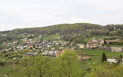
Arogno is a municipality in the district of Lugano in the canton of Ticino, located south of Lake Lugano in the southernmost tip of Switzerland.Wiki
Attractions near Arogno
Arogno,Piagno,Porzo,Valmara,Alpe Di Arogno,Pianca,Belvedere Vetta Sighignola (Belvedere della Sighignola),Alpe Pianca,Sighignola,Balcone D'Italia,Alpe D'Arogno,Ricovero Delle Guardie Di Confine,Campione D'Italia,Atelier Marmo,Albero Monumentale - Fo Di Parol,Campione d'Italia/Svizzera,Bissone/Via Campione/Italia,Campione, Via Tagliaferri,Apartment Lake Lugano,Trincea - OafnHow to get to popular attractions in Arogno with public transit
Niguarda Centro, Milano,Piazza 24 Maggio, Milano,Colonne Di San Lorenzo, Milano,Gruppo Mondadori, Segrate,Piazza XXIV Maggio, Milano,Samsung Electronics Italia S.p.A., Cernusco Sul Naviglio,Porta Genova M2, Milano,Iulm University, Milano,Università Bocconi, Milano,Metro Sesto 1° Maggio FS (M1), Sesto San Giovanni,Darsena, Milano,Stazione Malpensa Aeroporto T1, Ferno,Cinisello Balsamo, Cinisello Balsamo,Cologno Monzese, Milano,Rivellino Di Santo Spirito, Milano,Campus Politecnico Milano Bovisa, Milano,MediaWorld, Milano,Centro Commerciale Fiordaliso, Rozzano,Piazza Napoli, Milano,Ospedale San Raffaele, MilanoGet around Arogno by public transit!
Traveling around Arogno has never been so easy. See step by step directions as you travel to any attraction, street or major public transit station. View bus and train schedules, arrival times, service alerts and detailed routes on a map, so you know exactly how to get to anywhere in Arogno.
When traveling to any destination around Arogno use Moovit's Live Directions with Get Off Notifications to know exactly where and how far to walk, how long to wait for your line, and how many stops are left. Moovit will alert you when it's time to get off — no need to constantly re-check whether yours is the next stop.
Wondering how to use public transit in Arogno or how to pay for public transit in Arogno? Moovit public transit app can help you navigate your way with public transit easily, and at minimum cost. It includes public transit fees, ticket prices, and costs. Looking for a map of Arogno public transit lines? Moovit public transit app shows all public transit maps in Arogno with all bus or ferry routes and stops on an interactive map.
Arogno has 2 transit type(s), including: bus or ferry, operated by several transit agencies, including ATM, ATM, ATM, Trenord, Trenitalia, Autoguidovie S.p.A., NET, Movibus, ATM, ASF Autolinee, Autostradale S.r.l., Terravision, AirPullman, TEB and ATB