Artis stop - Wednesday schedule
| Line | Direction | Time |
|---|---|---|
| N87 | Centraal Station | 03:15 |
| N87 | Centraal Station | 04:12 |
| N87 | Centraal Station | 05:18 |
| 14 | Centraal Station | 06:08 |
| N87 | Centraal Station | 06:15 |
| 14 | Centraal Station | 06:19 |
| 14 | Centraal Station | 06:23 |
| 14 | Centraal Station | 06:34 |
| 14 | Centraal Station | 06:38 |
| 14 | Centraal Station | 06:49 |
| 14 | Centraal Station | 06:53 |
| 14 | Centraal Station | 07:04 |
| 14 | Centraal Station | 07:08 |
| 14 | Centraal Station | 07:17 |
| 14 | Centraal Station | 07:19 |
| 14 | Centraal Station | 07:25 |
| 14 | Centraal Station | 07:32 |
| 14 | Centraal Station | 07:40 |
| 14 | Centraal Station | 07:44 |
| 14 | Centraal Station | 07:55 |
| 14 | Centraal Station | 07:56 |
| 14 | Centraal Station | 08:06 |
| 14 | Centraal Station | 08:08 |
| 14 | Centraal Station | 08:18 |
| 14 | Centraal Station | 08:19 |
Directions to Artis (Amsterdam) with public transportation
The following transit lines have routes that pass near Artis
How to get to Artis by bus?
Click on the bus route to see step by step directions with maps, line arrival times and updated time schedules.
How to get to Artis by train?
Click on the train route to see step by step directions with maps, line arrival times and updated time schedules.
How to get to Artis by metro?
Click on the metro route to see step by step directions with maps, line arrival times and updated time schedules.
Bus stations near Artis in Amsterdam
- Artis,1 min walk,
- Ij Tunnel,7 min walk,
- Waterlooplein,9 min walk,
- Kadijksplein,11 min walk,
- Weesperplein,11 min walk,
Light Rail stations near Artis in Amsterdam
- K. 'S-Gravesandestr.,10 min walk,
Bus lines to Artis in Amsterdam
- 14,Javaplein,
- N87,Station Bijlmer Arena,
- N06,Amsterdam Centraal - Purmerend Overwhere,
- N07,Amsterdam Centraal - Purmerend De Purmer,
- N11,Amsterdam Centraal - Marken,
- N14,Amsterdam - Broek in Waterland - Edam - Scharwoude - Hoorn,
- N19,Amsterdam Centraal via Oostzaan - Zaandam,
- N94,Amsterdam Centraal via Zaandam - Krommenie,
- 291,Amsterdam Centraal - Zaandam De Vlinder,
- 246,Schiphol Airport/Plaza,
- N86,Centraal Station,
- N89,Ijburg,
- N91,Nieuwendam,
- N93,Molenwijk,
- 22,Station Sloterdijk,
- N85,Centraal Station,
What are the closest stations to Artis?
The closest stations to Artis are:
- Artis is 30 meters away, 1 min walk.
- Ij Tunnel is 484 meters away, 7 min walk.
- Waterlooplein is 626 meters away, 9 min walk.
- K. 'S-Gravesandestr. is 757 meters away, 10 min walk.
- Kadijksplein is 774 meters away, 11 min walk.
- Weesperplein is 783 meters away, 11 min walk.
Which bus lines stop near Artis?
These bus lines stop near Artis: 22, 37, 397, 41.
Which train lines stop near Artis?
These train lines stop near Artis: IC, SPR.
Which metro line stops near Artis?
54
Which light rail line stops near Artis?
14
What’s the nearest light rail station to Artis in Amsterdam?
The nearest light rail station to Artis in Amsterdam is K. 'S-Gravesandestr.. It’s a 10 min walk away.
What’s the nearest bus stop to Artis in Amsterdam?
The nearest bus stop to Artis in Amsterdam is Artis. It’s a 1 min walk away.
What time is the first light rail to Artis in Amsterdam?
The 19 is the first light rail that goes to Artis in Amsterdam. It stops nearby at 6:58 AM.
What time is the last light rail to Artis in Amsterdam?
The 19 is the last light rail that goes to Artis in Amsterdam. It stops nearby at 12:47 AM.
What time is the first bus to Artis in Amsterdam?
The N85 is the first bus that goes to Artis in Amsterdam. It stops nearby at 3:00 AM.
What time is the last bus to Artis in Amsterdam?
The N87 is the last bus that goes to Artis in Amsterdam. It stops nearby at 3:18 AM.
See Artis, Amsterdam, on the map
Public transit to Artis stop (ID: 08042) in Amsterdam
Looking for directions to Artis in Amsterdam, Netherlands?
Download the Moovit App to find the current schedule and step-by-step directions for Bus, Train, Light Rail or Metro routes that pass through Artis.
Looking for the nearest stops closest to Artis ? Check out this list of closest stops to your destination: Artis; Ij Tunnel; Waterlooplein; K. 'S-Gravesandestr.; Kadijksplein; Weesperplein.
Bus:22373974114N87N06N07N11N14N19246N86N89N91N93N85Train:ICSPRMetro:54Light Rail:14
We make riding on public transit to Artis easy, which is why over 1.5 million users, including users in Amsterdam trust Moovit as the best app for public transit.
Use the app to navigate to popular places including to the airport, hospital, stadium, grocery store, mall, coffee shop, school, college, and university.
Artis stop’s code is 08042
The first line to this stop is N87, at 03:15, and the last line is N87 at 02:15.
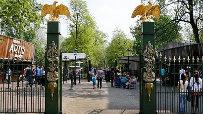
20B Plantage Middenlaan, Amsterdam, Netherlands
This stop serves GVB and GVB’s lines
Light Rail station near Artis
K. 'S-Gravesandestr.Popular public transit stations in Amsterdam
Raamsdonksveer, Kerklaan,Alphen A/D Rijn, Willem De Zwijgerlaan,Ottho Heldringstraat,Bilderdijkstraat,Aletta Jacobslaan,Molukkenstraat,Weesperplein,Olympiaplein,Breda, St.Ignatiusstraat,Maastricht, Tongerseplein,Hemsterhuisstraat,Purmerend, Jan Blankenbrug,Archimedesweg,Dalen,Amsterdam Amstel,Purmerplein,Tilburg, Verdiplein,Uitdam, Aansluiting Markerdijk,Pythagorasweg,MospleinGet around Amsterdam by public transit!
Traveling around Amsterdam has never been so easy. See step by step directions as you travel to any attraction, street or major public transit station. View bus and train schedules, arrival times, service alerts and detailed routes on a map, so you know exactly how to get to anywhere in Amsterdam.
When traveling to any destination around Amsterdam use Moovit's Live Directions with Get Off Notifications to know exactly where and how far to walk, how long to wait for your line, and how many stops are left. Moovit will alert you when it's time to get off — no need to constantly re-check whether yours is the next stop.
Wondering how to use public transit in Amsterdam or how to pay for public transit in Amsterdam? Moovit public transit app can help you navigate your way with public transit easily, and at minimum cost. It includes public transit fees, ticket prices, and costs. Looking for a map of Amsterdam public transit lines? Moovit public transit app shows all public transit maps in Amsterdam with all bus, train, light rail or metro routes and stops on an interactive map.
Amsterdam has 4 transit type(s), including: bus, train, light rail or metro, operated by several transit agencies, including NS, NS International, GVB, GVB, GVB, GVB, U-OV, U-OV, Overal, HTM, R-net, RET, RET, De Lijn and Connexxion