Directions to At&T Store (Hoboken) with public transportation
The following transit lines have routes that pass near At&T Store
How to get to At&T Store by bus?
Click on the bus route to see step by step directions with maps, line arrival times and updated time schedules.
From Lenox Hill Hospital, Manhattan
68 minFrom Warwick Hotel, Manhattan
37 minFrom Bellevue Hospital, Manhattan
51 minFrom Riverside Church, Manhattan
87 minFrom 59th Street, Manhattan
49 minFrom Sojo Spa Club, Edgewater
52 minFrom Medieval Times Dinner & Tournament, Lyndhurst
59 minFrom Sojo Spa, Edgewater
51 minFrom Medieval Times, Lyndhurst
59 min
How to get to At&T Store by train?
Click on the train route to see step by step directions with maps, line arrival times and updated time schedules.
Bus stops near At&T Store in Hoboken
Light Rail stations near At&T Store in Hoboken
- Hoboken Terminal Light Rail Station, 11 min walk,VIEW
Ferry station near At&T Store in Hoboken
- Hoboken / NJ Transit Terminal, 16 min walk,VIEW
Bus lines to At&T Store in Hoboken
What are the closest stations to At&T Store?
The closest stations to At&T Store are:
- Washington St at 2nd St is 91 yards away, 2 min walk.
- River St at 2nd St is 366 yards away, 5 min walk.
- Hoboken Terminal is 385 yards away, 6 min walk.
- Hoboken Terminal Lane 6 is 385 yards away, 6 min walk.
- Hoboken is 385 yards away, 5 min walk.
- Hoboken Terminal Light Rail Station is 860 yards away, 11 min walk.
- Hoboken / NJ Transit Terminal is 1222 yards away, 16 min walk.
Which bus line stops near At&T Store?
126 (Hoboken-Path)
Which train lines stop near At&T Store?
These train lines stop near At&T Store: BLU, MCL.
What’s the nearest light rail station to At&T Store in Hoboken?
The nearest light rail station to At&T Store in Hoboken is Hoboken Terminal Light Rail Station. It’s a 11 min walk away.
What’s the nearest train station to At&T Store in Hoboken?
The nearest train station to At&T Store in Hoboken is Hoboken. It’s a 5 min walk away.
What’s the nearest bus station to At&T Store in Hoboken?
The nearest bus station to At&T Store in Hoboken is Washington St at 2nd St. It’s a 2 min walk away.
What’s the nearest ferry station to At&T Store in Hoboken?
The nearest ferry station to At&T Store in Hoboken is Hoboken / NJ Transit Terminal. It’s a 16 min walk away.
What time is the first light rail to At&T Store in Hoboken?
The HBLR is the first light rail that goes to At&T Store in Hoboken. It stops nearby at 4:55 AM.
What time is the last light rail to At&T Store in Hoboken?
The HBLR is the last light rail that goes to At&T Store in Hoboken. It stops nearby at 2:05 AM.
What time is the first train to At&T Store in Hoboken?
The ATW is the first train that goes to At&T Store in Hoboken. It stops nearby at 3:06 AM.
What time is the last train to At&T Store in Hoboken?
The ATW is the last train that goes to At&T Store in Hoboken. It stops nearby at 3:06 AM.
What time is the first bus to At&T Store in Hoboken?
The 85 is the first bus that goes to At&T Store in Hoboken. It stops nearby at 5:00 AM.
What time is the last bus to At&T Store in Hoboken?
The 126 is the last bus that goes to At&T Store in Hoboken. It stops nearby at 2:17 AM.
What time is the first ferry to At&T Store in Hoboken?
The HOBOKEN / NJ TRANSIT TERMINAL - BROOKFIELD PLACE is the first ferry that goes to At&T Store in Hoboken. It stops nearby at 6:00 AM.
What time is the last ferry to At&T Store in Hoboken?
The HOBOKEN / NJ TRANSIT TERMINAL - BROOKFIELD PLACE is the last ferry that goes to At&T Store in Hoboken. It stops nearby at 9:20 PM.
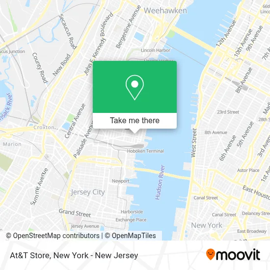
See At&T Store, Hoboken, on the map
Public Transit to At&T Store in Hoboken
Wondering how to get to At&T Store in Hoboken? Moovit helps you find the best way to get to At&T Store with step-by-step directions from the nearest public transit station.
Moovit provides free maps and live directions to help you navigate through your city. View schedules, routes, timetables, and find out how long does it take to get to At&T Store in real time.
Looking for the nearest stop or station to At&T Store? Check out this list of stops closest to your destination: Washington St at 2nd St; River St at 2nd St; Hoboken Terminal; Hoboken Terminal Lane 6; Hoboken; Hoboken Terminal Light Rail Station; Hoboken / NJ Transit Terminal.
Bus: 126, 22, 89, 23, 63, 85, 87.Train: BLU, MCL, ATW, GRE, GB, MEL, ML, PJL.Ferry: HOBOKEN / NJ TRANSIT TERMINAL - BROOKFIELD PLACE, HOBOKEN / NJ TRANSIT TERMINAL - PIER 11 / WALL ST, HOBOKEN / NJ TRANSIT TERMINAL - MIDTOWN / W 39TH ST.
Want to see if there’s another route that gets you there at an earlier time? Moovit helps you find alternative routes or times. Get directions from and directions to At&T Store easily from the Moovit App or Website.
We make riding to At&T Store easy, which is why over 1.5 million users, including users in Hoboken, trust Moovit as the best app for public transit. You don’t need to download an individual bus app or train app, Moovit is your all-in-one transit app that helps you find the best bus time or train time available.
For information on prices of bus, train and subway, costs and ride fares to At&T Store, please check the Moovit app.
Use the app to navigate to popular places including to the airport, hospital, stadium, grocery store, mall, coffee shop, school, college, and university.
At&T Store Address: 106 Washington St street in Hoboken
- Foot and Ankle Care Associates,
- Hmh - Primary Care - Hoboken,
- De Marco Angelo A Md,
- Zain Nagaria, M.D.,
- Karnik Patel, D.O.,
- Juan Paolo Prudente, M.D.,
- Hudson Mart,
- Gravity Title,
- Rossy Guzman,
- Sticky's,
- Gcm Homes,
- Joachim Horvitz at Compass Real Estate,
- Meyer-Dantel Real Estate Group,
- Shaka Kitchen,
- Susan Maryanski, Sales Agent (Keller Williams City Life Realty),
- Denill Grimaud,
- Turnbull Property Group,
- Conor Ruane Real Estate,
- Welcome Home Hoboken,
- Homes & Apartments For Sale Or Rent
Places Near At&T Store (Hoboken)
- Pier 83, Manhattan,
- 26 Federal Plaza, Manhattan,
- Hudson Yards, Manhattan,
- Rockefeller Center, Manhattan,
- 3 Stone St, Manhattan,
- Times Square, Manhattan,
- 1 Police Plaza, Manhattan,
- SoHo, Manhattan,
- 66 John Street, Manhattan,
- San Gennaro Feast, Manhattan,
- Wall Street, Manhattan,
- Katz's Deli, Manhattan,
- qqqq, Manhattan,
- Bellevue Hospital, Manhattan,
- Queens Center Mall, Queens,
- Mountainside Hospital, Glen Ridge,
- 111 Centre New York City Supreme Court, Manhattan,
- Chinatown, Manhattan,
- 376 Hudson Street, Manhattan,
- 911 Memorial, Manhattan
How to get to popular places in New York - New Jersey with public transit
Get around Hoboken by public transit!
Traveling around Hoboken has never been so easy. See step by step directions as you travel to any attraction, street or major public transit station. View bus and train schedules, arrival times, service alerts and detailed routes on a map, so you know exactly how to get to anywhere in Hoboken.
When traveling to any destination around Hoboken use Moovit's Live Directions with Get Off Notifications to know exactly where and how far to walk, how long to wait for your line, and how many stops are left. Moovit will alert you when it's time to get off — no need to constantly re-check whether yours is the next stop.
Wondering how to use public transit in Hoboken or how to pay for public transit in Hoboken? Moovit public transit app can help you navigate your way with public transit easily, and at minimum cost. It includes public transit fees, ticket prices, and costs. Looking for a map of Hoboken public transit lines? Moovit public transit app shows all public transit maps in Hoboken with all Bus, Train, Subway, Light Rail, Ferry and Cable Car routes and stops on an interactive map.
New York - New Jersey has 6 transit type(s), including: Bus, Train, Subway, Light Rail, Ferry and Cable Car, operated by several transit agencies, including MTA Subway, Metro-North Railroad, LIRR, PATH, MTA New York City Transit - Express routes, MTA Bus, NJ Transit, NYC Ferry, NICE bus, Bee-Line Bus, NJ Transit Rail, Norwalk Transit District, Hartford Line, River Valley Transit and HART