How to get to ATG by bus?
Click on the bus route to see step by step directions with maps, line arrival times and updated time schedules.
From Tobacco Manufactory (Former Tobacco Manufactory), Florence
72 minFrom Tramvia T1 "Federiga", Florence
80 minFrom Coop-Fi, Sesto Fiorentino
52 minFrom Coop of Ponte a Greve, Florence
52 minFrom Visarno Arena, Florence
81 minFrom Mondo Convenienza, Prato
170 minFrom Tenax, Florence
173 minFrom Le Piagge, Florence
155 minFrom Paganini Street, Florence
175 minFrom Novoli, Florence
169 min
How to get to ATG by train?
Click on the train route to see step by step directions with maps, line arrival times and updated time schedules.
Train station near ATG in Signa
- Signa, 2 min walk,VIEW
Bus lines to ATG in Signa
- 26, San Colombano/Badia A Settimo - Torregalli,VIEW
- 67, Signa Station - Campi Bisenzio San Donnino,VIEW
- 72, T1 Nenni - Lastra A Signa Station/Signa/Montelupo,VIEW
- 83, Torregalli - Signa/Porto Di Mezzo,VIEW
- 86, Campi Bisenzio Magenta - Sesto Via Gramsci/Scientific Center,VIEW
- 87, Signa Station - Campi Bisenzio Liceo Agnoletti,VIEW
- 94, Le Bagnese/Lastra A Signa Station - Officine Galileo/M&R,VIEW
- 210, Lastra A Signa Railway Station,VIEW
What are the closest stations to ATG?
The closest stations to ATG are:
- Santelli is 25 meters away, 1 min walk.
- Signa Station is 139 meters away, 3 min walk.
- Signa is 139 meters away, 2 min walk.
Which bus lines stop near ATG?
These bus lines stop near ATG: 210, 67, 83.
Which train line stops near ATG?
R (Empoli/Grosseto/Pisa)
What’s the nearest train station to ATG in Signa?
The nearest train station to ATG in Signa is Signa. It’s a 2 min walk away.
What’s the nearest bus station to ATG in Signa?
The nearest bus station to ATG in Signa is Santelli. It’s a 1 min walk away.
What time is the first train to ATG in Signa?
The R is the first train that goes to ATG in Signa. It stops nearby at 5:09 AM.
What time is the last train to ATG in Signa?
The R is the last train that goes to ATG in Signa. It stops nearby at 12:58 AM.
What time is the first bus to ATG in Signa?
The 210 is the first bus that goes to ATG in Signa. It stops nearby at 6:57 AM.
What time is the last bus to ATG in Signa?
The 210 is the last bus that goes to ATG in Signa. It stops nearby at 8:58 PM.
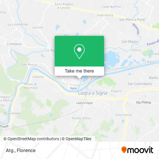
See ATG, Signa, on the map
Public Transit to ATG in Signa
Wondering how to get to ATG in Signa? Moovit helps you find the best way to get to ATG with step-by-step directions from the nearest public transit station.
Moovit provides free maps and live directions to help you navigate through your city. View schedules, routes, timetables, and find out how long does it take to get to ATG in real time.
Looking for the nearest stop or station to ATG? Check out this list of stops closest to your destination: Santelli; Signa Station; Signa.
Bus: 210, 67, 83, 26, 72, 86.Train: R.
Want to see if there’s another route that gets you there at an earlier time? Moovit helps you find alternative routes or times. Get directions from and directions to ATG easily from the Moovit App or Website.
We make riding to ATG easy, which is why over 1.5 million users, including users in Signa, trust Moovit as the best app for public transit. You don’t need to download an individual bus app or train app, Moovit is your all-in-one transit app that helps you find the best bus time or train time available.
For information on prices of bus, train and light rail, costs and ride fares to ATG, please check the Moovit app.
Use the app to navigate to popular places including to the airport, hospital, stadium, grocery store, mall, coffee shop, school, college, and university.
ATG Address: Via Giuseppe Santelli, 18 50058 Signa street in Signa
- Etienne Aigner Italy,
- Emdp Italian Furnishing,
- EETI A. Services and Environmental Technologies,
- Cdq. Montaggi,
- eni,
- Meva Constructions,
- Diva,
- Efferre by Donnini Roano and C.,
- Little Footprints Baby Parking,
- Elle,
- Donizetti Club,
- Gaetano Donizetti Recreational Society,
- Signa's Eatery,
- Gattei Maimiliano,
- Lawyer Rombolà Alessandro,
- Daniela Corsini,
- Spartaco Lavagnini Street,
- Bonciani Painting,
- Crazy Line,
- Gima Auto Repair Shop
Places Near ATG (Signa)
- Cascine Park, Florence,
- Verdi Theater, Florence,
- OOO, Florence,
- Michelangelo Square, Florence,
- Campi Bisenzio, Campi Bisenzio,
- Santa Maria Novella Station, Florence,
- IKEA Florence, Sesto Fiorentino,
- Santa Maria Nuova Hospital, Florence,
- Visarno Arena, Florence,
- Field of Mars, Florence,
- I Gigli, Campi Bisenzio,
- Torregalli Hospital Scandicci *, Scandicci,
- Asmana, Campi Bisenzio,
- Tobacco Manufacture, Florence,
- Artemio Franchi Municipal Stadium, Florence,
- Visarno Hippodrome, Florence,
- Mandela Forum (Nelson Mandela Forum), Florence,
- Michelangelo Square, Florence,
- Piero Palagi Hospital Facility-Florence, Florence,
- Nelson Mandela Forum, Florence
How to get to popular places in Florence with public transit
Get around Signa by public transit!
Traveling around Signa has never been so easy. See step by step directions as you travel to any attraction, street or major public transit station. View bus and train schedules, arrival times, service alerts and detailed routes on a map, so you know exactly how to get to anywhere in Signa.
When traveling to any destination around Signa use Moovit's Live Directions with Get Off Notifications to know exactly where and how far to walk, how long to wait for your line, and how many stops are left. Moovit will alert you when it's time to get off — no need to constantly re-check whether yours is the next stop.
Wondering how to use public transit in Signa or how to pay for public transit in Signa? Moovit public transit app can help you navigate your way with public transit easily, and at minimum cost. It includes public transit fees, ticket prices, and costs. Looking for a map of Signa public transit lines? Moovit public transit app shows all public transit maps in Signa with all Bus, Train, Light Rail, Ferry and Funicular routes and stops on an interactive map.
Florence has 5 transit type(s), including: Bus, Train, Light Rail, Ferry and Funicular, operated by several transit agencies, including Florence Urban - Tuscan Bus Lines, GEST, Livorno and Province - Tuscan Bus Lines, Arezzo, Florence and Provinces - Tuscan Bus Lines, Prato and Province - Tuscan Bus Lines, Lucca and Province - Tuscan Bus Lines, Massa, Carrara and Province - Tuscan Bus Lines, Pisa and Province - Tuscan Bus Lines, Grosseto, Siena and Provinces - Tuscan Bus Lines, Arezzo, Siena and Provinces - Tuscan Bus Lines, Florence and Province - Tuscan Bus Lines, Pistoia and Province - Tuscan Bus Lines, Siena and Province - Tuscan Bus Lines, Arezzo and Province - Tuscan Bus Lines and Trenitalia