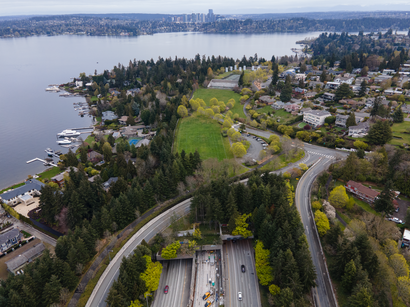
See Aubrey Davis Park, Mercer Island, on the map
Directions to Aubrey Davis Park (Mercer Island) with public transportation
The following transit lines have routes that pass near Aubrey Davis Park
 Bus:
Bus:
How to get to Aubrey Davis Park by bus?
Click on the bus route to see step by step directions with maps, line arrival times and updated time schedules.
Bus stations near Aubrey Davis Park in Mercer Island
- 78th Ave SE & SE 28th St,3 min walk,
- N Mercer Way & 80th Ave SE - Bay 2,5 min walk,
Bus lines to Aubrey Davis Park in Mercer Island
- 204,N Mercer Island,
- 550,Bellevue,
- 554,Downtown Seattle,
- 630,S Mercer Island,
What are the closest stations to Aubrey Davis Park?
The closest stations to Aubrey Davis Park are:
- 78th Ave SE & SE 28th St is 148 yards away, 3 min walk.
- N Mercer Way & 80th Ave SE - Bay 2 is 349 yards away, 5 min walk.
Which bus lines stop near Aubrey Davis Park?
These bus lines stop near Aubrey Davis Park: 550, 554.
What’s the nearest bus stop to Aubrey Davis Park in Mercer Island?
The nearest bus stop to Aubrey Davis Park in Mercer Island is 78th Ave SE & SE 28th St. It’s a 3 min walk away.
What time is the first bus to Aubrey Davis Park in Mercer Island?
The 554 is the first bus that goes to Aubrey Davis Park in Mercer Island. It stops nearby at 4:44 AM.
What time is the last bus to Aubrey Davis Park in Mercer Island?
The 550 is the last bus that goes to Aubrey Davis Park in Mercer Island. It stops nearby at 12:43 AM.
How much is the ferry fare to Aubrey Davis Park?
The ferry fare to Aubrey Davis Park costs about $5.00.
How much is the bus fare to Aubrey Davis Park?
The bus fare to Aubrey Davis Park costs about $2.00 - $3.25.
See Aubrey Davis Park, Mercer Island, on the map
Public Transit to Aubrey Davis Park in Mercer Island
Wondering how to get to Aubrey Davis Park in Mercer Island, United States? Moovit helps you find the best way to get to Aubrey Davis Park with step-by-step directions from the nearest public transit station.
Moovit provides free maps and live directions to help you navigate through your city. View schedules, routes, timetables, and find out how long does it take to get to Aubrey Davis Park in real time.
Looking for the nearest stop or station to Aubrey Davis Park? Check out this list of stops closest to your destination: 78th Ave SE & SE 28th St; N Mercer Way & 80th Ave SE - Bay 2.
Bus:
Want to see if there’s another route that gets you there at an earlier time? Moovit helps you find alternative routes or times. Get directions from and directions to Aubrey Davis Park easily from the Moovit App or Website.
We make riding to Aubrey Davis Park easy, which is why over 1.5 million users, including users in Mercer Island, trust Moovit as the best app for public transit. You don’t need to download an individual bus app or train app, Moovit is your all-in-one transit app that helps you find the best bus time or train time available.
For information on prices of bus and ferry, costs and ride fares to Aubrey Davis Park, please check the Moovit app.
Use the app to navigate to popular places including to the airport, hospital, stadium, grocery store, mall, coffee shop, school, college, and university.
Aubrey Davis Park Address: 72nd Ave SE Mercer Island, WA 98040 street in Mercer Island
Attractions near Aubrey Davis Park
Rock da Rooster: Sriracha,Sightmind of Puget Sound,John L Scott,Creative Balance Health,Patina Realty,Mercer Island United Methodist Church (The United Methodist Church),Hmi Construction,Hagar Institute,Washington State of (State Liquor Store),Vivienne's Bistro,Mud Bay,Cardiographics,Lewis and Gibson,The Release Point,Charcuterina,Regina Dylan,Summerfield Commercial,24 Hours Emergency Locksmith (24 Hour Locksmith of Mercer Island),Stretchlab,Grace PlaceHow to get to popular attractions in Mercer Island with public transit
City of University Place, University Place,QFC, Edmonds,Tavolàta, Seattle,Renton Highlands Connector Stop, Renton,TCC Transit Center, Tacoma,Crossroads Bellevue, Bellevue,Northwest Detention Center, Tacoma,City of SeaTac, Seatac,Watertown Hotel, Seattle,Marketplace At Factoria, Bellevue,QFC, Seattle,Phinney Ridge Neighborhood, Seattle,Downtown Tacoma, Tacoma,Fremont Troll, Seattle,Alaska Airlines' McGee Building, Seatac,Starbucks, Lynnwood,Walmart Supercenter, Lakewood,I-5,Safeway, Seattle,Woodland Park Zoo, SeattleGet around Mercer Island by public transit!
Traveling around Mercer Island has never been so easy. See step by step directions as you travel to any attraction, street or major public transit station. View bus and train schedules, arrival times, service alerts and detailed routes on a map, so you know exactly how to get to anywhere in Mercer Island.
When traveling to any destination around Mercer Island use Moovit's Live Directions with Get Off Notifications to know exactly where and how far to walk, how long to wait for your line, and how many stops are left. Moovit will alert you when it's time to get off — no need to constantly re-check whether yours is the next stop.
Wondering how to use public transit in Mercer Island or how to pay for public transit in Mercer Island? Moovit public transit app can help you navigate your way with public transit easily, and at minimum cost. It includes public transit fees, ticket prices, and costs. Looking for a map of Mercer Island public transit lines? Moovit public transit app shows all public transit maps in Mercer Island with all bus or ferry routes and stops on an interactive map.
Mercer Island has 2 transit type(s), including: bus or ferry, operated by several transit agencies, including Sound Transit, Seattle Streetcar, Sound Transit, Metro Transit, Metro Transit, Sound Transit, Whatcom Transportation Authority, Mason Transit Authority, Snoqualmie Valley Transportation (SVT), Snoqualmie Valley Transportation, Amtrak, Island Transit, Kitsap Transit, Intercity Transit and Everett Transit