See August Martin High School, Queens, on the map
Directions to August Martin High School (Queens) with public transportation
The following transit lines have routes that pass near August Martin High School
 Bus:
Bus: - Train:
- Subway:
How to get to August Martin High School by bus?
Click on the bus route to see step by step directions with maps, line arrival times and updated time schedules.
How to get to August Martin High School by train?
Click on the train route to see step by step directions with maps, line arrival times and updated time schedules.
How to get to August Martin High School by subway?
Click on the subway route to see step by step directions with maps, line arrival times and updated time schedules.
Bus stations near August Martin High School in Queens
- Rockaway Blvd/150 St,1 min walk,
- Guy R Brewer Blvd/Baisley Blvd,7 min walk,
- Guy R Brewer Blvd/130 Av,9 min walk,
Light Rail stations near August Martin High School in Queens
- Federal Circle,5 min walk,
Train stations near August Martin High School in Queens
- Locust Manor,32 min walk,
- St.Albans,40 min walk,
Bus lines to August Martin High School in Queens
- Q7,Cross Bay Bl Via Rockaway Bl,
- Q6,Archer Av Via Sutphin Bl,
- Q111,Cedarhurst Peninsula Bl Via Brewer Bl Via 147 Av,
- Q113,Limited Jamaica Parsons-Hillside Via Nassau Exy Via Brewer Bl,
- Q114,Limited Far Rockaway Seagirt Bl Via Brewer Bl,
- QM21,Rochdale Village Via Brewer Bl,
What are the closest stations to August Martin High School?
The closest stations to August Martin High School are:
- Rockaway Blvd/150 St is 69 yards away, 1 min walk.
- Federal Circle is 327 yards away, 5 min walk.
- Guy R Brewer Blvd/Baisley Blvd is 503 yards away, 7 min walk.
- Guy R Brewer Blvd/130 Av is 702 yards away, 9 min walk.
- Locust Manor is 2732 yards away, 32 min walk.
- St.Albans is 3321 yards away, 40 min walk.
Which bus lines stop near August Martin High School?
These bus lines stop near August Martin High School: Q111, Q113, Q114, Q6, Q7.
Which train lines stop near August Martin High School?
These train lines stop near August Martin High School: FAR ROCKAWAY BRANCH, LONG BEACH BRANCH.
Which subway lines stop near August Martin High School?
These subway lines stop near August Martin High School: E, J.
What’s the nearest light rail station to August Martin High School in Queens?
The nearest light rail station to August Martin High School in Queens is Federal Circle. It’s a 5 min walk away.
What’s the nearest bus stop to August Martin High School in Queens?
The nearest bus stop to August Martin High School in Queens is Rockaway Blvd/150 St. It’s a 1 min walk away.
What time is the first light rail to August Martin High School in Queens?
The AIRTRAIN is the first light rail that goes to August Martin High School in Queens. It stops nearby at 3:01 AM.
What time is the last light rail to August Martin High School in Queens?
The AIRTRAIN is the last light rail that goes to August Martin High School in Queens. It stops nearby at 3:01 AM.
What time is the first train to August Martin High School in Queens?
The FAR ROCKAWAY BRANCH is the first train that goes to August Martin High School in Queens. It stops nearby at 3:28 AM.
What time is the last train to August Martin High School in Queens?
The FAR ROCKAWAY BRANCH is the last train that goes to August Martin High School in Queens. It stops nearby at 2:52 AM.
What time is the first bus to August Martin High School in Queens?
The Q114 is the first bus that goes to August Martin High School in Queens. It stops nearby at 3:00 AM.
What time is the last bus to August Martin High School in Queens?
The Q6 is the last bus that goes to August Martin High School in Queens. It stops nearby at 3:08 AM.
How much is the subway fare to August Martin High School?
The subway fare to August Martin High School costs about $2.90.
How much is the train fare to August Martin High School?
The train fare to August Martin High School costs about $3.50 - $17.50.
How much is the bus fare to August Martin High School?
The bus fare to August Martin High School costs about $2.90.
See August Martin High School, Queens, on the map
Public Transit to August Martin High School in Queens
Wondering how to get to August Martin High School in Queens, United States? Moovit helps you find the best way to get to August Martin High School with step-by-step directions from the nearest public transit station.
Moovit provides free maps and live directions to help you navigate through your city. View schedules, routes, timetables, and find out how long does it take to get to August Martin High School in real time.
Looking for the nearest stop or station to August Martin High School? Check out this list of stops closest to your destination: Rockaway Blvd/150 St; Federal Circle; Guy R Brewer Blvd/Baisley Blvd; Guy R Brewer Blvd/130 Av; Locust Manor; St.Albans.
Bus:Train:Subway:
Want to see if there’s another route that gets you there at an earlier time? Moovit helps you find alternative routes or times. Get directions from and directions to August Martin High School easily from the Moovit App or Website.
We make riding to August Martin High School easy, which is why over 1.5 million users, including users in Queens, trust Moovit as the best app for public transit. You don’t need to download an individual bus app or train app, Moovit is your all-in-one transit app that helps you find the best bus time or train time available.
For information on prices of bus, subway and train, costs and ride fares to August Martin High School, please check the Moovit app.
Use the app to navigate to popular places including to the airport, hospital, stadium, grocery store, mall, coffee shop, school, college, and university.
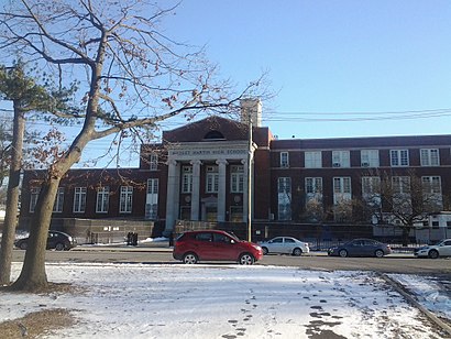
August Martin High School Address: 156-10 Baisley Blvd street in Queens
Attractions near August Martin High School
155th St & Baisley,August Martin Hs,August Martin High School,Baisley Pond Park,Baisley Blvd and Rockaway Blvd,152-32 Rockaway Boulevard,MTA Bus Q6,Sutphin Boulevard & Rockaway Boulevard,Baisley Blvd (Guy R Brewer Blvd and baisley),130th Ave and 163rd St,130th Ave (guy r brewer blvd 130th),Rockaway Blvd (rockaway / Sutphin Blvd),Sutphin Blvd (150th / sutphin),Rockaway Blvd (rockaway blvd / 150th st),P.S. 223 Lyndon B Johnson,The Door,16307 Baisley Blvd,MTABus Q7 (Rockaway Blvd / 150th St-Sutphin Blvd),125-30 Sutphin Boulevard,163-49 130th AvenueHow to get to popular attractions in Queens with public transit
The Meatball Shop,Stamford Transportation Center : Bus / Train (STM) Metro North & Amtrak, Stamford, Ct,Nathan's Famous,Dinosaur Bar-B-Que, Manhattan,Culture Espresso, Manhattan,Gyu-Kaku Japanese BBQ, Manhattan,High Line, Manhattan,Jackson Heights, NY, Queens,Smith Haven Mall, Lake Grove, Ny,Nan Xiang Xiao Long Bao, Queens,NJT - New Brunswick Station (NEC), New Brunswick, Nj,The Standard Grill, Manhattan,Rubirosa Ristorante, Manhattan,The Plaza Hotel, Manhattan,Tom & Jerry's, Manhattan,Great Lawn, Manhattan,The Stanton Social, Manhattan,Hill Country Chicken, Manhattan,24 Hour Fitness, Manhattan,Tacombi at Fonda Nolita, ManhattanGet around Queens by public transit!
Traveling around Queens has never been so easy. See step by step directions as you travel to any attraction, street or major public transit station. View bus and train schedules, arrival times, service alerts and detailed routes on a map, so you know exactly how to get to anywhere in Queens.
When traveling to any destination around Queens use Moovit's Live Directions with Get Off Notifications to know exactly where and how far to walk, how long to wait for your line, and how many stops are left. Moovit will alert you when it's time to get off — no need to constantly re-check whether yours is the next stop.
Wondering how to use public transit in Queens or how to pay for public transit in Queens? Moovit public transit app can help you navigate your way with public transit easily, and at minimum cost. It includes public transit fees, ticket prices, and costs. Looking for a map of Queens public transit lines? Moovit public transit app shows all public transit maps in Queens with all bus, subway or train routes and stops on an interactive map.
Queens has 3 transit type(s), including: bus, subway or train, operated by several transit agencies, including MTA Subway, Metro-North Railroad, LIRR, PATH, Shore Line East, MTA Bus Company, MTA New York City Transit - Express routes, MTA Bus, NJ Transit, NYC Ferry, NICE bus, Bee-Line Bus, NJ Transit Rail, NJ Transit Rail and Norwalk Transit District