Directions to Av (Tel Aviv-Yafo) with public transportation
The following transit lines have routes that pass near Av
 Bus: 14, 270, 347, 379, 66.
- Israel Railways: Ashdod Ad Halom - Herzliya, Be'er Sheva Center - Herzliya, Carmiel - Beer Sheva Center, Ofakim - Herzliya, Ashdod Ad Halom - Herzliya.
How to get to Av by bus?
Click on the bus route to see step by step directions with maps, line arrival times and updated time schedules.
From 71 HaNadiv, Herzliya
40 minFrom Medical Center, Herzliya
37 minFrom Yachin Center, Petah Tikva
32 minFrom HaShlosha Corner, Tel Aviv-Yafo
28 minFrom Holon Licensing Office, Tel Aviv-Yafo
38 minFrom Eilat 2, Petah Tikva
51 minFrom Herzliya Medical Center, Herzliya
38 minFrom Segula Cemetery, Petah Tikva
46 minFrom Holon Cemetery, Bat Yam
47 min
How to get to Av by Israel Railways?
Click on the Israel Railways route to see step by step directions with maps, line arrival times and updated time schedules.
Bus stops near Av in Tel Aviv-Yafo
Light Rail stations near Av in Tel Aviv-Yafo
- Arlozorov Light Rail Station, 12 min walk,VIEW
Israel Railways stations near Av in Tel Aviv-Yafo
Bus lines to Av in Tel Aviv-Yafo
- 3, Cemetery/Kiryat Shaul,VIEW
- 7, Wolfson Terminal,VIEW
- 14, Halochamim Terminal/Vehicle Licensing Office,VIEW
- 66, Petah Tikva,VIEW
- 89, Tel Aviv-Yafo,VIEW
- 90, Herzliya,VIEW
- 706, Halochamim Terminal/Vehicle Licensing Office,VIEW
- 7, Tel Aviv-Yafo,VIEW
- 706, Tel Aviv-Yafo,VIEW
- White Savvus, Ramat Gan,VIEW
- 28, Kiryat Ono,VIEW
- 55, Kiryat Ono,VIEW
- 59, Or Yehuda,VIEW
- 61, Ramat Gan,VIEW
- 161, Bnei Brak,VIEW
- 379, Tel Aviv-Yafo,VIEW
- 705, Givatayim,VIEW
- 705, Kurazin Terminal,VIEW
- 5, Halochamim Terminal/Vehicle Licensing Office,VIEW
What are the closest stations to Av?
The closest stations to Av are:
- Kikar HaMedina/1948 is 62 meters away, 2 min walk.
- Kikar HaMedina/Weizmann is 84 meters away, 2 min walk.
- Arlozorov/Weizmann is 269 meters away, 4 min walk.
- Jabotinsky/Kikar HaMedina is 311 meters away, 5 min walk.
- Arlozorov Light Rail Station is 920 meters away, 12 min walk.
- Tel Aviv HaShalom Station is 1984 meters away, 26 min walk.
- Tel Aviv Savidor Central Station is 3126 meters away, 40 min walk.
Which bus lines stop near Av?
These bus lines stop near Av: 14, 270, 347, 379, 66, 7, 90.
Which Israel Railways lines stop near Av?
These Israel Railways lines stop near Av: Ashdod Ad Halom - Herzliya, Be'er Sheva Center - Herzliya, Carmiel - Beer Sheva Center.
What’s the nearest light rail station to Av in Tel Aviv-Yafo?
The nearest light rail station to Av in Tel Aviv-Yafo is Arlozorov Light Rail Station. It’s a 12 min walk away.
What’s the nearest Israel Railways station to Av in Tel Aviv-Yafo?
The nearest Israel Railways station to Av in Tel Aviv-Yafo is Tel Aviv HaShalom Station. It’s a 26 min walk away.
What’s the nearest bus station to Av in Tel Aviv-Yafo?
The nearest bus stations to Av in Tel Aviv-Yafo are Kikar HaMedina/1948 and Kikar HaMedina/Weizmann. The closest one is a 2 min walk away.
What time is the first light rail to Av in Tel Aviv-Yafo?
The R3 is the first light rail that goes to Av in Tel Aviv-Yafo. It stops nearby at 5:38 AM.
What time is the last light rail to Av in Tel Aviv-Yafo?
The R2 is the last light rail that goes to Av in Tel Aviv-Yafo. It stops nearby at 12:57 AM.
What time is the first Israel Railways to Av in Tel Aviv-Yafo?
The Jerusalem/Yitzhak Navon - Herzliya is the first Israel Railways that goes to Av in Tel Aviv-Yafo. It stops nearby at 3:09 AM.
What time is the last Israel Railways to Av in Tel Aviv-Yafo?
The Nahariya - Ben Gurion Airport is the last Israel Railways that goes to Av in Tel Aviv-Yafo. It stops nearby at 4:34 AM.
What time is the first bus to Av in Tel Aviv-Yafo?
The 5 is the first bus that goes to Av in Tel Aviv-Yafo. It stops nearby at 5:02 AM.
What time is the last bus to Av in Tel Aviv-Yafo?
The 61 is the last bus that goes to Av in Tel Aviv-Yafo. It stops nearby at 2:16 AM.
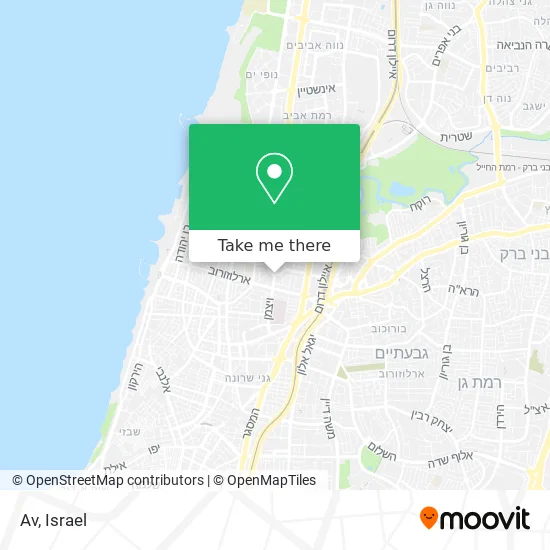
See Av, Tel Aviv-Yafo, on the map
Public Transit to Av in Tel Aviv-Yafo
Wondering how to get to Av in Tel Aviv-Yafo? Moovit helps you find the best way to get to Av with step-by-step directions from the nearest public transit station.
Moovit provides free maps and live directions to help you navigate through your city. View schedules, routes, timetables, and find out how long does it take to get to Av in real time.
Looking for the nearest stop or station to Av? Check out this list of stops closest to your destination: Kikar HaMedina/1948; Kikar HaMedina/Weizmann; Arlozorov/Weizmann; Jabotinsky/Kikar HaMedina; Arlozorov Light Rail Station; Tel Aviv HaShalom Station; Tel Aviv Savidor Central Station.
Bus: 14, 270, 347, 379, 66, 7, 90, 3, 89, 706, White Savvus, 28, 55, 59, 61, 5.Israel Railways: Ashdod Ad Halom - Herzliya, Be'er Sheva Center - Herzliya, Carmiel - Beer Sheva Center, Ofakim - Herzliya, Ashdod Ad Halom - Herzliya, Ashkelon - Binyamina, Ashkelon - Herzliya, Ashkelon - Tel Aviv Center, בנימינה - מודיעין מרכז, Binyamina - Tel Aviv Center, Herzliya - Ben Gurion Airport, Herzliya - Tel Aviv Center, Modi'in Center - Binyamina.
Want to see if there’s another route that gets you there at an earlier time? Moovit helps you find alternative routes or times. Get directions from and directions to Av easily from the Moovit App or Website.
We make riding to Av easy, which is why over 1.5 million users, including users in Tel Aviv-Yafo, trust Moovit as the best app for public transit. You don’t need to download an individual bus app or train app, Moovit is your all-in-one transit app that helps you find the best bus time or train time available.
For information on prices of bus and Israel Railways, costs and ride fares to Av, please check the Moovit app.
Use the app to navigate to popular places including to the airport, hospital, stadium, grocery store, mall, coffee shop, school, college, and university.
Av Address: ה' באייר הצפון החדש-כיכר המדינה, 60000 תל אביב - יפו street in Tel Aviv-Yafo
- Melania Tel Aviv,
- Chabad Shop,
- MRD Medical Service,
- Professional Tailoring Repairs - Hadar Yosef and Moaz Aviv,
- Barbara,
- So Tel Aviv,
- HaMisbaa Port Tel Aviv,
- Vilebrequin,
- Furla,
- 5th of Iyar 24,
- Lesin House Tower,
- Beit Lessin Theater,
- 53 Weizmann Street,
- 5 Iyyar 12,
- New Company Parking Lot,
- Weizmann,
- Sako Or,
- Shelter Tel Aviv-Yafo, Weizmann 30,
- Kikar Hamedina,
- Lisin 2
Places Near Av (Tel Aviv-Yafo)
- Dizengoff Center, Tel Aviv-Yafo,
- Yarkon Park, Tel Aviv-Yafo,
- Ramat Gan Stadium, Ramat Gan,
- Moovit Office, Nes Ziona,
- Tel Hashomer Base, Ramat Gan,
- Bislach 17, Ramat Negev Regional Council,
- Azrieli, Tel Aviv-Yafo,
- Bloomfield Stadium, Tel Aviv-Yafo,
- Beilinson Hospital, Petah Tikva,
- Expo Tel Aviv, Tel Aviv-Yafo,
- Tel HaShomer North Gate, Ramat Gan,
- Menora Mivtachim Arena, Tel Aviv-Yafo,
- Kashcafe, Kiryat Ata,
- Carmel Market, Tel Aviv-Yafo,
- Ichilov Hospital, Tel Aviv-Yafo,
- Gideon Camp - Military Base 7, Emek Lod Regional Council,
- Assuta Hospital - Ramat HaHayal, Tel Aviv-Yafo,
- HaKotel, Jerusalem,
- Glilot Complex, Hof HaSharon Regional Council,
- Southern Medical Center, Ramat Negev Regional Council
How to get to popular places in Israel with public transit
Get around Tel Aviv-Yafo by public transit!
Traveling around Tel Aviv-Yafo has never been so easy. See step by step directions as you travel to any attraction, street or major public transit station. View bus and train schedules, arrival times, service alerts and detailed routes on a map, so you know exactly how to get to anywhere in Tel Aviv-Yafo.
When traveling to any destination around Tel Aviv-Yafo use Moovit's Live Directions with Get Off Notifications to know exactly where and how far to walk, how long to wait for your line, and how many stops are left. Moovit will alert you when it's time to get off — no need to constantly re-check whether yours is the next stop.
Wondering how to use public transit in Tel Aviv-Yafo or how to pay for public transit in Tel Aviv-Yafo? Moovit public transit app can help you navigate your way with public transit easily, and at minimum cost. It includes public transit fees, ticket prices, and costs. Looking for a map of Tel Aviv-Yafo public transit lines? Moovit public transit app shows all public transit maps in Tel Aviv-Yafo with all Bus, Israel Railways, Light Rail, Carmelit / Rachbalit and Shuttle routes and stops on an interactive map.
Israel has 5 transit type(s), including: Bus, Israel Railways, Light Rail, Carmelit / Rachbalit and Shuttle, operated by several transit agencies, including Dan, Tel Aviv Light Rail - Tevel - Red Line, Israel Railways, Egged, Metropoline, Kavim, Electra Afikim, Nateev Express, Extra, Extra Jerusalem, Jerusalem Light Rail - Kfir, Egged Jerusalem Envelope Route, Dan Badarom, Dan Beer-Sheva and Electra Afikim Transport
