See Avenida Caracas # Calle 60, Chapinero, on the map
Directions to Avenida Caracas # Calle 60 (Chapinero) with public transportation
The following transit lines have routes that pass near Avenida Caracas # Calle 60
 SITP:
SITP: - Transmilenio:
How to get to Avenida Caracas # Calle 60 by SITP?
Click on the SITP route to see step by step directions with maps, line arrival times and updated time schedules.
How to get to Avenida Caracas # Calle 60 by Transmilenio?
Click on the Transmilenio route to see step by step directions with maps, line arrival times and updated time schedules.
Sitp stations near Avenida Caracas # Calle 60 in Chapinero
- Estación Calle 63 (Av. Caracas - Cl 60),1 min walk,
- Cuerpo Oficial De Bomberos De Bogotá (Ak 13 - Cl 60 Bis) (A),3 min walk,
- Centro Comercial Aquarium (Cl 60 - Kr 9a),3 min walk,
- Avenida Caracas (Ac 57 - Kr 13),3 min walk,
- Cuerpo Oficial De Bomberos De Bogotá (Ak 13 - Cl 61) (B),4 min walk,
- Cuerpo Oficial De Bomberos De Bogotá (Ak 13 - Cl 61) (C),4 min walk,
- Fundación Universitaria San Martín (Cl 60 - Kr 14a),5 min walk,
- Estación Calle 63 (Ac 63 - Av. Caracas),5 min walk,
- Parque Lourdes (Ak 13 - Cl 63a) (A),6 min walk,
- Br. La Esperanza (Ac 63 - Kr 15),7 min walk,
Transmilenio stations near Avenida Caracas # Calle 60 in Chapinero
- Alcaldía Local De Chapinero (Ak 13 - Cl 55),5 min walk,
- Calle 63,7 min walk,
Sitp lines to Avenida Caracas # Calle 60 in Chapinero
- A001,Bosque Calderón,
- SE10,Germania,
- 59B,Chapinero,
- 142,Teusaquillo,
- A151,Centro,
- 166,Metrovivienda,
- 193B,Marly,
- K303,Fontibón Recodo,
- K319,Fontibón Brisas,
- K332,El Recodo,
- A541,Chapinero,
- H601,Perdomo,
- L919,Gaviotas,
- 59B,Bachué,
- G532,Metrovivienda,
- A003,Estación Universidad Nacional,
- A516,Chapinero,
- G516,Portal Del Sur,
- A518,Chapinero,
- 56A,Isla Del Sol,
What are the closest stations to Avenida Caracas # Calle 60?
The closest stations to Avenida Caracas # Calle 60 are:
- Estación Calle 63 (Av. Caracas - Cl 60) is 55 meters away, 1 min walk.
- Cuerpo Oficial De Bomberos De Bogotá (Ak 13 - Cl 60 Bis) (A) is 175 meters away, 3 min walk.
- Centro Comercial Aquarium (Cl 60 - Kr 9a) is 192 meters away, 3 min walk.
- Avenida Caracas (Ac 57 - Kr 13) is 228 meters away, 3 min walk.
- Cuerpo Oficial De Bomberos De Bogotá (Ak 13 - Cl 61) (B) is 247 meters away, 4 min walk.
- Cuerpo Oficial De Bomberos De Bogotá (Ak 13 - Cl 61) (C) is 277 meters away, 4 min walk.
- Fundación Universitaria San Martín (Cl 60 - Kr 14a) is 334 meters away, 5 min walk.
- Estación Calle 63 (Ac 63 - Av. Caracas) is 344 meters away, 5 min walk.
- Alcaldía Local De Chapinero (Ak 13 - Cl 55) is 389 meters away, 5 min walk.
- Parque Lourdes (Ak 13 - Cl 63a) (A) is 430 meters away, 6 min walk.
- Br. La Esperanza (Ac 63 - Kr 15) is 469 meters away, 7 min walk.
- Calle 63 is 540 meters away, 7 min walk.
Which SITP lines stop near Avenida Caracas # Calle 60?
These SITP lines stop near Avenida Caracas # Calle 60: 669, A134, A410, A538, A541, D906, K303.
Which Transmilenio lines stop near Avenida Caracas # Calle 60?
These Transmilenio lines stop near Avenida Caracas # Calle 60: A60, B23, H20, K86, L81.
What’s the nearest SITP stop to Avenida Caracas # Calle 60 in Chapinero?
The nearest SITP stop to Avenida Caracas # Calle 60 in Chapinero is Estación Calle 63 (Av. Caracas - Cl 60). It’s a 1 min walk away.
What’s the nearest Transmilenio station to Avenida Caracas # Calle 60 in Chapinero?
The nearest Transmilenio station to Avenida Caracas # Calle 60 in Chapinero is Alcaldía Local De Chapinero (Ak 13 - Cl 55). It’s a 5 min walk away.
What time is the first SITP to Avenida Caracas # Calle 60 in Chapinero?
The F410 is the first SITP that goes to Avenida Caracas # Calle 60 in Chapinero. It stops nearby at 3:39 AM.
What time is the last SITP to Avenida Caracas # Calle 60 in Chapinero?
The 193B is the last SITP that goes to Avenida Caracas # Calle 60 in Chapinero. It stops nearby at 11:34 PM.
What time is the first Transmilenio to Avenida Caracas # Calle 60 in Chapinero?
The C15 is the first Transmilenio that goes to Avenida Caracas # Calle 60 in Chapinero. It stops nearby at 4:15 AM.
What time is the last Transmilenio to Avenida Caracas # Calle 60 in Chapinero?
The 8 is the last Transmilenio that goes to Avenida Caracas # Calle 60 in Chapinero. It stops nearby at 11:29 PM.
How much is the SITP fare to Avenida Caracas # Calle 60?
The SITP fare to Avenida Caracas # Calle 60 costs about $2950.00.
How much is the Transmilenio fare to Avenida Caracas # Calle 60?
The Transmilenio fare to Avenida Caracas # Calle 60 costs about $2950.00.
See Avenida Caracas # Calle 60, Chapinero, on the map
Public Transit to Avenida Caracas # Calle 60 in Chapinero
Wondering how to get to Avenida Caracas # Calle 60 in Chapinero, Colombia? Moovit helps you find the best way to get to Avenida Caracas # Calle 60 with step-by-step directions from the nearest public transit station.
Moovit provides free maps and live directions to help you navigate through your city. View schedules, routes, timetables, and find out how long does it take to get to Avenida Caracas # Calle 60 in real time.
Looking for the nearest stop or station to Avenida Caracas # Calle 60? Check out this list of stops closest to your destination: Estación Calle 63 (Av. Caracas - Cl 60); Cuerpo Oficial De Bomberos De Bogotá (Ak 13 - Cl 60 Bis) (A); Centro Comercial Aquarium (Cl 60 - Kr 9a); Avenida Caracas (Ac 57 - Kr 13); Cuerpo Oficial De Bomberos De Bogotá (Ak 13 - Cl 61) (B); Cuerpo Oficial De Bomberos De Bogotá (Ak 13 - Cl 61) (C); Fundación Universitaria San Martín (Cl 60 - Kr 14a); Estación Calle 63 (Ac 63 - Av. Caracas); Alcaldía Local De Chapinero (Ak 13 - Cl 55); Parque Lourdes (Ak 13 - Cl 63a) (A); Br. La Esperanza (Ac 63 - Kr 15); Calle 63.
SITP:Transmilenio:
Want to see if there’s another route that gets you there at an earlier time? Moovit helps you find alternative routes or times. Get directions from and directions to Avenida Caracas # Calle 60 easily from the Moovit App or Website.
We make riding to Avenida Caracas # Calle 60 easy, which is why over 1.5 million users, including users in Chapinero, trust Moovit as the best app for public transit. You don’t need to download an individual bus app or train app, Moovit is your all-in-one transit app that helps you find the best bus time or train time available.
For information on prices of Transmilenio and SITP, costs and ride fares to Avenida Caracas # Calle 60, please check the Moovit app.
Use the app to navigate to popular places including to the airport, hospital, stadium, grocery store, mall, coffee shop, school, college, and university.
Location: Chapinero, Bogota
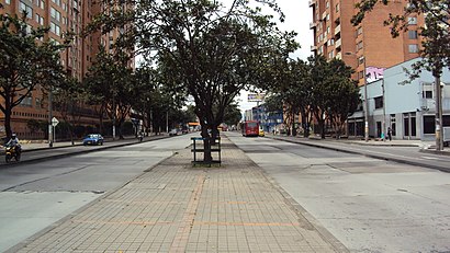
Avenida Caracas is an arterial road in Bogotá, Colombia that runs through the city from north to south.Wiki
Attractions near Avenida Caracas # Calle 60
Avenida Carrera 14 / Calle 60,Calle 60 # Avenida Caracas,Motel Meridian,El Campin,New Lash Especialistas en Cejas y Pestañas,#60- 24,Carrera 13a 59a-07,AlmacéN El Condor,Calle 60 Bis A 13 A - 11,Centro Comercial Minicentro,Calle 59 13-84,Carrera 13 59 - 69,TransMilenio: Calle 63,Politécnico Suramericano L&H,Panamericana,Inter Rapidisimo,Sim Chapinero,Avenida Caracas # Calle 59,Avenida Carrera 14 59 / Avenida Carrera 14 58,Carrera 14a # Calle 60How to get to popular attractions in Chapinero with public transit
Galerías, Teusaquillo,Club El Nogal, Chapinero,Hospital El Tunal, Tunjuelito,Calle 93 # Carrera 15, Chapinero,Avenida Calle 82 # Carrera 7, Chapinero,Avenida Carrera 15 # Glorieta Calle 100, Usaquén,Calle 106 # Avenida Carrera 15, Usaquén,Castilla, Kennedy,Calle 72 Bis # Carrera 7, Chapinero,Hayuelos, Fontibón,Calle 45 # Avenida Nqs - Ciudad De Quito - Carrera 30, Teusaquillo,Parque Ciudad Montes, Puente Aranda,Calle 57 # Carrera 13, Chapinero,Universidad Pedagógica Nacional, Chapinero,Edificio Torre Pacific, Usaquén,Avenida Calle 13 # Avenida - Carrera 68, Fontibón,Cafam, Barrios Unidos,Centro Comercial Porto Alegre, Suba,Centro Comercial Cafam Floresta, Barrios Unidos,Distrito Militar 3, KennedyGet around Chapinero by public transit!
Traveling around Chapinero has never been so easy. See step by step directions as you travel to any attraction, street or major public transit station. View bus and train schedules, arrival times, service alerts and detailed routes on a map, so you know exactly how to get to anywhere in Chapinero.
When traveling to any destination around Chapinero use Moovit's Live Directions with Get Off Notifications to know exactly where and how far to walk, how long to wait for your line, and how many stops are left. Moovit will alert you when it's time to get off — no need to constantly re-check whether yours is the next stop.
Wondering how to use public transit in Chapinero or how to pay for public transit in Chapinero? Moovit public transit app can help you navigate your way with public transit easily, and at minimum cost. It includes public transit fees, ticket prices, and costs. Looking for a map of Chapinero public transit lines? Moovit public transit app shows all public transit maps in Chapinero with all Transmilenio or SITP routes and stops on an interactive map.
Chapinero has 2 transit type(s), including: Transmilenio or SITP, operated by several transit agencies, including Buses Troncales, Buses Alimentadores, Buses Urbanos, Buses Complementarios, Buses Especiales, TransMiCable, Cerro de Monserrate, Aeropuerto El Dorado, Flota Chia LTDA, Auto Servicio Chía LTDA and Politécnico Grancolombiano