Directions to Avenida Dos Democraticos (Manguinhos) with public transportation
The following transit lines have routes that pass near Avenida Dos Democraticos
 Bus: 312, 371, 488L, 621, 711.
- Metro: L2.
- Train: RAMAL BELFORD ROXO, RAMAL SARACURUNA.
How to get to Avenida Dos Democraticos by bus?
Click on the bus route to see step by step directions with maps, line arrival times and updated time schedules.
From Praça Seca, Praça Seca
47 minFrom Hospital Samaritano, Botafogo
50 minFrom Rua Mariz e Barros, Maracanã
27 minFrom Real Gabinete Português - Centro, Botafogo
48 minFrom Estrada Dos Tres Rios, Freguesia (Jacarepaguá)
27 minFrom Pedra Do Sal, Saúde
40 minFrom Rua Dois de Fevereiro, Engenho De Dentro
41 minFrom Vila Mimosa, Praça Da Bandeira
30 minFrom Jardim Botânico, Jardim Botânico
44 minFrom RioFarmes, Cidade Nova
33 min
How to get to Avenida Dos Democraticos by train?
Click on the train route to see step by step directions with maps, line arrival times and updated time schedules.
How to get to Avenida Dos Democraticos by metro?
Click on the metro route to see step by step directions with maps, line arrival times and updated time schedules.
Bus stops near Avenida Dos Democraticos in Manguinhos
Train stations near Avenida Dos Democraticos in Manguinhos
Metro station near Avenida Dos Democraticos in Manguinhos
- Maria Da Graça, 18 min walk,VIEW
Bus lines to Avenida Dos Democraticos in Manguinhos
- 312, Olaria - Candelária (Brs 4 - Via São Cristóvão),VIEW
- SN 312, Penha - Candelária (Via Ibiapina / Itararé / Rodoviária),VIEW
- 313, Penha - Tiradentes (Brs 4 - Via São Cristóvão),VIEW
- 488L, Caxias - Usina (Brs I - Via Uerj / Vila Isabel),VIEW
- 600C, Wona - Central (Brs I - Via Penha),VIEW
- 621, Penha - Saens Peña (Brs 6),VIEW
- 622, Penha - Saens Peña (Circular),VIEW
- 630, Iapi da Penha - Saens Peña (Brs 6 - Via Bonsucesso / Benfica),VIEW
- 663, Méier - Fundão (Via Av. Brasil),VIEW
- 696, Praia do Dendê - Méier (Via Av. Brasil),VIEW
- SN 696, Praia do Dendê - Meier (Via Praia do Rosa / Bancários),VIEW
- 979, Terminal Madureira - Terminal Fundão (via Rua Goiás),VIEW
- 350, Castelo,VIEW
- 486L, Bar Dos Cavaleiros,VIEW
- 489L, Saens Peña,VIEW
- 634, Bananal,VIEW
- 265, Marechal Hermes - Castelo (Brs 4 - Via Norte Shopping),VIEW
- SN 265, Marechal Hermes - Castelo (BRS 4 - via Terminal Gentileza),VIEW
- SP 265, Marechal Hermes - Terminal Gentileza (Via Norte Shopping),VIEW
- 298, Acari - Castelo (Brs 4 - Via Norte Shopping),VIEW
What are the closest stations to Avenida Dos Democraticos?
The closest stations to Avenida Dos Democraticos are:
- Avenida Dos Democráticos | Cidade Da Polícia (1) is 167 meters away, 3 min walk.
- Del Castilho is 307 meters away, 5 min walk.
- Estação De Trem De Manguinhos is 320 meters away, 5 min walk.
- Avenida Dom Hélder Câmara | Cidade Da Polícia is 345 meters away, 5 min walk.
- Avenida Dom Hélder Câmara, 1446-1558 is 364 meters away, 5 min walk.
- Fiocruz is 467 meters away, 7 min walk.
- Portaria Leopoldo Bulhões is 489 meters away, 7 min walk.
- Maria Da Graça is 1332 meters away, 18 min walk.
- Manguinhos is 3895 meters away, 50 min walk.
Which bus lines stop near Avenida Dos Democraticos?
These bus lines stop near Avenida Dos Democraticos: 312, 371, 488L, 621, 711.
Which metro line stops near Avenida Dos Democraticos?
L2 (Pavuna)
Which train lines stop near Avenida Dos Democraticos?
These train lines stop near Avenida Dos Democraticos: RAMAL BELFORD ROXO, RAMAL SARACURUNA.
What’s the nearest metro station to Avenida Dos Democraticos in Manguinhos?
The nearest metro station to Avenida Dos Democraticos in Manguinhos is Maria Da Graça. It’s a 18 min walk away.
What’s the nearest train station to Avenida Dos Democraticos in Manguinhos?
The nearest train station to Avenida Dos Democraticos in Manguinhos is Del Castilho. It’s a 5 min walk away.
What’s the nearest bus station to Avenida Dos Democraticos in Manguinhos?
The nearest bus station to Avenida Dos Democraticos in Manguinhos is Avenida Dos Democráticos | Cidade Da Polícia (1). It’s a 3 min walk away.
What time is the first metro to Avenida Dos Democraticos in Manguinhos?
The L2 is the first metro that goes to Avenida Dos Democraticos in Manguinhos. It stops nearby at 5:23 AM.
What time is the last metro to Avenida Dos Democraticos in Manguinhos?
The L2 is the last metro that goes to Avenida Dos Democraticos in Manguinhos. It stops nearby at 12:28 AM.
What time is the first train to Avenida Dos Democraticos in Manguinhos?
The RAMAL SARACURUNA is the first train that goes to Avenida Dos Democraticos in Manguinhos. It stops nearby at 4:55 AM.
What time is the last train to Avenida Dos Democraticos in Manguinhos?
The RAMAL SARACURUNA is the last train that goes to Avenida Dos Democraticos in Manguinhos. It stops nearby at 10:52 PM.
What time is the first bus to Avenida Dos Democraticos in Manguinhos?
The SN 634 is the first bus that goes to Avenida Dos Democraticos in Manguinhos. It stops nearby at 3:05 AM.
What time is the last bus to Avenida Dos Democraticos in Manguinhos?
The SN 634 is the last bus that goes to Avenida Dos Democraticos in Manguinhos. It stops nearby at 3:28 AM.
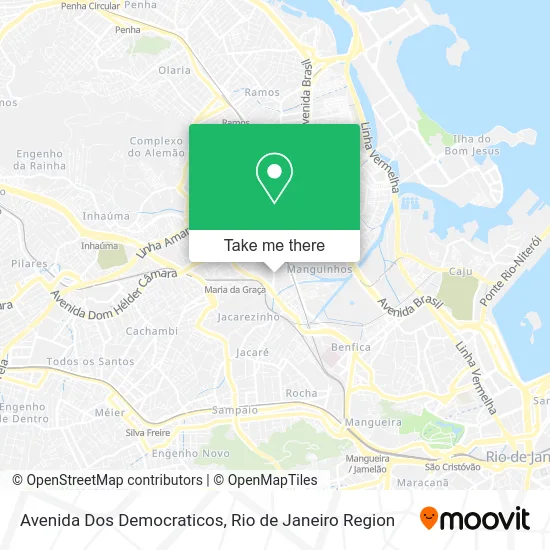
See Avenida Dos Democraticos, Manguinhos, on the map
Public Transit to Avenida Dos Democraticos in Manguinhos
Wondering how to get to Avenida Dos Democraticos in Manguinhos? Moovit helps you find the best way to get to Avenida Dos Democraticos with step-by-step directions from the nearest public transit station.
Moovit provides free maps and live directions to help you navigate through your city. View schedules, routes, timetables, and find out how long does it take to get to Avenida Dos Democraticos in real time.
Looking for the nearest stop or station to Avenida Dos Democraticos? Check out this list of stops closest to your destination: Avenida Dos Democráticos | Cidade Da Polícia (1); Del Castilho; Estação De Trem De Manguinhos; Avenida Dom Hélder Câmara | Cidade Da Polícia; Avenida Dom Hélder Câmara; Fiocruz; Portaria Leopoldo Bulhões; Maria Da Graça; Manguinhos.
Bus: 312, 371, 488L, 621, 711, SN 312, 313, 600C, 350, 486L, 489L, 634, 265, SN 265, SP 265, 298, SN 298.Metro: L2.Train: RAMAL BELFORD ROXO, RAMAL SARACURUNA.
Want to see if there’s another route that gets you there at an earlier time? Moovit helps you find alternative routes or times. Get directions from and directions to Avenida Dos Democraticos easily from the Moovit App or Website.
We make riding to Avenida Dos Democraticos easy, which is why over 1.5 million users, including users in Manguinhos, trust Moovit as the best app for public transit. You don’t need to download an individual bus app or train app, Moovit is your all-in-one transit app that helps you find the best bus time or train time available.
For information on prices of bus, metro and train, costs and ride fares to Avenida Dos Democraticos, please check the Moovit app.
Use the app to navigate to popular places including to the airport, hospital, stadium, grocery store, mall, coffee shop, school, college, and university.
Location: Manguinhos, Rio de Janeiro Region
- Camila Lourenco Terapeuta Capilar,
- Koma Bem,
- Favela de Manguinhos,
- G.R.E.S. Unidos de Manguinhos,
- DRCPIM - Delegacia de Repressão aos Crimes contra a Propriedade Imaterial,
- DDSD - Delegacia de Defesa dos Serviços Delegados,
- Cidade da Polícia Civil,
- S & S Kids,
- Estacao Manguinhos,
- SUIPA - Sociedade União Internacional Protetora dos Animais,
- Pizzaria B13,
- Rua Jacinto,
- Verdinho's Bar e Lanchonete,
- Avenida Dom Hélder Câmara 2066,
- Rua Nossa Senhora dos Navegantes,
- Rua São Jose,
- Seção de Operações com Cães (PCERJ / CORE / SOC) - Cidade da Polícia,
- Avenida Dom Hélder Câmara Próximo ao 1862-2056,
- Rua Maranhão 71,
- Rua Santana do Livramento 2-92
Places Near Avenida Dos Democraticos (Manguinhos)
- Shopping RioSul, Botafogo,
- Hospital Federal Do Andaraí, Andaraí,
- Shopping Downtown, Barra Da Tijuca,
- Hospital Pedro Ernesto, Vila Isabel,
- Shopping Nova América, Del Castilho,
- Hospital Federal Cardoso Fontes, Jacarepaguá,
- Avenida Venezuela 134, Saúde,
- Rua Licínio Cardoso, São Francisco Xavier,
- Rodoviária Novo Rio (Rodoviária do Rio de Janeiro), Santo Cristo,
- Feira Livre da Gloria, Glória,
- Avenida Rio Branco, Centro,
- Praia do Arpoador, Ipanema,
- Rio De Janeiro,
- Museu Do Amanhã, Centro,
- Hospital Municipal Ronaldo Gazolla, Acari,
- Norte Shopping, Cachambi,
- Niterói, Niterói,
- Shopping Rio Sul, Botafogo,
- Rua Ulysses Guimarães 16, Cidade Nova,
- Feirão De Malhas, Duque De Caxias
How to get to popular places in Rio de Janeiro Region with public transit
Get around Manguinhos by public transit!
Traveling around Manguinhos has never been so easy. See step by step directions as you travel to any attraction, street or major public transit station. View bus and train schedules, arrival times, service alerts and detailed routes on a map, so you know exactly how to get to anywhere in Manguinhos.
When traveling to any destination around Manguinhos use Moovit's Live Directions with Get Off Notifications to know exactly where and how far to walk, how long to wait for your line, and how many stops are left. Moovit will alert you when it's time to get off — no need to constantly re-check whether yours is the next stop.
Wondering how to use public transit in Manguinhos or how to pay for public transit in Manguinhos? Moovit public transit app can help you navigate your way with public transit easily, and at minimum cost. It includes public transit fees, ticket prices, and costs. Looking for a map of Manguinhos public transit lines? Moovit public transit app shows all public transit maps in Manguinhos with all Bus, Train, Metro, Light Rail, Ferry, Cable Car, Gondola and Funicular routes and stops on an interactive map.
Rio de Janeiro Region has 8 transit type(s), including: Bus, Train, Metro, Light Rail, Ferry, Cable Car, Gondola and Funicular, operated by several transit agencies, including TrensRJ, Metrô Rio, VLT Carioca, Barcas Rio, BRT MOBI-Rio, Auto Viação Alpha, Auto Viação Tijuca, Gire Transportes, Transurb, Viação Nossa Senhora das Graças, Consórcio INTERSUL, Braso Lisboa (Municipal), Caprichosa Auto Ônibus, Auto Viação Três Amigos and Rodoviária Âncora Matias
Public transit lines with stations closest to Avenida Dos Democraticos in Manguinhos
Metro lines with stations closest to Avenida Dos Democraticos in Manguinhos
Train lines with stations closest to Avenida Dos Democraticos in Manguinhos
Bus lines with stations closest to Avenida Dos Democraticos in Manguinhos
Avenida Dom Hélder Câmara | Cidade Da Polícia
- 265Marechal Hermes - Castelo (Brs 4 - Via Norte Shopping)
- SN 265Marechal Hermes - Castelo (BRS 4 - via Terminal Gentileza)
- SP 265Marechal Hermes - Terminal Gentileza (Via Norte Shopping)
- 298Acari - Castelo (Brs 4 - Via Norte Shopping)
- SN 298Acari - Castelo (Brs 4 - Via Norte Shopping / Terminal Gentileza)