How to get to BEALLS FLORIDA by bus?
Click on the bus route to see step by step directions with maps, line arrival times and updated time schedules.
Bus stops near BEALLS FLORIDA in West Vero Corridor
Bus lines to BEALLS FLORIDA in West Vero Corridor
What are the closest stations to BEALLS FLORIDA?
The closest stations to BEALLS FLORIDA are:
- Bob Evans is 335 yards away, 5 min walk.
- Chick-fil-a EB is 361 yards away, 5 min walk.
- Indian River Charter HS Inbound W is 699 yards away, 9 min walk.
- Indian River Mall (Food Court) is 1134 yards away, 14 min walk.
Which bus lines stop near BEALLS FLORIDA?
These bus lines stop near BEALLS FLORIDA: RT 13, RT 7.
What’s the nearest bus station to BEALLS FLORIDA in West Vero Corridor?
The nearest bus stations to BEALLS FLORIDA in West Vero Corridor are Bob Evans and Chick-fil-a EB. The closest one is a 5 min walk away.
What time is the first bus to BEALLS FLORIDA in West Vero Corridor?
The RT 2 is the first bus that goes to BEALLS FLORIDA in West Vero Corridor. It stops nearby at 6:00 AM.
What time is the last bus to BEALLS FLORIDA in West Vero Corridor?
The RT 2 is the last bus that goes to BEALLS FLORIDA in West Vero Corridor. It stops nearby at 6:59 PM.
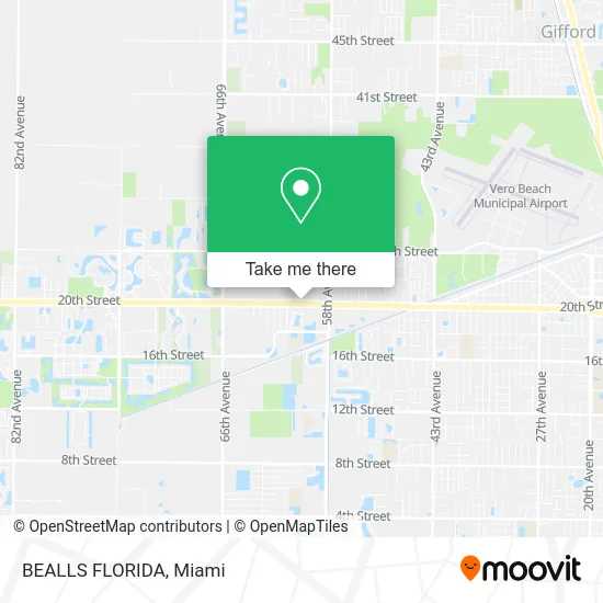
See BEALLS FLORIDA, West Vero Corridor, on the map
Public Transit to BEALLS FLORIDA in West Vero Corridor
Wondering how to get to BEALLS FLORIDA in West Vero Corridor? Moovit helps you find the best way to get to BEALLS FLORIDA with step-by-step directions from the nearest public transit station.
Moovit provides free maps and live directions to help you navigate through your city. View schedules, routes, timetables, and find out how long does it take to get to BEALLS FLORIDA in real time.
Looking for the nearest stop or station to BEALLS FLORIDA? Check out this list of stops closest to your destination: Bob Evans; Chick-fil-a EB; Indian River Charter HS Inbound W; Indian River Mall (Food Court).
Bus: RT 13, RT 7, RT 2, RT 9, RT 14.
Want to see if there’s another route that gets you there at an earlier time? Moovit helps you find alternative routes or times. Get directions from and directions to BEALLS FLORIDA easily from the Moovit App or Website.
We make riding to BEALLS FLORIDA easy, which is why over 1.5 million users, including users in West Vero Corridor, trust Moovit as the best app for public transit. You don’t need to download an individual bus app or train app, Moovit is your all-in-one transit app that helps you find the best bus time or train time available.
For information on prices of bus, costs and ride fares to BEALLS FLORIDA, please check the Moovit app.
Use the app to navigate to popular places including to the airport, hospital, stadium, grocery store, mall, coffee shop, school, college, and university.
BEALLS FLORIDA Address: 5900 20th St Vero Beach, FL 32966 street in West Vero Corridor
- Ichiddo Vero Beach,
- Verocarvel,
- Ryanwood Square,
- Buff City Soap - Vero Beach,
- Carvel,
- WW Weight Watchers,
- Burlington,
- PNC Mortgage,
- Olive Garden Italian Restaurant,
- Total Wine & More,
- Motto Clear Aligners,
- Big Blue Box of Pain and Suffering,
- Atm Target,
- 5800 20th St Parking,
- Charr-Nix's New Generation School of Beauty,
- Mambo's Cafe,
- Swara Food of Vero Beach,
- chanel,
- Victory Center Military Store,
- Fix It Quick
Places Near BEALLS FLORIDA (West Vero Corridor)
- Miami-Dade County Courthouse, Miami,
- Sawgrass Mall, Miami,
- Miami VA Hospital, Miami,
- Little Havana, Miami,
- Marlins Park, Miami,
- Richard E. Gerstein Justice Building, Miami,
- Dolphin Mall, Miami,
- Port of Miami Cruise Terminal, Miami,
- Miami Design District, Miami,
- Wynwood, Miami,
- Aventura Mall, Miami,
- Hard Rock Stadium, Miami Gardens,
- Brickell City Centre, Miami,
- Keiser University Flagship Campus, West Palm Beach,
- Aventura Mall, Miami Beach,
- Dolphin Mall Bus, Miami,
- Zoo Miami, Miami,
- Miami Freedom Park, Miami,
- Bayside Marketplace, Miami,
- Sawgrass mall ( FL ), Miami Beach
How to get to popular places in Miami with public transit
Get around West Vero Corridor by public transit!
Traveling around West Vero Corridor has never been so easy. See step by step directions as you travel to any attraction, street or major public transit station. View bus and train schedules, arrival times, service alerts and detailed routes on a map, so you know exactly how to get to anywhere in West Vero Corridor.
When traveling to any destination around West Vero Corridor use Moovit's Live Directions with Get Off Notifications to know exactly where and how far to walk, how long to wait for your line, and how many stops are left. Moovit will alert you when it's time to get off — no need to constantly re-check whether yours is the next stop.
Wondering how to use public transit in West Vero Corridor or how to pay for public transit in West Vero Corridor? Moovit public transit app can help you navigate your way with public transit easily, and at minimum cost. It includes public transit fees, ticket prices, and costs. Looking for a map of West Vero Corridor public transit lines? Moovit public transit app shows all public transit maps in West Vero Corridor with all Bus, Train, Light Rail and Ferry routes and stops on an interactive map.
Miami has 4 transit type(s), including: Bus, Train, Light Rail and Ferry, operated by several transit agencies, including Broward County Transit, Miami-Dade Transit, Metrorail, Palm Tran, Tri-Rail, Brightline, MARTY, City of Homestead Trolley, Key West Transit, Treasure Coast Connector, GoLine IRT, Amtrak, Greyhound-us, FlixBus-us and Aventura Express Shuttle Bus