Directions to B FRT (Boston) with public transportation
The following transit lines have routes that pass near B FRT
 Bus: 4, 501, 504, 93, FLIXBUS N2605.
- Train: FRAMINGHAM/WORCESTER, LOWELL, NEEDHAM, NEWBURYPORT/ROCKPORT, COMMUTER RAIL SHUTTLE.
- Subway: BLUE LINE, GREEN LINE D, ORANGE LINE, RED LINE.
How to get to B FRT by bus?
Click on the bus route to see step by step directions with maps, line arrival times and updated time schedules.
From Regent Theatre, Arlington
77 minFrom Massachusetts Water Resource Authority (MWRA), Chelsea
41 minFrom Watertown, MA, Watertown Town
50 minFrom Agganis Arena, Boston
64 minFrom The Monument, Boston
53 minFrom Milton Academy, Milton
100 minFrom Revere Beach, Revere
76 minFrom Christian A Herter Park, Boston
68 minFrom La Quinta Inn & Suites Boston Somerville, Somerville
66 minFrom The Mall At Chestnut Hill, Newton
73 min
How to get to B FRT by train?
Click on the train route to see step by step directions with maps, line arrival times and updated time schedules.
How to get to B FRT by subway?
Click on the subway route to see step by step directions with maps, line arrival times and updated time schedules.
Bus stops near B FRT in Boston
Subway station near B FRT in Boston
- Downtown Crossing, 2 min walk,VIEW
Train station near B FRT in Boston
- South Station, 4 min walk,VIEW
Bus lines to B FRT in Boston
- 501, Downtown Via Cambridge St And Copley (Express),VIEW
- 504, Watertown Via Copley And Newton Corner (Express),VIEW
- 4, Design Center - North Station via South Station,VIEW
- 7, Otis & Summer - City Point,VIEW
- 11, Chauncy & Summer - City Point,VIEW
- RED LINE SHUTTLE, Kendall/MIT - JFK/UMass,VIEW
- RED LINE SHUTTLE, Kendall/MIT - Broadway via Pearl Street,VIEW
- RED LINE SHUTTLE, Harvard - South Station,VIEW
- RED LINE SHUTTLE, Kendall/MIT - Broadway via Downtown Crossing,VIEW
- RED LINE SHUTTLE, Harvard - JFK/UMass via Congress Street,VIEW
- RED LINE SHUTTLE, JFK/UMass - Park Street via Post Office,VIEW
- RED LINE SHUTTLE, Harvard - Broadway,VIEW
- RED LINE SHUTTLE, JFK/UMass - Park Street,VIEW
- RED LINE SHUTTLE, JFK/UMass - Kendall/MIT (Shuttle),VIEW
- RED LINE SHUTTLE, Ashmont - Park Street via Post Office,VIEW
- 505, Waltham (Express),VIEW
- SL4, Nubian,VIEW
- RED LINE SHUTTLE, Jfk/Umass (Shuttle),VIEW
- BOSTON EXPRESS 3, Boston-Logan Airport,VIEW
- BOSTON EXPRESS 93, Boston-South Station,VIEW
What are the closest stations to B FRT?
The closest stations to B FRT are:
- Kneeland St @ Washington St is 35 yards away, 1 min walk.
- Downtown Crossing is 140 yards away, 2 min walk.
- South Station is 255 yards away, 4 min walk.
- Summer St @ South Station - Red Line Entrance is 363 yards away, 5 min walk.
- Chinatown Gate is 387 yards away, 5 min walk.
- Summer St @ Atlantic Ave is 444 yards away, 6 min walk.
- Boston-South Station is 459 yards away, 6 min walk.
- South Station Boston is 495 yards away, 7 min walk.
- South Station Bus Terminal is 680 yards away, 9 min walk.
Which bus lines stop near B FRT?
These bus lines stop near B FRT: 4, 501, 504, 93, FLIXBUS N2605, SL3, SL4.
Which train lines stop near B FRT?
These train lines stop near B FRT: FRAMINGHAM/WORCESTER, LOWELL, NEEDHAM, NEWBURYPORT/ROCKPORT.
Which subway lines stop near B FRT?
These subway lines stop near B FRT: BLUE LINE, GREEN LINE D, ORANGE LINE, RED LINE.
What’s the nearest subway station to B FRT in Boston?
The nearest subway station to B FRT in Boston is Downtown Crossing. It’s a 2 min walk away.
What’s the nearest train station to B FRT in Boston?
The nearest train station to B FRT in Boston is South Station. It’s a 4 min walk away.
What’s the nearest bus station to B FRT in Boston?
The nearest bus station to B FRT in Boston is Kneeland St @ Washington St. It’s a 1 min walk away.
What time is the first subway to B FRT in Boston?
The ORANGE LINE is the first subway that goes to B FRT in Boston. It stops nearby at 5:28 AM.
What time is the last subway to B FRT in Boston?
The RED LINE is the last subway that goes to B FRT in Boston. It stops nearby at 1:51 AM.
What time is the first train to B FRT in Boston?
The PROVIDENCE/STOUGHTON is the first train that goes to B FRT in Boston. It stops nearby at 4:20 AM.
What time is the last train to B FRT in Boston?
The LAKE SHORE LIMITED is the last train that goes to B FRT in Boston. It stops nearby at 8:32 PM.
What time is the first bus to B FRT in Boston?
The SLW is the first bus that goes to B FRT in Boston. It stops nearby at 4:19 AM.
What time is the last bus to B FRT in Boston?
The FLIXBUS N2605 is the last bus that goes to B FRT in Boston. It stops nearby at 9:25 AM.
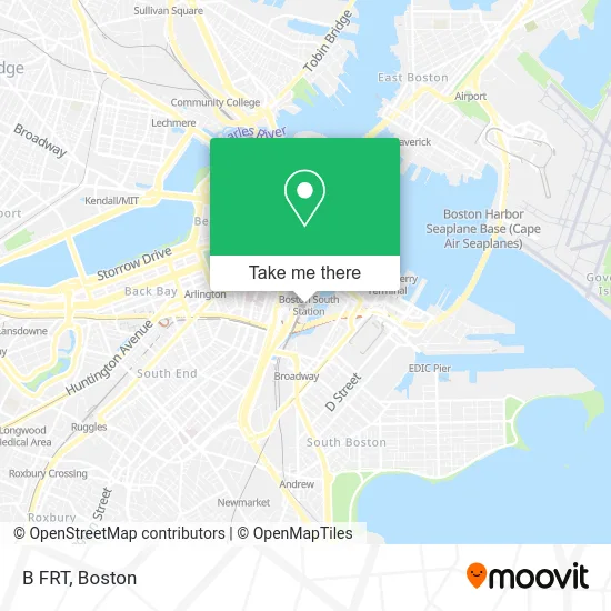
See B FRT, Boston, on the map
Public Transit to B FRT in Boston
Wondering how to get to B FRT in Boston? Moovit helps you find the best way to get to B FRT with step-by-step directions from the nearest public transit station.
Moovit provides free maps and live directions to help you navigate through your city. View schedules, routes, timetables, and find out how long does it take to get to B FRT in real time.
Looking for the nearest stop or station to B FRT? Check out this list of stops closest to your destination: Kneeland St @ Washington St; Downtown Crossing; South Station; Summer St @ South Station - Red Line Entrance; Chinatown Gate; Summer St @ Atlantic Ave; Boston-South Station; South Station Boston; South Station Bus Terminal.
Bus: 4, 501, 504, 93, FLIXBUS N2605, SL3, SL4, 7, 11, RED LINE SHUTTLE, RED LINE SHUTTLE, 505, RED LINE SHUTTLE.Train: FRAMINGHAM/WORCESTER, LOWELL, NEEDHAM, NEWBURYPORT/ROCKPORT, COMMUTER RAIL SHUTTLE, FAIRMOUNT LINE SHUTTLE, FRANKLIN LINE SHUTTLE, KINGSTON LINE SHUTTLE, SL1.Subway: BLUE LINE, GREEN LINE D, ORANGE LINE, RED LINE.
Want to see if there’s another route that gets you there at an earlier time? Moovit helps you find alternative routes or times. Get directions from and directions to B FRT easily from the Moovit App or Website.
We make riding to B FRT easy, which is why over 1.7 million users, including users in Boston, trust Moovit as the best app for public transit. You don’t need to download an individual bus app or train app, Moovit is your all-in-one transit app that helps you find the best bus time or train time available.
For information on prices of bus, subway and train, costs and ride fares to B FRT, please check the Moovit app.
Use the app to navigate to popular places including to the airport, hospital, stadium, grocery store, mall, coffee shop, school, college, and university.
B FRT Address: Boston, MA 02111 street in Boston
- Amtrak Train 93,
- Boston - Hyannis,
- USPS Boston P&DC,
- DATTCO,
- Greyhound Express to NYC,
- Dartmouth Coach,
- Lucky Star Bus,
- MBTA Franklin Commuter Train,
- I-90 Mass Pike, South Station Exit,
- Deaf & Hard of Hearng Ma Commission for,
- Fair Work P.C.,
- Dewey Square Tunnel,
- Neuraflash,
- Greenway Conservancy,
- South Street Diner (South St Diner),
- Boston Express Platform A1,
- MBTA P507 Outbound Framingham Train,
- Credo Reference,
- Middleboro / Lakeville Commuter Rail Train,
- Patriots Train To Gillette Stadium
Places Near B FRT (Boston)
- North End, Boston,
- Castle Island, Boston,
- Prudential Center, Boston,
- Wilbur Theatre, Boston,
- Faneuil Hall, Boston,
- Quincy Market, Boston,
- House Of Blues, Boston,
- Boston Common, Boston,
- Cheers, Boston,
- Td Garden, Boston,
- Seaport District, Boston,
- Isabella Stewart Gardner Museum, Boston,
- Boston Convention & Exhibition Center, Boston,
- Boston Medical Center, Boston,
- Leader Bank Pavilion (Leader Bank Pavillion), Boston,
- Massachusetts General Hospital, Boston,
- Boston Children's Hospital, Boston,
- Mgm Music Hall, Boston,
- Museum Of Science, Boston,
- Wang Theater, Boston
How to get to popular places in Boston with public transit
Get around Boston by public transit!
Traveling around Boston has never been so easy. See step by step directions as you travel to any attraction, street or major public transit station. View bus and train schedules, arrival times, service alerts and detailed routes on a map, so you know exactly how to get to anywhere in Boston.
When traveling to any destination around Boston use Moovit's Live Directions with Get Off Notifications to know exactly where and how far to walk, how long to wait for your line, and how many stops are left. Moovit will alert you when it's time to get off — no need to constantly re-check whether yours is the next stop.
Wondering how to use public transit in Boston or how to pay for public transit in Boston? Moovit public transit app can help you navigate your way with public transit easily, and at minimum cost. It includes public transit fees, ticket prices, and costs. Looking for a map of Boston public transit lines? Moovit public transit app shows all public transit maps in Boston with all Bus, Train, Subway and Ferry routes and stops on an interactive map.
Boston has 4 transit type(s), including: Bus, Train, Subway and Ferry, operated by several transit agencies, including MBTA, Southeastern Regional Transit Authority, MetroWest Regional Transit Authority, Rhode Island Public Transit Authority, WRTA, Lowell Regional Transit Authority, Merrimack Valley Transit, Montachusett Regional Transit Authority, Cape Cod Regional Transit Authority, Brockton Area Transit Authority, Martha's Vineyard Transit Authority, the WAVE - Nantucket Regional Transit Authority, GATRA, Cape Ann Transportation Authority and Massport