Directions to Back To the Roots (Boston) with public transportation
The following transit lines have routes that pass near Back To the Roots
 Bus: 19, 23, 28, 44, 32.
- Train: FAIRMOUNT, FRANKLIN/FOXBORO, PROVIDENCE/STOUGHTON.
- Subway: ORANGE LINE.
How to get to Back To the Roots by bus?
Click on the bus route to see step by step directions with maps, line arrival times and updated time schedules.
From Hilton Garden Inn Boston Logan Airport, Boston
84 minFrom Massachusetts Water Resource Authority (MWRA), Chelsea
79 minFrom Long Wharf Station, Boston
55 minFrom Wegmans, Medford
121 minFrom Quincy, MA, Quincy
82 minFrom Winter Hill, Somerville
92 minFrom Tufts University, Medford
88 minFrom Tip O'Neil Building, Boston
76 minFrom Quincy Market, Quincy
83 minFrom Mount Auburn, Cambridge
72 min
How to get to Back To the Roots by train?
Click on the train route to see step by step directions with maps, line arrival times and updated time schedules.
How to get to Back To the Roots by subway?
Click on the subway route to see step by step directions with maps, line arrival times and updated time schedules.
From Hilton Garden Inn Boston Logan Airport, Boston
57 minFrom Massachusetts Water Resource Authority (MWRA), Chelsea
68 minFrom Long Wharf Station, Boston
41 minFrom Wegmans, Medford
64 minFrom Quincy, MA, Quincy
64 minFrom Winter Hill, Somerville
64 minFrom Tufts University, Medford
58 minFrom Tip O'Neil Building, Boston
38 minFrom Quincy Market, Quincy
63 min
Bus stops near Back To the Roots in Boston
Subway station near Back To the Roots in Boston
- Jackson Square, 6 min walk,VIEW
Train station near Back To the Roots in Boston
- Uphams Corner, 13 min walk,VIEW
Bus lines to Back To the Roots in Boston
- 32, Forest Hills - Wolcott Square,VIEW
- 34, Forest Hills - Dedham Mall,VIEW
- 36, Forest Hills - VA Hospital,VIEW
- 44, Ruggles - Jackson Square,VIEW
- 38, Wren St,VIEW
- 14, Heath St,VIEW
- 19, Gallivan Blvd,VIEW
- 23, Franklin Park,VIEW
- 28, Avenue Louis Pasteur Via Ruggles,VIEW
- 10, Townsend & Humboldt,VIEW
- 22, Ashmont,VIEW
What are the closest stations to Back To the Roots?
The closest stations to Back To the Roots are:
- Humboldt Ave @ Wyoming St is 180 yards away, 3 min walk.
- Humboldt Ave @ Townsend St is 252 yards away, 4 min walk.
- Warren St @ Quincy St is 271 yards away, 4 min walk.
- Warren St @ Townsend St is 290 yards away, 4 min walk.
- Jackson Square is 451 yards away, 6 min walk.
- Uphams Corner is 1042 yards away, 13 min walk.
Which bus lines stop near Back To the Roots?
These bus lines stop near Back To the Roots: 19, 23, 28, 44.
Which train line stops near Back To the Roots?
FAIRMOUNT (#1619 | Fairmount)
Which subway line stops near Back To the Roots?
ORANGE LINE (Forest Hills)
What’s the nearest subway station to Back To the Roots in Boston?
The nearest subway station to Back To the Roots in Boston is Jackson Square. It’s a 6 min walk away.
What’s the nearest train station to Back To the Roots in Boston?
The nearest train station to Back To the Roots in Boston is Uphams Corner. It’s a 13 min walk away.
What’s the nearest bus station to Back To the Roots in Boston?
The nearest bus station to Back To the Roots in Boston is Humboldt Ave @ Wyoming St. It’s a 3 min walk away.
What time is the first subway to Back To the Roots in Boston?
The ORANGE LINE is the first subway that goes to Back To the Roots in Boston. It stops nearby at 5:18 AM.
What time is the last subway to Back To the Roots in Boston?
The ORANGE LINE is the last subway that goes to Back To the Roots in Boston. It stops nearby at 1:54 AM.
What time is the first train to Back To the Roots in Boston?
The FAIRMOUNT is the first train that goes to Back To the Roots in Boston. It stops nearby at 4:47 AM.
What time is the last train to Back To the Roots in Boston?
The FAIRMOUNT is the last train that goes to Back To the Roots in Boston. It stops nearby at 12:00 AM.
What time is the first bus to Back To the Roots in Boston?
The 28 is the first bus that goes to Back To the Roots in Boston. It stops nearby at 3:18 AM.
What time is the last bus to Back To the Roots in Boston?
The 23 is the last bus that goes to Back To the Roots in Boston. It stops nearby at 2:32 AM.
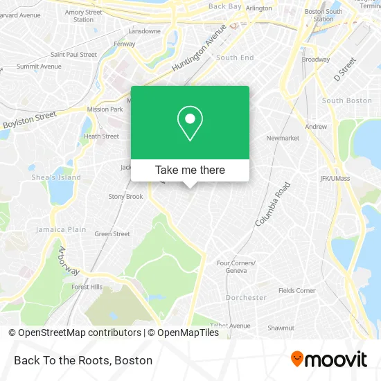
See Back To the Roots, Boston, on the map
Public Transit to Back To the Roots in Boston
Wondering how to get to Back To the Roots in Boston? Moovit helps you find the best way to get to Back To the Roots with step-by-step directions from the nearest public transit station.
Moovit provides free maps and live directions to help you navigate through your city. View schedules, routes, timetables, and find out how long does it take to get to Back To the Roots in real time.
Looking for the nearest stop or station to Back To the Roots? Check out this list of stops closest to your destination: Humboldt Ave @ Wyoming St; Humboldt Ave @ Townsend St; Warren St @ Quincy St; Warren St @ Townsend St; Jackson Square; Uphams Corner.
Bus: 19, 23, 28, 44, 32, 34, 36, 38, 14, 10, 22.Train: FAIRMOUNT, FRANKLIN/FOXBORO, PROVIDENCE/STOUGHTON.Subway: ORANGE LINE.
Want to see if there’s another route that gets you there at an earlier time? Moovit helps you find alternative routes or times. Get directions from and directions to Back To the Roots easily from the Moovit App or Website.
We make riding to Back To the Roots easy, which is why over 1.5 million users, including users in Boston, trust Moovit as the best app for public transit. You don’t need to download an individual bus app or train app, Moovit is your all-in-one transit app that helps you find the best bus time or train time available.
For information on prices of bus, subway and train, costs and ride fares to Back To the Roots, please check the Moovit app.
Use the app to navigate to popular places including to the airport, hospital, stadium, grocery store, mall, coffee shop, school, college, and university.
Back To the Roots Address: 103 Harrishof St Dorchester, MA 02121 street in Boston
- Michelle Green Thu,
- William Monroe Trotter,
- Bethel Pentecostal Church (Bethel Pentcostal Church Uhc),
- Community Newspaper,
- Ill. City Records,
- National Life Insurance Inc,
- Humbolt Apartments,
- Travelers Inn,
- Roxbury,
- City of Boston,
- CBHM Research Committee,
- Opportunities Unlimited,
- Museum of the National Center of Afro-American Artists, Inc.,
- Abbotsford,
- 176 Humboldt Avenue Condominium Association,
- Overall Construction,
- Boston Latin Academy,
- Bridge Boston Charter School,
- Humano Multi Cultural Project Jorge Arci,
- Greater Boston
Places Near Back To the Roots (Boston)
- Wang Theater, Boston,
- Wilbur Theatre, Boston,
- Isabella Stewart Gardner Museum, Boston,
- Td Garden, Boston,
- House Of Blues, Boston,
- Leader Bank Pavilion (Leader Bank Pavillion), Boston,
- Boston Children's Hospital, Boston,
- Faneuil Hall, Boston,
- Museum Of Science, Boston,
- Quincy Market, Boston,
- Cheers, Boston,
- Boston Common, Boston,
- North End, Boston,
- Prudential Center, Boston,
- Boston Medical Center, Boston,
- Mgm Music Hall, Boston,
- Boston Convention & Exhibition Center, Boston,
- Massachusetts General Hospital, Boston,
- Seaport District, Boston,
- Castle Island, Boston
How to get to popular places in Boston with public transit
Get around Boston by public transit!
Traveling around Boston has never been so easy. See step by step directions as you travel to any attraction, street or major public transit station. View bus and train schedules, arrival times, service alerts and detailed routes on a map, so you know exactly how to get to anywhere in Boston.
When traveling to any destination around Boston use Moovit's Live Directions with Get Off Notifications to know exactly where and how far to walk, how long to wait for your line, and how many stops are left. Moovit will alert you when it's time to get off — no need to constantly re-check whether yours is the next stop.
Wondering how to use public transit in Boston or how to pay for public transit in Boston? Moovit public transit app can help you navigate your way with public transit easily, and at minimum cost. It includes public transit fees, ticket prices, and costs. Looking for a map of Boston public transit lines? Moovit public transit app shows all public transit maps in Boston with all Bus, Train, Subway and Ferry routes and stops on an interactive map.
Boston has 4 transit type(s), including: Bus, Train, Subway and Ferry, operated by several transit agencies, including MBTA, Southeastern Regional Transit Authority, MetroWest Regional Transit Authority, Rhode Island Public Transit Authority, WRTA, Lowell Regional Transit Authority, Merrimack Valley Transit, Montachusett Regional Transit Authority, Cape Cod Regional Transit Authority, Brockton Area Transit Authority, Martha's Vineyard Transit Authority, the WAVE - Nantucket Regional Transit Authority, GATRA, Cape Ann Transportation Authority and Massport