Directions to Bagcilar with public transportation
The following transit lines have routes that pass near Bagcilar
How to get to Bagcilar by bus?
Click on the bus route to see step by step directions with maps, line arrival times and updated time schedules.
How to get to Bagcilar by metro?
Click on the metro route to see step by step directions with maps, line arrival times and updated time schedules.
Dolmus & minibus stations near Bagcilar
- Batışehir,10 min walk,
- Hüseyin Karaaslan Caddesi,10 min walk,
- Hüseyin Karaaslan Caddesi-2,10 min walk,
- Basın Tesisleri / Başakşehir Yönü,18 min walk,
What are the closest stations to Bagcilar?
The closest stations to Bagcilar are:
- Batışehir is 716 meters away, 10 min walk.
- Hüseyin Karaaslan Caddesi is 783 meters away, 10 min walk.
- Hüseyin Karaaslan Caddesi-2 is 783 meters away, 10 min walk.
- Basın Tesisleri / Başakşehir Yönü is 1372 meters away, 18 min walk.
Which bus lines stop near Bagcilar?
These bus lines stop near Bagcilar: 146B, 31Y, 76O, 78, 79F, 97M.
Which metro lines stop near Bagcilar?
These metro lines stop near Bagcilar: M3, M7.
Which Dolmus & Minibus lines stop near Bagcilar?
These Dolmus & Minibus lines stop near Bagcilar: MİNİBÜS: A-27, MİNİBÜS: A-73.
What’s the nearest Dolmus & Minibus station to Bagcilar?
The nearest Dolmus & Minibus stations to Bagcilar are Batışehir, Hüseyin Karaaslan Caddesi and Hüseyin Karaaslan Caddesi-2. The closest one is a 10 min walk away.
What time is the first Dolmus & Minibus to Bagcilar?
The MİNİBÜS: A-27 is the first Dolmus & Minibus that goes to Bagcilar. It stops nearby at 5:36 AM.
What time is the last Dolmus & Minibus to Bagcilar?
The MİNİBÜS: A-48 is the last Dolmus & Minibus that goes to Bagcilar. It stops nearby at 11:13 PM.
What time is the first bus to Bagcilar?
The 97M is the first bus that goes to Bagcilar. It stops nearby at 5:38 AM.
What time is the last bus to Bagcilar?
The 89C is the last bus that goes to Bagcilar. It stops nearby at 1:35 AM.
How much is the Dolmus & Minibus fare to Bagcilar?
The Dolmus & Minibus fare to Bagcilar costs about ₺5.25 - ₺9.75.
See Bagcilar on the map
Kendi çekimim
Public Transportation to Bagcilar
Wondering how to get to Bagcilar, Turkey? Moovit helps you find the best way to get to Bagcilar with step-by-step directions from the nearest public transit station.
Moovit provides free maps and live directions to help you navigate through your city. View schedules, routes, timetables, and find out how long does it take to get to Bagcilar in real time.
Looking for the nearest stop or station to Bagcilar? Check out this list of stops closest to your destination: Batışehir; Hüseyin Karaaslan Caddesi; Hüseyin Karaaslan Caddesi-2; Basın Tesisleri / Başakşehir Yönü.
Bus:146B31Y76O7879F97MMetro:M3M7Dolmus & Minibus:MİNİBÜS: A-27MİNİBÜS: A-73EYÜP - ISTOÇALIBEYKÖY - SANKO - İSTOÇBAĞCILAR -OTOCENTER-MOİŞIRINEVLER-TAVUKÇU DERESI-42 EVLERBAKIRKÖY-ŞIRINEVLER-İSTOÇ-İKITELLIBAKIRKÖY-ŞIRINEVLER-FATIH MAHDEPREM KONUTLARI - OTOGARİKITELLI ORG.SAN.-MEHMET AKIF MAH.GÖZTEPE MAH.-TOPKAPI
Want to see if there’s another route that gets you there at an earlier time? Moovit helps you find alternative routes or times. Get directions from and directions to Bagcilar easily from the Moovit App or Website.
We make riding to Bagcilar easy, which is why over 1.5 million users, including users in Bagcilar, trust Moovit as the best app for public transit. You don’t need to download an individual bus app or train app, Moovit is your all-in-one transit app that helps you find the best bus time or train time available.
For information on prices of Dolmus & Minibus, bus, metro and train, costs and ride fares to Bagcilar, please check the Moovit app.
Use the app to navigate to popular places including to the airport, hospital, stadium, grocery store, mall, coffee shop, school, college, and university.
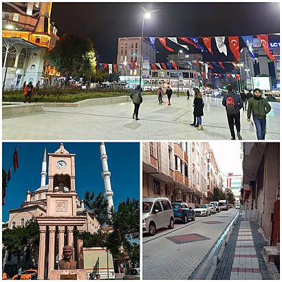
Bagcilar Address: Göztepe Mah. Batışehir Cad. No:2 K3 Blok, 34218 Bagcilar/İstanbul, Türkiye street in Bagcilar
Kendi çekimim
Attractions near Bagcilar
Bagcilar,Gazi Çiğköfte Batışehir,Four Points By Sheraton Batışehir,Ever Hotel Europe,Batı Şehir Sitesi F Blok,Dry Clean Kuru Temizleme & Terzi,Batışehir Caddesi, 28,Namsan Turizm,batışehir koşu parkuru,Batışehir Bisiklet Parkuru,Green Moss Batışehir,Batışehir Yürüyüş Parkuru,Pure Athletic Club / Batışehir VIP,Koza Batı Döviz,Batışehir Sports & Gym,Batışehir Camii,Medipol Mega Hastanesi - Dil ve Konuşma Terapisi Polikliniği,Teve 2 - Magazin,Albaraka Türk Trakya Kurumsal Şube,Medipol Üniversitesi Hastanesi - Göz PolikliniğiHow to get to popular attractions in Bagcilar with public transit
132H Pendik Yht- Sabiha Gökçen Havalimanı, Pendik,Dudullu-taşdelen-yenidoğan Minibüs Hattı, Çekmekoy,Viaport AVM, Pendik,Topkapı Sarayı, Fatih,bilişim vadisi, Gebze,Haliç,City Center Avm, Esenyurt,Taşdelen, Çekmekoy,Çamsan Park Alışveriş Ve Yaşam Merkezi, Sancaktepe,SGK Fatih Sosyal Güvenlik Merkezi, Fatih,Yenikapı İETT Durakları, Yenikapı, Fatih,İBB Florya Sosyal Tesisleri, Bakirköy,Necmi Kadıoğlu Stadı, Esenyurt,İstanbul Çaglayan Adliyesi, Şişli,16S Sabiha Gökçen - Uzunçayır, Maltepe,Başkent Üniversitesi Hastanesi, Altunizade, Üsküdar,Beylikdüzü 5 No'lu Asm, Beylikduzu,Haseki Eğitim ve Araştırma Hastanesi, Fatih,TCDD Halkalı Tren İstasyonu, Küçükçekmece,Bahçeköy Life Park, SariyerGet around Bagcilar by public transit!
Traveling around Bagcilar has never been so easy. See step by step directions as you travel to any attraction, street or major public transit station. View bus and train schedules, arrival times, service alerts and detailed routes on a map, so you know exactly how to get to anywhere in Bagcilar.
When traveling to any destination around Bagcilar use Moovit's Live Directions with Get Off Notifications to know exactly where and how far to walk, how long to wait for your line, and how many stops are left. Moovit will alert you when it's time to get off — no need to constantly re-check whether yours is the next stop.
Wondering how to use public transit in Bagcilar or how to pay for public transit in Bagcilar? Moovit public transit app can help you navigate your way with public transit easily, and at minimum cost. It includes public transit fees, ticket prices, and costs. Looking for a map of Bagcilar public transit lines? Moovit public transit app shows all public transit maps in Bagcilar with all Dolmus & Minibus, bus, metro or train routes and stops on an interactive map.
Bagcilar has 4 transit type(s), including: Dolmus & Minibus, bus, metro or train, operated by several transit agencies, including Metro İstanbul, UAB, Marmaray, Metrobüs, UAB, Metro İstanbul, İETT, İETT, Şehir Hatları, Dentur Avrasya, Beyden, Turyol, Mavi Marmara, Prenstur and İETT