How to get to Bagi Dreamtech by bus?
Click on the bus route to see step by step directions with maps, line arrival times and updated time schedules.
From Tulsibag Wada, Pune & Velhe
54 minFrom Kasba Ganpati, Pune & Velhe
58 minFrom Lic Office Camp Branch-956, Pune & Velhe
70 minFrom Bibwewadi-Kondhwa Road, Pune & Velhe
74 minFrom Fashion Street, Pune & Velhe
67 minFrom Film And Television Institute Of India, Pune & Velhe
47 minFrom Nehru Memorial Hall, Pune & Velhe
64 minFrom Bj Medical College, Pune & Velhe
62 minFrom Mamledar Kacheri, Pune & Velhe
70 minFrom Junna bazar, Pune & Velhe
58 min
Bus stops near Bagi Dreamtech in Paud
- Rosary School Warje, 9 min walk,VIEW
Metro station near Bagi Dreamtech in Paud
- Vanaz, 12 min walk,VIEW
Bus lines to Bagi Dreamtech in Paud
- 43, Nigdi Bhakti Shakti Terminal - Katraj,VIEW
- 44, Akurdi Railway Station - Katraj,VIEW
- 45, Radha Chowk (Mhalunge Phata) - Katraj,VIEW
- 228, Katraj - Vadgaon Mawal,VIEW
- 43A, Hinjawadi Maan Phase 3 - Katraj,VIEW
- 228B, Balewadi Depot - Katraj,VIEW
- METRO SHUTTLE 3, Sutardara - Ganpati Matha,VIEW
- 50N, Nigdi Bhakti Shakti Terminal - Sinhgad Paytha,VIEW
- 80, Ma.Na.Pa Bhavan ⟲ Ma.Na.Pa Bhavan Via Rahul Park (Circular),VIEW
- 64A, Shewalewadi Depot,VIEW
- 80A, Ma.Na.Pa Bhavan,VIEW
- 144A, Aditya Garden City Dnyaneshwari Udyan,VIEW
What are the closest stations to Bagi Dreamtech?
The closest stations to Bagi Dreamtech are:
- Rosary School Warje is 642 meters away, 9 min walk.
- Vanaz is 895 meters away, 12 min walk.
Which bus lines stop near Bagi Dreamtech?
These bus lines stop near Bagi Dreamtech: 228, 43, 43A, 64A, 94A.
Which metro line stops near Bagi Dreamtech?
AQUA (Towards Vanaz)
What’s the nearest metro station to Bagi Dreamtech in Paud?
The nearest metro station to Bagi Dreamtech in Paud is Vanaz. It’s a 12 min walk away.
What’s the nearest bus station to Bagi Dreamtech in Paud?
The nearest bus station to Bagi Dreamtech in Paud is Rosary School Warje. It’s a 9 min walk away.
What time is the first metro to Bagi Dreamtech in Paud?
The AQUA is the first metro that goes to Bagi Dreamtech in Paud. It stops nearby at 6:00 AM.
What time is the last metro to Bagi Dreamtech in Paud?
The AQUA is the last metro that goes to Bagi Dreamtech in Paud. It stops nearby at 11:36 PM.
What time is the first bus to Bagi Dreamtech in Paud?
The 228B is the first bus that goes to Bagi Dreamtech in Paud. It stops nearby at 5:37 AM.
What time is the last bus to Bagi Dreamtech in Paud?
The 43 is the last bus that goes to Bagi Dreamtech in Paud. It stops nearby at 12:53 AM.
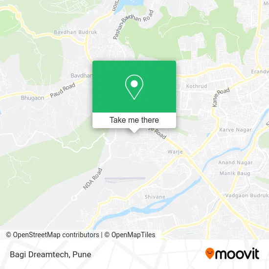
See Bagi Dreamtech, Paud, on the map
Public Transit to Bagi Dreamtech in Paud
Wondering how to get to Bagi Dreamtech in Paud? Moovit helps you find the best way to get to Bagi Dreamtech with step-by-step directions from the nearest public transit station.
Moovit provides free maps and live directions to help you navigate through your city. View schedules, routes, timetables, and find out how long does it take to get to Bagi Dreamtech in real time.
Looking for the nearest stop or station to Bagi Dreamtech? Check out this list of stops closest to your destination: Rosary School Warje; Vanaz.
Bus: 228, 43, 43A, 64A, 94A, 44, 45, 80, 80A, 144A.Metro: AQUA.
Want to see if there’s another route that gets you there at an earlier time? Moovit helps you find alternative routes or times. Get directions from and directions to Bagi Dreamtech easily from the Moovit App or Website.
We make riding to Bagi Dreamtech easy, which is why over 1.5 million users, including users in Paud, trust Moovit as the best app for public transit. You don’t need to download an individual bus app or train app, Moovit is your all-in-one transit app that helps you find the best bus time or train time available.
For information on prices of bus and metro, costs and ride fares to Bagi Dreamtech, please check the Moovit app.
Use the app to navigate to popular places including to the airport, hospital, stadium, grocery store, mall, coffee shop, school, college, and university.
Bagi Dreamtech Address: पुणे 411058 MH street in Paud
- Jhabra Enterprises,
- Shri Sadguru Shreedher Swami Temple,
- Varuna Ganga Sra,
- Maple Aapla Ghar Kirkitwadi,
- Kumbheshwar Mahadev Temple,
- Mahadev Temple,
- Fluorochem,
- Techshed Technologies,
- Megrang,
- Shri Datta Temple,
- Indica Building,
- Adityas A Garden,
- Blossom,
- Aditya Garden Floraa,
- Daffodils,
- Camellia,
- Oval Nest,
- Project Aditya Garden City,
- Aditi's Maths and Science Academy,
- Exide
Places Near Bagi Dreamtech (Paud)
- Vishwakarma Institute Of Technology (Vit), Pune & Velhe,
- Cognizant Deccan Campus (CDC), Paud,
- Symbiosis Lavale Bus Stop, Pune & Velhe,
- Westend Mall, Pune & Velhe,
- M G Road, Pune & Velhe,
- Dagadusheth Halwai Ganapati Temple, Pune & Velhe,
- BAPS Shri Swaminarayan Mandir, Pune & Velhe,
- Dagdusheth Halwai Ganpati Mandir, Pune & Velhe,
- Tulshibaug, Pune & Velhe,
- Sarasbaug, Pune & Velhe,
- ISKCON Pune, Pune & Velhe,
- Pvr Icon - Pavilion Mall, Pune & Velhe,
- Pune Okayama Friendship Garden, Pune & Velhe,
- ISKCON Nvcc Temple, Pune & Velhe,
- Fc Road, Pune & Velhe,
- Laxmi Road, Pune & Velhe,
- Ion Digital Zone, Pune & Velhe,
- Chaturshringi Temple, Pune & Velhe,
- Swaminarayan Mandir, Pune & Velhe,
- Senapati Bapat Road, Pune & Velhe
How to get to popular places in Pune with public transit
Get around Paud by public transit!
Traveling around Paud has never been so easy. See step by step directions as you travel to any attraction, street or major public transit station. View bus and train schedules, arrival times, service alerts and detailed routes on a map, so you know exactly how to get to anywhere in Paud.
When traveling to any destination around Paud use Moovit's Live Directions with Get Off Notifications to know exactly where and how far to walk, how long to wait for your line, and how many stops are left. Moovit will alert you when it's time to get off — no need to constantly re-check whether yours is the next stop.
Wondering how to use public transit in Paud or how to pay for public transit in Paud? Moovit public transit app can help you navigate your way with public transit easily, and at minimum cost. It includes public transit fees, ticket prices, and costs. Looking for a map of Paud public transit lines? Moovit public transit app shows all public transit maps in Paud with all Bus, Train and Metro routes and stops on an interactive map.
Pune has 3 transit type(s), including: Bus, Train and Metro, operated by several transit agencies, including Pune Metro (Maha Metro), PMPML, PMPML Night Bus Service (Ratrani) and Central Railways (Indian Railways)