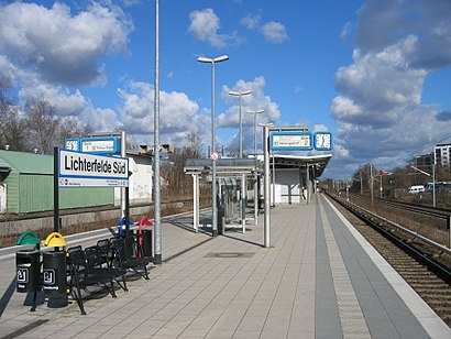
Directions to Bahnhof Lichterfelde Süd with public transportation
The following transit lines have routes that pass near Bahnhof Lichterfelde Süd
How to get to Bahnhof Lichterfelde Süd by bus?
Click on the bus route to see step by step directions with maps, line arrival times and updated time schedules.
How to get to Bahnhof Lichterfelde Süd by train?
Click on the train route to see step by step directions with maps, line arrival times and updated time schedules.
Train stations near Bahnhof Lichterfelde Süd
- Lichterfelde Süd, 3 min walk,
What are the closest stations to Bahnhof Lichterfelde Süd?
The closest stations to Bahnhof Lichterfelde Süd are:
- Lichterfelde Süd is 202 meters away, 3 min walk.
Which train line stops near Bahnhof Lichterfelde Süd?
RE4
Which bus lines stop near Bahnhof Lichterfelde Süd?
These bus lines stop near Bahnhof Lichterfelde Süd: 170, 186, M85.
What’s the nearest train station to Bahnhof Lichterfelde Süd?
The nearest train station to Bahnhof Lichterfelde Süd is Lichterfelde Süd. It’s a 3 min walk away.
See Bahnhof Lichterfelde Süd on the map
Public Transportation to Bahnhof Lichterfelde Süd
Wondering how to get to Bahnhof Lichterfelde Süd, Germany? Moovit helps you find the best way to get to Bahnhof Lichterfelde Süd with step-by-step directions from the nearest public transit station.
Moovit provides free maps and live directions to help you navigate through your city. View schedules, routes, timetables, and find out how long does it take to get to Bahnhof Lichterfelde Süd in real time.
Looking for the nearest stop or station to Bahnhof Lichterfelde Süd? Check out this list of stops closest to your destination: Lichterfelde Süd.
Train: RE4, S25, S26.Bus: 170, 186, M85.
Want to see if there’s another route that gets you there at an earlier time? Moovit helps you find alternative routes or times. Get directions from and directions to Bahnhof Lichterfelde Süd easily from the Moovit App or Website.
We make riding to Bahnhof Lichterfelde Süd easy, which is why over 1.5 million users, including users in Lichterfelde, trust Moovit as the best app for public transit. You don’t need to download an individual bus app or train app, Moovit is your all-in-one transit app that helps you find the best bus time or train time available.
For information on prices of bus and train, costs and ride fares to Bahnhof Lichterfelde Süd, please check the Moovit app.
Use the app to navigate to popular places including to the airport, hospital, stadium, grocery store, mall, coffee shop, school, college, and university.
Bahnhof Lichterfelde Süd Address: Fürstenstraße street in Lichterfelde
Attractions near Bahnhof Lichterfelde Süd
S-Bahn-Lichterfelde Süd,S-Bahn-Lichterfelde Süd (Berlin-Lichterfelde Süd),S Lichterfelde Süd,S Lichterfelde Süd,S Lichterfelde Süd,Keysans,S Lichterfelde Süd,Kiosk,Hobre Immobilien Gmbh,Kinder-evangelisations- Bewegung Deutschland E. V.,Lichterfelde Süd,Kita Holtheimer,Abreder Autovermietung E. K.,Reckewerth,S Lichterfelde Süd,S Lichterfelde Süd,Holtheimer westfalen,Feldstraße 22,Helga Schmidt,Kleingartenanlage FürstenstraßeHow to get to popular attractions in Lichterfelde with public transit
Humboldt-Klinikum, Borsigwalde,Joachimsthaler Straße 31-32, Berlin Mitte,Reichpietschufer 86-90, Tiergarten,TITANIC Comfort Hotel Berlin - Mitte, Berlin Mitte,Schlachtensee, Nikolassee,Haupteingang Tor 9 Tempelhofer Damm, Tempelhof,Brandenburgische Straße 2, Wilmersdorf,Britzer Garten, Britz,Berlin-Köpenick, Köpenick,Olympiastadion, Westend,Tempelhofer Feld, Tempelhof,Liepnitzsee, Barnim,Seminaris Seehotel Potsdam, Potsdam,Bahnhof Berlin Südkreuz, Schöneberg,U Schlesisches Tor , Kreuzberg,Berlinische Galerie, Kreuzberg,Hampton by Hilton Berlin City East Side Gallery, Friedrichshain,Südwestkirchhof Stahnsdorf, Stahnsdorf,Kaiser-Wilhelm-Gedächtniskirche, Charlottenburg,Itb Berlin, WestendGet around Berlin - Brandenburg by public transit!
Traveling around Berlin - Brandenburg has never been so easy. See step by step directions as you travel to any attraction, street or major public transit station. View bus and train schedules, arrival times, service alerts and detailed routes on a map, so you know exactly how to get to anywhere in Berlin - Brandenburg.
When traveling to any destination around Berlin - Brandenburg use Moovit's Live Directions with Get Off Notifications to know exactly where and how far to walk, how long to wait for your line, and how many stops are left. Moovit will alert you when it's time to get off — no need to constantly re-check whether yours is the next stop.
Wondering how to use public transit in Berlin - Brandenburg or how to pay for public transit in Berlin - Brandenburg? Moovit public transit app can help you navigate your way with public transit easily, and at minimum cost. It includes public transit fees, ticket prices, and costs. Looking for a map of Berlin - Brandenburg public transit lines? Moovit public transit app shows all public transit maps in Berlin - Brandenburg with all Bus, Train, Subway, Light Rail and Ferry routes and stops on an interactive map.
Berlin - Brandenburg has 5 transit type(s), including: Bus, Train, Subway, Light Rail and Ferry, operated by several transit agencies, including BVG, VBB, S-Bahn, Cottbusverkehr, Schöneicher Rüdersdorfer Straßenbahn, Strausberger Eisenbahn GmbH, Stadtverkehrsgesellschaft Tram, Verkehrsbetriebe Brandenburg, Verkehrsverbund Potsdam, DB Regio Bus, Barnimer Busgesellschaft, Busverkehr Oder-Spree GmbH, A. Reich, ANG, Busverkehr Gerd Schmidt