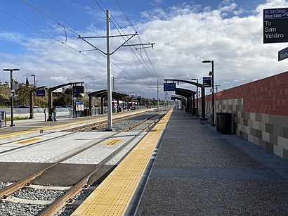
Balboa Avenue Transit Center stop - Saturday schedule
| Line | Direction | Time |
|---|---|---|
| 43 | Kearny Mesa | 5:58 AM |
| 43 | Kearny Mesa | 6:28 AM |
| 43 | Kearny Mesa | 6:58 AM |
| 43 | Balboa Ave Transit Center | 7:00 AM |
| 43 | Kearny Mesa | 7:28 AM |
| 43 | Balboa Ave Transit Center | 7:31 AM |
| 43 | Kearny Mesa | 7:58 AM |
| 43 | Balboa Ave Transit Center | 8:01 AM |
| 43 | Kearny Mesa | 8:28 AM |
| 43 | Balboa Ave Transit Center | 8:31 AM |
| 43 | Kearny Mesa | 8:58 AM |
| 43 | Balboa Ave Transit Center | 9:01 AM |
| 43 | Kearny Mesa | 9:28 AM |
| 43 | Balboa Ave Transit Center | 9:31 AM |
| 43 | Kearny Mesa | 9:58 AM |
| 43 | Balboa Ave Transit Center | 10:01 AM |
| 43 | Kearny Mesa | 10:28 AM |
| 43 | Balboa Ave Transit Center | 10:31 AM |
| 43 | Kearny Mesa | 10:58 AM |
| 43 | Balboa Ave Transit Center | 11:07 AM |
| 43 | Kearny Mesa | 11:28 AM |
| 43 | Balboa Ave Transit Center | 11:37 AM |
| 43 | Kearny Mesa | 11:58 AM |
| 43 | Balboa Ave Transit Center | 12:07 PM |
| 43 | Kearny Mesa | 12:28 PM |
See Balboa Avenue Transit Center, San Diego, on the map
Directions to Balboa Avenue Transit Center (San Diego) with public transportation
The following transit lines have routes that pass near Balboa Avenue Transit Center
 Bus:
Bus: - Cable Car:
How to get to Balboa Avenue Transit Center by bus?
Click on the bus route to see step by step directions with maps, line arrival times and updated time schedules.
Bus stations near Balboa Avenue Transit Center in San Diego
- Balboa Avenue Transit Center,1 min walk,
- Balboa Av & Moraga Av,8 min walk,
- Grand Av & Mission Bay Dr,16 min walk,
Cable Car stations near Balboa Avenue Transit Center in San Diego
- Balboa Avenue Station,20 min walk,
Bus lines to Balboa Avenue Transit Center in San Diego
- 8,Balboa Ave Transit Center,
- 27,Balboa Ave Transit Center,
- 43,Kearny Mesa,
- 30,Pacific Beach,
What are the closest stations to Balboa Avenue Transit Center?
The closest stations to Balboa Avenue Transit Center are:
- Balboa Avenue Transit Center is 25 yards away, 1 min walk.
- Balboa Av & Moraga Av is 659 yards away, 8 min walk.
- Grand Av & Mission Bay Dr is 1340 yards away, 16 min walk.
- Balboa Avenue Station is 1668 yards away, 20 min walk.
Which bus lines stop near Balboa Avenue Transit Center?
These bus lines stop near Balboa Avenue Transit Center: 27, 43, 8.
Which cable car line stops near Balboa Avenue Transit Center?
BLUE
What’s the nearest bus stop to Balboa Avenue Transit Center in San Diego?
The nearest bus stop to Balboa Avenue Transit Center in San Diego is Balboa Avenue Transit Center. It’s a 1 min walk away.
What’s the nearest cable car station to Balboa Avenue Transit Center in San Diego?
The nearest cable car station to Balboa Avenue Transit Center in San Diego is Balboa Avenue Station. It’s a 20 min walk away.
What time is the first bus to Balboa Avenue Transit Center in San Diego?
The 43 is the first bus that goes to Balboa Avenue Transit Center in San Diego. It stops nearby at 4:57 AM.
What time is the last bus to Balboa Avenue Transit Center in San Diego?
The 30 is the last bus that goes to Balboa Avenue Transit Center in San Diego. It stops nearby at 12:30 AM.
What time is the first cable car to Balboa Avenue Transit Center in San Diego?
The BLUE is the first cable car that goes to Balboa Avenue Transit Center in San Diego. It stops nearby at 4:49 AM.
What time is the last cable car to Balboa Avenue Transit Center in San Diego?
The BLUE is the last cable car that goes to Balboa Avenue Transit Center in San Diego. It stops nearby at 12:36 AM.
See Balboa Avenue Transit Center, San Diego, on the map
Public transit to Balboa Avenue Transit Center stop (ID: 89002) in San Diego
Looking for directions to Balboa Avenue Transit Center in San Diego, United States?
Download the Moovit App to find the current schedule and step-by-step directions for Bus, Cable Car or Train routes that pass through Balboa Avenue Transit Center.
Looking for the nearest stops closest to Balboa Avenue Transit Center ? Check out this list of closest stops to your destination: Balboa Avenue Transit Center; Balboa Av & Moraga Av; Grand Av & Mission Bay Dr; Balboa Avenue Station.
Bus:Cable Car:
We make riding on public transit to Balboa Avenue Transit Center easy, which is why over 1.5 million users, including users in San Diego trust Moovit as the best app for public transit.
Use the app to navigate to popular places including to the airport, hospital, stadium, grocery store, mall, coffee shop, school, college, and university.
Balboa Avenue Transit Center stop’s code is 89002
The first line to this stop is 43, at 5:58 AM, and the last line is 43 at 10:26 PM.
This stop serves MTS-Bus’s lines
Popular routes from Balboa Avenue Transit Center, San Diego
Bus stops near Balboa Avenue Transit Center
Balboa Avenue Transit Center,Balboa Av & Moraga Av,Grand Av & Mission Bay DrCable Car station near Balboa Avenue Transit Center
Balboa Avenue StationPopular public transit stations in San Diego
Sr-905 & Caliente Av,East Palomar St & La Media Rd,Hwy 78 & San Pasqual Rd,40th St & University Av,H St & 4th Av,Santa Fe Depot,Eastlake Pkwy & Eastlake Village Center,30th St & Redwood St,Bancroft Dr & 2300,Sweetwater Rd & Plaza Bonita Rd,N Santa Fe Av & Mesa Dr,2nd St & Pepper Dr,Aero Dr & Sandrock Rd,Broadway & E St,Utc Transit Center,Morena/Linda Vista Station,Pomerado Rd & Holland Rd,Genesee Av & Osler St,Vista Way & 3330 (Auto Club),Bonita Rd & Plaza Bonita RdGet around San Diego by public transit!
Traveling around San Diego has never been so easy. See step by step directions as you travel to any attraction, street or major public transit station. View bus and train schedules, arrival times, service alerts and detailed routes on a map, so you know exactly how to get to anywhere in San Diego.
When traveling to any destination around San Diego use Moovit's Live Directions with Get Off Notifications to know exactly where and how far to walk, how long to wait for your line, and how many stops are left. Moovit will alert you when it's time to get off — no need to constantly re-check whether yours is the next stop.
Wondering how to use public transit in San Diego or how to pay for public transit in San Diego? Moovit public transit app can help you navigate your way with public transit easily, and at minimum cost. It includes public transit fees, ticket prices, and costs. Looking for a map of San Diego public transit lines? Moovit public transit app shows all public transit maps in San Diego with all bus, cable car or train routes and stops on an interactive map.
San Diego has 3 transit type(s), including: bus, cable car or train, operated by several transit agencies, including MTS-Cable, North County Transit District-Tram, North County Transit District-Rail, MTS-Bus, MTS-Ferry, North County Transit District-Bus, San Diego International Airport, Amtrak, FlixBus-us and Greyhound-us