Directions to Baltimore Grand with public transportation
The following transit lines have routes that pass near Baltimore Grand
How to get to Baltimore Grand by bus?
Click on the bus route to see step by step directions with maps, line arrival times and updated time schedules.
How to get to Baltimore Grand by train?
Click on the train route to see step by step directions with maps, line arrival times and updated time schedules.
How to get to Baltimore Grand by metro?
Click on the metro route to see step by step directions with maps, line arrival times and updated time schedules.
Bus stations near Baltimore Grand
- Fayette St & Howard St,3 min walk,
- Univ. Of Md Medical Center On-Street Stop,5 min walk,
- Charles St & Fayette St,8 min walk,
- Pine Street,8 min walk,
- Baltimore St & Charles St Eb,8 min walk,
- Cathedral St & Saratoga St Sb,9 min walk,
- Saint Paul St & Fayette St FS Sb,9 min walk,
- Lombard St & Light St,13 min walk,
- Charles St & Conway St,17 min walk,
Light Rail stations near Baltimore Grand
- Pratt Street / Convention Center,9 min walk,
Bus lines to Baltimore Grand
- CITYLINK ORANGE,Essex,
- CITYLINK PURPLE,Paradise,
- CITYLINK RED,Towson Town Center,
- 71,Patapsco Station,
- 78,Downtown,
- 105,Cedonia,
- 150,Downtown/Harbor East,
- 702,Mount Vernon- Students Only,
- 69,Patapsco Station - Jumpers Hole,
- 70,Patapsco Station - Annapolis,
- 75,Patapsco Station - Arundel Mills,
- CITYLINK GREEN,Downtown,
- CITYLINK SILVER,Medfield,
- 51,Towson Town Center,
- 95,Roland Park,
- 103,Cromwell Bridge Park & Ride,
- 410,410/4 Centreville - Bel Air,
- 411,411/4 Hickory Park & Ride,
- 420,420/2 Johns Hopkins,
- PURPLE ROUTE,29th St. (Sb),
What are the closest stations to Baltimore Grand?
The closest stations to Baltimore Grand are:
- Fayette St & Howard St is 168 yards away, 3 min walk.
- Univ. Of Md Medical Center On-Street Stop is 371 yards away, 5 min walk.
- Charles St & Fayette St is 572 yards away, 8 min walk.
- Pine Street is 615 yards away, 8 min walk.
- Baltimore St & Charles St Eb is 619 yards away, 8 min walk.
- Pratt Street / Convention Center is 630 yards away, 9 min walk.
- Cathedral St & Saratoga St Sb is 676 yards away, 9 min walk.
- Saint Paul St & Fayette St FS Sb is 711 yards away, 9 min walk.
- Lombard St & Light St is 1021 yards away, 13 min walk.
- Charles St & Conway St is 1324 yards away, 17 min walk.
Which bus lines stop near Baltimore Grand?
These bus lines stop near Baltimore Grand: 51, 702, 73, 94, CITYLINK GREEN, CITYLINK PURPLE, CITYLINK RED, CITYLINK YELLOW.
Which train lines stop near Baltimore Grand?
These train lines stop near Baltimore Grand: ACELA EXPRESS, MARC.
Which metro line stops near Baltimore Grand?
METRO
Which light rail line stops near Baltimore Grand?
LIGHT RAIL
What’s the nearest light rail station to Baltimore Grand?
The nearest light rail station to Baltimore Grand is Pratt Street / Convention Center. It’s a 9 min walk away.
What’s the nearest bus stop to Baltimore Grand?
The nearest bus stop to Baltimore Grand is Fayette St & Howard St. It’s a 3 min walk away.
See Baltimore Grand on the map
Public Transportation to Baltimore Grand
Wondering how to get to Baltimore Grand, United States? Moovit helps you find the best way to get to Baltimore Grand with step-by-step directions from the nearest public transit station.
Moovit provides free maps and live directions to help you navigate through your city. View schedules, routes, timetables, and find out how long does it take to get to Baltimore Grand in real time.
Looking for the nearest stop or station to Baltimore Grand? Check out this list of stops closest to your destination: Fayette St & Howard St; Univ. Of Md Medical Center On-Street Stop; Charles St & Fayette St; Pine Street; Baltimore St & Charles St Eb; Pratt Street / Convention Center; Cathedral St & Saratoga St Sb; Saint Paul St & Fayette St FS Sb; Lombard St & Light St; Charles St & Conway St.
Bus:517027394CITYLINK GREENCITYLINK PURPLECITYLINK REDCITYLINK YELLOWCITYLINK ORANGE7178697075CITYLINK SILVER951037037044056120160210320Train:ACELA EXPRESSMARCMetro:METROLight Rail:LIGHT RAIL
Want to see if there’s another route that gets you there at an earlier time? Moovit helps you find alternative routes or times. Get directions from and directions to Baltimore Grand easily from the Moovit App or Website.
We make riding to Baltimore Grand easy, which is why over 1.5 million users, including users in Baltimore, trust Moovit as the best app for public transit. You don’t need to download an individual bus app or train app, Moovit is your all-in-one transit app that helps you find the best bus time or train time available.
For information on prices of bus, train, light rail and metro, costs and ride fares to Baltimore Grand, please check the Moovit app.
Use the app to navigate to popular places including to the airport, hospital, stadium, grocery store, mall, coffee shop, school, college, and university.
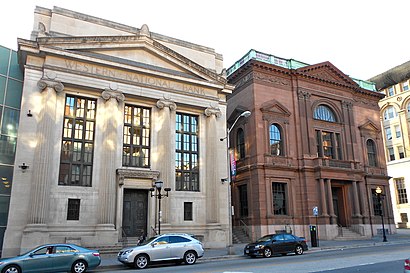
Baltimore Grand Address: 401 W Fayette St street in Baltimore
Attractions near Baltimore Grand
Fayette St & Eutaw,Eutaw and Faye St,Fayette & Eutaw St,The Hippodrome Theatre at the France-Merrick Performing Arts Center,The Hippodrome Theatre at the France-Merrick Performing Arts Center,France-Merrick Performing Arts,Um PTS / Grand,Chargepoint,400,W Fairmount Ave W Fairmount Ave,Lexus Lounge @ The Hippodrome,Eutaw Marion St,N Eutaw St Marion St,Eutaw Mar,Shen Yun,TMG Hippodrome,The Hipp Cafe @ The Hippodrome,The Everyman Theatre,SECU,Secu,Maiwand GrillHow to get to popular attractions in Baltimore with public transit
Hank's Oyster Bar, Washington,Greater Baltimore Medical Center, Baltimore County,Bloomingdale, Washington DC, Washington,Dogfish Head Alehouse, Fairfax County,Murphy's Grand Irish Pub, Alexandria,Looney's Pub, Baltimore,Starbucks, Washington,Target, Baltimore County,White Flint Metro Station, Montgomery County,The Washington Post, Washington,Merritt Downtown Athletic Club, Baltimore,Iron Horse Tap Room, Washington,Columbia, MD, Howard County,Spider Kelly's, Arlington County,Capital One Arena, Washington,Wegmans, Prince William County,Patterson Park, Baltimore,Nordstrom Tysons Corner Center, Fairfax County,The Willard InterContinental Washington D.C. Hotel, Washington,Tenleytown-AU Metro Station, WashingtonGet around Baltimore by public transit!
Traveling around Baltimore has never been so easy. See step by step directions as you travel to any attraction, street or major public transit station. View bus and train schedules, arrival times, service alerts and detailed routes on a map, so you know exactly how to get to anywhere in Baltimore.
When traveling to any destination around Baltimore use Moovit's Live Directions with Get Off Notifications to know exactly where and how far to walk, how long to wait for your line, and how many stops are left. Moovit will alert you when it's time to get off — no need to constantly re-check whether yours is the next stop.
Wondering how to use public transit in Baltimore or how to pay for public transit in Baltimore? Moovit public transit app can help you navigate your way with public transit easily, and at minimum cost. It includes public transit fees, ticket prices, and costs. Looking for a map of Baltimore public transit lines? Moovit public transit app shows all public transit maps in Baltimore with all bus, train, light rail or metro routes and stops on an interactive map.
Baltimore has 4 transit type(s), including: bus, train, light rail or metro, operated by several transit agencies, including WMATA, WMATA, Montgomery County Ride On, Fairfax Connector, TheBus, DC Circulator, MDOT MTA, Marc, MDOT MTA, MDOT MTA, Virginia Railway Express (VRE), PRTC, DASH - Alexandria, Arlington Transit (ART) and DC Streetcar