Directions to Baltimore Vehicle Processing with public transportation
The following transit lines have routes that pass near Baltimore Vehicle Processing
 Bus: 26, 71, 73, CHERRY ROUTE, 70.
- Light Rail: LIGHT RAILLINK.
How to get to Baltimore Vehicle Processing by bus?
Click on the bus route to see step by step directions with maps, line arrival times and updated time schedules.
From Baltimore Poly Tech High School
64 minFrom Bwi2 Employee Shuttles
53 minFrom MVA Glen Burnie
33 minFrom Mondawmin Mall
43 minFrom Loyola University Maryland
69 minFrom Johns Hopkins University
61 minFrom Glen Burnie, MD
48 minFrom Eastern Ave (eastern avenue and dundalk av)
62 minFrom Morgan State University
76 minFrom Western High School
75 min
Bus stops near Baltimore Vehicle Processing
Light Rail stations near Baltimore Vehicle Processing
- Baltimore Highlands, 8 min walk,VIEW
Bus lines to Baltimore Vehicle Processing
What are the closest stations to Baltimore Vehicle Processing?
The closest stations to Baltimore Vehicle Processing are:
- 1400 Cherry Hill Rd is 389 yards away, 5 min walk.
- Waterview Ave & Erick St FS Wb is 566 yards away, 7 min walk.
- Cherrydale Apartments (Wb) is 580 yards away, 7 min walk.
- Baltimore Highlands is 597 yards away, 8 min walk.
- Waterview Ave & Sidney Ave FS Wb is 910 yards away, 11 min walk.
Which bus lines stop near Baltimore Vehicle Processing?
These bus lines stop near Baltimore Vehicle Processing: 26, 71, 73, CHERRY ROUTE.
Which light rail line stops near Baltimore Vehicle Processing?
LIGHT RAILLINK (Northbound)
What’s the nearest light rail station to Baltimore Vehicle Processing?
The nearest light rail station to Baltimore Vehicle Processing is Baltimore Highlands. It’s a 8 min walk away.
What’s the nearest bus station to Baltimore Vehicle Processing?
The nearest bus station to Baltimore Vehicle Processing is 1400 Cherry Hill Rd. It’s a 5 min walk away.
What time is the first light rail to Baltimore Vehicle Processing?
The LIGHT RAILLINK is the first light rail that goes to Baltimore Vehicle Processing. It stops nearby at 4:20 AM.
What time is the last light rail to Baltimore Vehicle Processing?
The LIGHT RAILLINK is the last light rail that goes to Baltimore Vehicle Processing. It stops nearby at 1:04 AM.
What time is the first bus to Baltimore Vehicle Processing?
The 26 is the first bus that goes to Baltimore Vehicle Processing. It stops nearby at 4:13 AM.
What time is the last bus to Baltimore Vehicle Processing?
The 69 is the last bus that goes to Baltimore Vehicle Processing. It stops nearby at 2:20 AM.
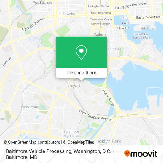
See Baltimore Vehicle Processing on the map
Public Transportation to Baltimore Vehicle Processing
Wondering how to get to Baltimore Vehicle Processing? Moovit helps you find the best way to get to Baltimore Vehicle Processing with step-by-step directions from the nearest public transit station.
Moovit provides free maps and live directions to help you navigate through your city. View schedules, routes, timetables, and find out how long does it take to get to Baltimore Vehicle Processing in real time.
Looking for the nearest stop or station to Baltimore Vehicle Processing? Check out this list of stops closest to your destination: 1400 Cherry Hill Rd; Waterview Ave & Erick St FS Wb; Cherrydale Apartments (Wb); Baltimore Highlands; Waterview Ave & Sidney Ave FS Wb.
Bus: 26, 71, 73, CHERRY ROUTE, 70, 69.Light Rail: LIGHT RAILLINK.
Want to see if there’s another route that gets you there at an earlier time? Moovit helps you find alternative routes or times. Get directions from and directions to Baltimore Vehicle Processing easily from the Moovit App or Website.
We make riding to Baltimore Vehicle Processing easy, which is why over 1.7 million users, including users in Baltimore, trust Moovit as the best app for public transit. You don’t need to download an individual bus app or train app, Moovit is your all-in-one transit app that helps you find the best bus time or train time available.
For information on prices of bus and light rail, costs and ride fares to Baltimore Vehicle Processing, please check the Moovit app.
Use the app to navigate to popular places including to the airport, hospital, stadium, grocery store, mall, coffee shop, school, college, and university.
Baltimore Vehicle Processing Address: 2940 Waterview Ave street in Baltimore
- The Baltimore VPC,
- Cherry Hill, Maryland,
- B-W Pkwy (MD 295) - Annapolis Rd (MD 648) Exit,
- Patapsco Flea Market,
- El Pueblito Restaurant & Bar,
- T-Mobile,
- Maisel Ct Building 2424,
- La Esperanza Cafe,
- Baltimore Link Bus 75 - Arundel Mills,
- Medstar Harbor Hospital,
- Parexel International Corporation,
- Patapsco,
- S Hanover and E Cromwell St,
- Nick's Fish House,
- social services,
- Patapsco Light Rail Station,
- Cherry Hill Light Rail Station,
- Baltimore Downtown,
- Baltimore Greyhound Station,
- Harbor Hospital
Places Near Baltimore Vehicle Processing
- Washington DC VA Medical Center, Washington,
- Washington National Cathedral, Washington,
- PG Mall, Prince George's County,
- Marriott Marquis Washington, DC, Washington,
- Georgetown, Washington,
- The Anthem, Washington,
- National Theatre, Washington,
- M&T Bank Stadium, Baltimore,
- Camden Yards, Baltimore,
- Westfield Montgomery Mall, Montgomery County,
- Rock Creek Tennis Center, Washington,
- Basilica of the National Shrine, Washington,
- Pennsylvania Ave NW (3rd st and pennsylvania), Washington,
- National Zoo, Washington,
- National Museum of African American History and Culture, Washington,
- Capital One Arena, Washington,
- Museum Of The Bible, Washington,
- Sibley Memorial Hospital, Washington,
- Amazon Hq2, Arlington County,
- Warner Theatre, Washington
How to get to popular places in Washington, D.C. - Baltimore, MD with public transit
Get around Baltimore by public transit!
Traveling around Baltimore has never been so easy. See step by step directions as you travel to any attraction, street or major public transit station. View bus and train schedules, arrival times, service alerts and detailed routes on a map, so you know exactly how to get to anywhere in Baltimore.
When traveling to any destination around Baltimore use Moovit's Live Directions with Get Off Notifications to know exactly where and how far to walk, how long to wait for your line, and how many stops are left. Moovit will alert you when it's time to get off — no need to constantly re-check whether yours is the next stop.
Wondering how to use public transit in Baltimore or how to pay for public transit in Baltimore? Moovit public transit app can help you navigate your way with public transit easily, and at minimum cost. It includes public transit fees, ticket prices, and costs. Looking for a map of Baltimore public transit lines? Moovit public transit app shows all public transit maps in Baltimore with all Bus, Train, Metro, Light Rail and Ferry routes and stops on an interactive map.
Washington, D.C. - Baltimore, MD has 5 transit type(s), including: Bus, Train, Metro, Light Rail and Ferry, operated by several transit agencies, including WMATA, Montgomery County Ride On, Fairfax Connector, TheBus, PRTC, DASH - Alexandria, Arlington Transit (ART), RTA of Central Maryland, MDOT MTA, MDOT MTA Light RailLink, MDOT MTA Commuter Bus, MDOT MTA Local Bus, FXBGO!, Virginia Railway Express (VRE) and MARC