How to get to Banco Santander by bus?
Click on the bus route to see step by step directions with maps, line arrival times and updated time schedules.
From World Emblem of Mexico SA de CV, Aguascalientes
45 minFrom EATON, Aguascalientes
48 minFrom Terminal de Autobuses Turipaquetes, Aguascalientes
29 minFrom Jesús Rivera Franco C-18E 409, Aguascalientes
43 minFrom Canchas de futbol Cruz Azul, Aguascalientes
64 minFrom Universidad Tecnológica De Aguascalientes, Aguascalientes
64 minFrom La Cantera, Aguascalientes
65 minFrom Unitec, Aguascalientes
63 minFrom Chedraui, Aguascalientes
40 minFrom Fraccionamiento Villa Taurina, Aguascalientes
52 min
Bus stops near Banco Santander in Aguascalientes
Bus lines to Banco Santander in Aguascalientes
- RUTA 04, Mahatma Gandhi - Jesús María,VIEW
- RUTA 11, Mahatma Gandhi,VIEW
- RUTA 33, Jesús María,VIEW
- RUTA 38, Paso Blanco,VIEW
- RUTA 18, Uaa,VIEW
- RUTA 35, Uaa,VIEW
- RUTA 45, Valle De Los Cactus - Uaa,VIEW
- RUTA 30, Martínez Dóminguez,VIEW
- RUTA 40, Terminal Oriente - Terminal Oriente (N),VIEW
- RUTA 40, Terminal Oriente - Terminal Oriente (S),VIEW
What are the closest stations to Banco Santander?
The closest stations to Banco Santander are:
- Licenciado Miguel De La Madrid Hurtado, 217 is 274 meters away, 4 min walk.
- Boulevard Luis Donaldo Colosio Murrieta, 318 is 364 meters away, 5 min walk.
- Avenida Aguascalientes Norte, 108 is 1152 meters away, 15 min walk.
- Uaa Sala De Juicios Orales is 1300 meters away, 17 min walk.
Which bus lines stop near Banco Santander?
These bus lines stop near Banco Santander: RUTA 04, RUTA 11, RUTA 33, RUTA 35.
What’s the nearest bus station to Banco Santander in Aguascalientes?
The nearest bus station to Banco Santander in Aguascalientes is Licenciado Miguel De La Madrid Hurtado, 217. It’s a 4 min walk away.
What time is the first bus to Banco Santander in Aguascalientes?
The RUTA 40 is the first bus that goes to Banco Santander in Aguascalientes. It stops nearby at 6:06 AM.
What time is the last bus to Banco Santander in Aguascalientes?
The RUTA 45 is the last bus that goes to Banco Santander in Aguascalientes. It stops nearby at 10:07 PM.
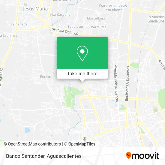
See Banco Santander, Aguascalientes, on the map
Public Transit to Banco Santander in Aguascalientes
Wondering how to get to Banco Santander in Aguascalientes? Moovit helps you find the best way to get to Banco Santander with step-by-step directions from the nearest public transit station.
Moovit provides free maps and live directions to help you navigate through your city. View schedules, routes, timetables, and find out how long does it take to get to Banco Santander in real time.
Looking for the nearest stop or station to Banco Santander? Check out this list of stops closest to your destination: Licenciado Miguel De La Madrid Hurtado; Boulevard Luis Donaldo Colosio Murrieta; Avenida Aguascalientes Norte; Uaa Sala De Juicios Orales.
Bus: RUTA 04, RUTA 11, RUTA 33, RUTA 35, RUTA 38, RUTA 18, RUTA 45, RUTA 30, RUTA 40, RUTA 40.
Want to see if there’s another route that gets you there at an earlier time? Moovit helps you find alternative routes or times. Get directions from and directions to Banco Santander easily from the Moovit App or Website.
We make riding to Banco Santander easy, which is why over 1.5 million users, including users in Aguascalientes, trust Moovit as the best app for public transit. You don’t need to download an individual bus app or train app, Moovit is your all-in-one transit app that helps you find the best bus time or train time available.
For information on prices of bus, costs and ride fares to Banco Santander, please check the Moovit app.
Use the app to navigate to popular places including to the airport, hospital, stadium, grocery store, mall, coffee shop, school, college, and university.
Banco Santander Address: Banco Santander, Avenida Universidad, Fracc Lomas del Campestre 1ra Secc, 20129 Aguascalientes, Agu street in Aguascalientes
- Santander,
- Dent Integradent,
- Superama México,
- San Jerónimo Laboratorio y Radiología,
- Dr. Walter Kettenhofen Enriquez,
- Walmart Express,
- Restaurante Ragazzi,
- WESTERN UNION,
- Superama,
- Diseño en Cristal y Aluminio,
- Diquinsa,
- La Casa del Pay,
- Hospital Animal Care Aguascalientes 24 / 7,
- Scotiabank Inverlat Vergeles,
- Ex Hacienda Pocitos,
- Dr. Alfredo Chew Wong.,
- Sastrería Kingsknight,
- Restaurante Bar Kimura,
- Instituto Nacional de música,
- Amazon Counter-F Ahorro Campestre
Places Near Banco Santander (Aguascalientes)
- Nuevo Hospital Hidalgo, Aguascalientes,
- Isla San Marcos, Aguascalientes,
- ESPACIOS, Aguascalientes,
- Terminal De Combis, Aguascalientes,
- Central De Autobuses, Aguascalientes,
- La Isla San Marcos, Aguascalientes,
- Villasuncion, Aguascalientes,
- Aeropuerto de Aguascalientes S.A. de C.V., Aguascalientes,
- Villas de Nuestra Señora de la Asunción, Aguascalientes,
- Ciudad industrial, Aguascalientes,
- Parque Las Tres Centurias, Aguascalientes,
- Agropecuario, Aguascalientes,
- Centro, Aguascalientes,
- Universidad Autónoma de Aguascalientes, Aguascalientes,
- Imss Clinica 1, Aguascalientes,
- Centro Comercial Altaria, Aguascalientes,
- clinica 3 uaa, Aguascalientes,
- Hospital Imss No. 3, Aguascalientes,
- Blvd. Luis Donaldo Colosio, Aguascalientes,
- Jesús María, Aguascalientes
How to get to popular places in Aguascalientes with public transit
Get around Aguascalientes by public transit!
Traveling around Aguascalientes has never been so easy. See step by step directions as you travel to any attraction, street or major public transit station. View bus and train schedules, arrival times, service alerts and detailed routes on a map, so you know exactly how to get to anywhere in Aguascalientes.
When traveling to any destination around Aguascalientes use Moovit's Live Directions with Get Off Notifications to know exactly where and how far to walk, how long to wait for your line, and how many stops are left. Moovit will alert you when it's time to get off — no need to constantly re-check whether yours is the next stop.
Wondering how to use public transit in Aguascalientes or how to pay for public transit in Aguascalientes? Moovit public transit app can help you navigate your way with public transit easily, and at minimum cost. It includes public transit fees, ticket prices, and costs. Looking for a map of Aguascalientes public transit lines? Moovit public transit app shows all public transit maps in Aguascalientes with all bus routes and stops on an interactive map.
Aguascalientes has 1 transit type(s), including: bus, operated by several transit agencies, including Coordinación General de Movilidad