How to get to Superama by bus?
Click on the bus route to see step by step directions with maps, line arrival times and updated time schedules.
From Fracc. Misión de Santa Lucía, Aguascalientes
53 minFrom El Papa, Aguascalientes
33 minFrom Cortijo San Marcos, Aguascalientes
74 minFrom Los Juarez, Aguascalientes
49 minFrom Calle Proceres de la Enseñanza, Aguascalientes
59 minFrom Universidad Tecnológica De Aguascalientes, Aguascalientes
64 minFrom Fraccionamiento Villa Taurina, Aguascalientes
53 minFrom Bosch, Aguascalientes
44 minFrom Sabropollo rastro, Aguascalientes
44 minFrom Hospital De La Mujer de Aguascalientes, Aguascalientes
49 min
Bus stops near Superama in Aguascalientes
Bus lines to Superama in Aguascalientes
- RUTA 04, Mahatma Gandhi - Jesús María,VIEW
- RUTA 11, Mahatma Gandhi,VIEW
- RUTA 33, Jesús María,VIEW
- RUTA 38, Paso Blanco,VIEW
- RUTA 18, Uaa,VIEW
- RUTA 30, Villa Montaña,VIEW
- RUTA 35, Uaa,VIEW
- RUTA 40, Terminal Oriente - Terminal Oriente (S),VIEW
- RUTA 45, Valle De Los Cactus - Uaa,VIEW
- RUTA 40, Terminal Oriente - Terminal Oriente (N),VIEW
What are the closest stations to Superama?
The closest stations to Superama are:
- Avenida Universidad, Lb is 192 meters away, 3 min walk.
- Uaa Sala De Juicios Orales is 273 meters away, 4 min walk.
- Unidad Medica Didáctica Uaa is 544 meters away, 8 min walk.
Which bus lines stop near Superama?
These bus lines stop near Superama: RUTA 04, RUTA 11, RUTA 18, RUTA 35, RUTA 45.
What’s the nearest bus station to Superama in Aguascalientes?
The nearest bus station to Superama in Aguascalientes is Avenida Universidad, Lb. It’s a 3 min walk away.
What time is the first bus to Superama in Aguascalientes?
The RUTA 40 is the first bus that goes to Superama in Aguascalientes. It stops nearby at 6:06 AM.
What time is the last bus to Superama in Aguascalientes?
The RUTA 45 is the last bus that goes to Superama in Aguascalientes. It stops nearby at 10:07 PM.
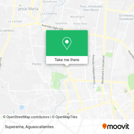
See Superama, Aguascalientes, on the map
Public Transit to Superama in Aguascalientes
Wondering how to get to Superama in Aguascalientes? Moovit helps you find the best way to get to Superama with step-by-step directions from the nearest public transit station.
Moovit provides free maps and live directions to help you navigate through your city. View schedules, routes, timetables, and find out how long does it take to get to Superama in real time.
Looking for the nearest stop or station to Superama? Check out this list of stops closest to your destination: Avenida Universidad; Uaa Sala De Juicios Orales; Unidad Medica Didáctica Uaa.
Bus: RUTA 04, RUTA 11, RUTA 18, RUTA 35, RUTA 45, RUTA 33, RUTA 38, RUTA 30, RUTA 40, RUTA 40.
Want to see if there’s another route that gets you there at an earlier time? Moovit helps you find alternative routes or times. Get directions from and directions to Superama easily from the Moovit App or Website.
We make riding to Superama easy, which is why over 1.5 million users, including users in Aguascalientes, trust Moovit as the best app for public transit. You don’t need to download an individual bus app or train app, Moovit is your all-in-one transit app that helps you find the best bus time or train time available.
For information on prices of bus, costs and ride fares to Superama, please check the Moovit app.
Use the app to navigate to popular places including to the airport, hospital, stadium, grocery store, mall, coffee shop, school, college, and university.
Superama Address: Licenciado Miguel de la Madrid Hurtado street in Aguascalientes
- Walmart Express,
- Scotiabank Inverlat Vergeles,
- Superama México,
- Amazon Counter-F Ahorro Campestre,
- Diseño en Cristal y Aluminio,
- Diquinsa,
- San Jerónimo Laboratorio y Radiología,
- Afirme,
- Banco Multiva,
- Santander,
- Restaurante Ragazzi,
- Dr. Walter Kettenhofen Enriquez,
- Banco Santander,
- Farmacia Guadalajara,
- Noudent Odontología Estética y Funcional,
- Restaurant Bar Museo Panteon Taurino,
- Dr Ricardo Choza Romero,
- Paku Paku,
- Dent Integradent,
- Biopath
Places Near Superama (Aguascalientes)
- Agropecuario, Aguascalientes,
- Isla San Marcos, Aguascalientes,
- Parque Las Tres Centurias, Aguascalientes,
- Centro Comercial Altaria, Aguascalientes,
- Jesús María, Aguascalientes,
- Imss Clinica 1, Aguascalientes,
- Ciudad industrial, Aguascalientes,
- Central De Autobuses, Aguascalientes,
- Villasuncion, Aguascalientes,
- ESPACIOS, Aguascalientes,
- Nuevo Hospital Hidalgo, Aguascalientes,
- Terminal De Combis, Aguascalientes,
- Universidad Autónoma de Aguascalientes, Aguascalientes,
- clinica 3 uaa, Aguascalientes,
- Centro, Aguascalientes,
- Villas de Nuestra Señora de la Asunción, Aguascalientes,
- Hospital Imss No. 3, Aguascalientes,
- Aeropuerto de Aguascalientes S.A. de C.V., Aguascalientes,
- La Isla San Marcos, Aguascalientes,
- Blvd. Luis Donaldo Colosio, Aguascalientes
How to get to popular places in Aguascalientes with public transit
Get around Aguascalientes by public transit!
Traveling around Aguascalientes has never been so easy. See step by step directions as you travel to any attraction, street or major public transit station. View bus and train schedules, arrival times, service alerts and detailed routes on a map, so you know exactly how to get to anywhere in Aguascalientes.
When traveling to any destination around Aguascalientes use Moovit's Live Directions with Get Off Notifications to know exactly where and how far to walk, how long to wait for your line, and how many stops are left. Moovit will alert you when it's time to get off — no need to constantly re-check whether yours is the next stop.
Wondering how to use public transit in Aguascalientes or how to pay for public transit in Aguascalientes? Moovit public transit app can help you navigate your way with public transit easily, and at minimum cost. It includes public transit fees, ticket prices, and costs. Looking for a map of Aguascalientes public transit lines? Moovit public transit app shows all public transit maps in Aguascalientes with all bus routes and stops on an interactive map.
Aguascalientes has 1 transit type(s), including: bus, operated by several transit agencies, including Coordinación General de Movilidad