Directions to Bangsar (Kuala Lumpur) with public transportation
The following transit lines have routes that pass near Bangsar
How to get to Bangsar by bus?
Click on the bus route to see step by step directions with maps, line arrival times and updated time schedules.
How to get to Bangsar by train?
Click on the train route to see step by step directions with maps, line arrival times and updated time schedules.
How to get to Bangsar by MRT & LRT?
Click on the MRT & LRT route to see step by step directions with maps, line arrival times and updated time schedules.
Bus stops near Bangsar in Kuala Lumpur
- Bangsar Telawi (Selatan), 2 min walk,
- Telawi Commercial Centre (Selatan), 4 min walk,
- Bangsar Baru (Timur), 7 min walk,
Bus lines to Bangsar in Kuala Lumpur
- 822, Uoa Bangsar ↺ Bangsar Park,
- T817, MRT Pusat Bandar Damansara ↺ Mid Valley,
- T850, Uoa Bangsar ↺ MRT Semantan,
What are the closest stations to Bangsar?
The closest stations to Bangsar are:
- Bangsar Telawi (Selatan) is 80 meters away, 2 min walk.
- Telawi Commercial Centre (Selatan) is 278 meters away, 4 min walk.
- Bangsar Baru (Timur) is 441 meters away, 7 min walk.
Which bus lines stop near Bangsar?
These bus lines stop near Bangsar: 780, 822.
Which train line stops near Bangsar?
2
Which MRT & LRT line stops near Bangsar?
5
What’s the nearest bus stop to Bangsar in Kuala Lumpur?
The nearest bus stop to Bangsar in Kuala Lumpur is Bangsar Telawi (Selatan). It’s a 2 min walk away.
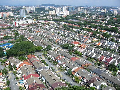
See Bangsar, Kuala Lumpur, on the map
Public Transit to Bangsar in Kuala Lumpur
Wondering how to get to Bangsar in Kuala Lumpur, Malaysia? Moovit helps you find the best way to get to Bangsar with step-by-step directions from the nearest public transit station.
Moovit provides free maps and live directions to help you navigate through your city. View schedules, routes, timetables, and find out how long does it take to get to Bangsar in real time.
Looking for the nearest stop or station to Bangsar? Check out this list of stops closest to your destination: Bangsar Telawi (Selatan); Telawi Commercial Centre (Selatan); Bangsar Baru (Timur).
Bus: 780, 822, T817, T850.Train: 2.MRT & LRT: 5.
Want to see if there’s another route that gets you there at an earlier time? Moovit helps you find alternative routes or times. Get directions from and directions to Bangsar easily from the Moovit App or Website.
We make riding to Bangsar easy, which is why over 1.5 million users, including users in Kuala Lumpur, trust Moovit as the best app for public transit. You don’t need to download an individual bus app or train app, Moovit is your all-in-one transit app that helps you find the best bus time or train time available.
For information on prices of bus, MRT & LRT and train, costs and ride fares to Bangsar, please check the Moovit app.
Use the app to navigate to popular places including to the airport, hospital, stadium, grocery store, mall, coffee shop, school, college, and university.
Bangsar Address: Jalan Telawi 4 street in Kuala Lumpur
Attractions near Bangsar
Berry's Bakery,Iyengar Yoga,Restoran Fu Yu,Bilique (Bar&Lounge),Hong Leong Bank Berhad,Pusat Latihan Yoga Swarupa Iyengar,RBL Banana Leaf,Swarupa Yoga,Blique,Raj's Banana Leaf,Shamrock Irish Bar And Restaurant,Syarikat Wongs Electric,Kedai Buku & Alat Tulis,Telawi Square Bangsar,Foodtique,Lonely Dream,Hong Kong Hot Pot,39-41,Lot 1,Hong Leong Bank Bangsar BaruHow to get to popular attractions in Kuala Lumpur with public transit
Tesco, Kuala Selangor,CUCMS Varsity Lodge, Sepang,Menara Usahawan, Sepang,Petronas, Shah Alam,Tune Hotel, Sepang,KTM Serdang Parking, Subang Jaya,Bandar Nusaputra Puchong, Sepang,Airod Aerospace Technology Sdn Bhd (AAe), Petaling Jaya,Domino's Pizza Bandar Baru Bangi, Hulu Langat,Restoran Original Penang Kayu Nasi Kandar, Petaling Jaya,友间茶餐室, Petaling Jaya,Warung Cikgu, Puchong,Uncle Jang Korean Restaurant, Kuala Lumpur,Masjid Jamek Sultan Ibrahim, Kuala Selangor,Bandar Puncak Alam, Kuala Selangor,Guthrie Corridor Expressway (GCE), Petaling Jaya,Perpustakaan Tun Abdul Razak, Kuala Selangor,Restoran Arafah, Petaling Jaya,Baskin Robbins, Klang,Burger King, KlangGet around Kuala Lumpur by public transit!
Traveling around Kuala Lumpur has never been so easy. See step by step directions as you travel to any attraction, street or major public transit station. View bus and train schedules, arrival times, service alerts and detailed routes on a map, so you know exactly how to get to anywhere in Kuala Lumpur.
When traveling to any destination around Kuala Lumpur use Moovit's Live Directions with Get Off Notifications to know exactly where and how far to walk, how long to wait for your line, and how many stops are left. Moovit will alert you when it's time to get off — no need to constantly re-check whether yours is the next stop.
Wondering how to use public transit in Kuala Lumpur or how to pay for public transit in Kuala Lumpur? Moovit public transit app can help you navigate your way with public transit easily, and at minimum cost. It includes public transit fees, ticket prices, and costs. Looking for a map of Kuala Lumpur public transit lines? Moovit public transit app shows all public transit maps in Kuala Lumpur with all Bus, Train, MRT & LRT, Monorail, Ferry and Cable Car routes and stops on an interactive map.
Kuala Lumpur has 6 transit type(s), including: Bus, Train, MRT & LRT, Monorail, Ferry and Cable Car, operated by several transit agencies, including rapidKL, rapidKL MRT, Express Rail Link - ERL, Keretapi Tanah Melayu - KTM, rapidKL BRT, rapidKL Bus, MRT Feeder Bus (Operated by RapidKL), GOKL City Bus, PJ City Bus (operated by rapidKL), Smart Selangor (operated by rapidKL), Smart Selangor, Nadiputra (Operated by RapidKL), Free Shuttle Service, Causeway Link (Handal Ceria Sdn Bhd), Universiti Malaya