See Barbizon 63, Manhattan, on the map
Directions to Barbizon 63 (Manhattan) with public transportation
The following transit lines have routes that pass near Barbizon 63
 Bus:
Bus: - Train:
- Subway:
- Cable Car:
How to get to Barbizon 63 by bus?
Click on the bus route to see step by step directions with maps, line arrival times and updated time schedules.
How to get to Barbizon 63 by train?
Click on the train route to see step by step directions with maps, line arrival times and updated time schedules.
How to get to Barbizon 63 by subway?
Click on the subway route to see step by step directions with maps, line arrival times and updated time schedules.
Bus stations near Barbizon 63 in Manhattan
- Lexington Av/E 64 St,1 min walk,
- Lexington Av/E 65 St,2 min walk,
- E 60 St/Lexington Av,4 min walk,
- 3rd Ave & 61st St,4 min walk,
- Lexington Ave & E 59th St,5 min walk,
- Madison Ave @ 63rd St,5 min walk,
- E 59 St/Lexington Av,5 min walk,
- Madison Av/E 63 St,5 min walk,
- Madison Av/E 62 St,5 min walk,
Subway stations near Barbizon 63 in Manhattan
- Lexington Av/59 St,4 min walk,
- Lexington Av/63 St,11 min walk,
Cable Car stations near Barbizon 63 in Manhattan
- Manhattan Tram Station,8 min walk,
Bus lines to Barbizon 63 in Manhattan
- M101,3 Av-96 St,
- M102,East Village 6 St Via Lex Av,
- M103,City Hall Via Lex Av,
- BXM1,Riverdale 263 St Via H Hudson Pkwy,
- Q32,Jackson Hts Northern-81 St Via Roosevelt,
- HAMPTON JITNEY MONTAUK,Amagansett,
- HAMPTON JITNEY NORTH FORK,Greenport-Manhattan,
- HAMPTON JITNEY WESTHAMPTON,Manhattan,
- SHORTLINE HUDSON,New York,
- BXM11,Wakefield 241 St Via Bronx Zoo Via White Plains Rd,
- 28,Express - White Plains,
- QM2,Bay Terrace Bell Bl Via Whitestone Exy Via Bayside,
- QM3,Little Neck L. Neck Pky Via Northern Blvd,
- QM20,Bay Terrace 211 St Via Willets Pt Bl Via Clearview,
- M2,Washington Hts Bway-168 St Via Madison,
- M3,125 St St. Nicholas Av,
- M4,Broadway-135 St,
- BXM3,Yonkers Getty Sq Via Sedgwick Av Via Broadway,
- BXM4,Woodlawn 242 St Via Concourse Via Katonah Av,
What are the closest stations to Barbizon 63?
The closest stations to Barbizon 63 are:
- Lexington Av/E 64 St is 69 yards away, 1 min walk.
- Lexington Av/E 65 St is 127 yards away, 2 min walk.
- E 60 St/Lexington Av is 254 yards away, 4 min walk.
- Lexington Av/59 St is 257 yards away, 4 min walk.
- 3rd Ave & 61st St is 324 yards away, 4 min walk.
- Lexington Ave & E 59th St is 330 yards away, 5 min walk.
- Madison Ave @ 63rd St is 352 yards away, 5 min walk.
- E 59 St/Lexington Av is 366 yards away, 5 min walk.
- Madison Av/E 63 St is 370 yards away, 5 min walk.
- Madison Av/E 62 St is 387 yards away, 5 min walk.
- Manhattan Tram Station is 620 yards away, 8 min walk.
- Lexington Av/63 St is 867 yards away, 11 min walk.
Which bus lines stop near Barbizon 63?
These bus lines stop near Barbizon 63: BM2, M102, M103, Q32.
Which train lines stop near Barbizon 63?
These train lines stop near Barbizon 63: FAR ROCKAWAY BRANCH, HARLEM, MEL, PATH, PORT WASHINGTON BRANCH, RONKONKOMA BRANCH.
Which subway lines stop near Barbizon 63?
These subway lines stop near Barbizon 63: 4, F, FX, Q.
What’s the nearest subway station to Barbizon 63 in Manhattan?
The nearest subway station to Barbizon 63 in Manhattan is Lexington Av/59 St. It’s a 4 min walk away.
What’s the nearest bus stop to Barbizon 63 in Manhattan?
The nearest bus stop to Barbizon 63 in Manhattan is Lexington Av/E 64 St. It’s a 1 min walk away.
What’s the nearest cable car station to Barbizon 63 in Manhattan?
The nearest cable car station to Barbizon 63 in Manhattan is Manhattan Tram Station. It’s a 8 min walk away.
What time is the first subway to Barbizon 63 in Manhattan?
The 6 is the first subway that goes to Barbizon 63 in Manhattan. It stops nearby at 3:01 AM.
What time is the last subway to Barbizon 63 in Manhattan?
The N is the last subway that goes to Barbizon 63 in Manhattan. It stops nearby at 4:06 AM.
What time is the first bus to Barbizon 63 in Manhattan?
The M101 is the first bus that goes to Barbizon 63 in Manhattan. It stops nearby at 3:00 AM.
What time is the last bus to Barbizon 63 in Manhattan?
The M103 is the last bus that goes to Barbizon 63 in Manhattan. It stops nearby at 3:10 AM.
What time is the first cable car to Barbizon 63 in Manhattan?
The ROOSEVELT ISLAND TRAM is the first cable car that goes to Barbizon 63 in Manhattan. It stops nearby at 5:52 AM.
What time is the last cable car to Barbizon 63 in Manhattan?
The ROOSEVELT ISLAND TRAM is the last cable car that goes to Barbizon 63 in Manhattan. It stops nearby at 2:10 AM.
How much is the subway fare to Barbizon 63?
The subway fare to Barbizon 63 costs about $2.90.
See Barbizon 63, Manhattan, on the map
Public Transit to Barbizon 63 in Manhattan
Wondering how to get to Barbizon 63 in Manhattan, United States? Moovit helps you find the best way to get to Barbizon 63 with step-by-step directions from the nearest public transit station.
Moovit provides free maps and live directions to help you navigate through your city. View schedules, routes, timetables, and find out how long does it take to get to Barbizon 63 in real time.
Looking for the nearest stop or station to Barbizon 63? Check out this list of stops closest to your destination: Lexington Av/E 64 St; Lexington Av/E 65 St; E 60 St/Lexington Av; Lexington Av/59 St; 3rd Ave & 61st St; Lexington Ave & E 59th St; Madison Ave @ 63rd St; E 59 St/Lexington Av; Madison Av/E 63 St; Madison Av/E 62 St; Manhattan Tram Station; Lexington Av/63 St.
Bus:Train:Subway:Cable Car:
Want to see if there’s another route that gets you there at an earlier time? Moovit helps you find alternative routes or times. Get directions from and directions to Barbizon 63 easily from the Moovit App or Website.
We make riding to Barbizon 63 easy, which is why over 1.5 million users, including users in Manhattan, trust Moovit as the best app for public transit. You don’t need to download an individual bus app or train app, Moovit is your all-in-one transit app that helps you find the best bus time or train time available.
For information on prices of subway, bus and train, costs and ride fares to Barbizon 63, please check the Moovit app.
Use the app to navigate to popular places including to the airport, hospital, stadium, grocery store, mall, coffee shop, school, college, and university.
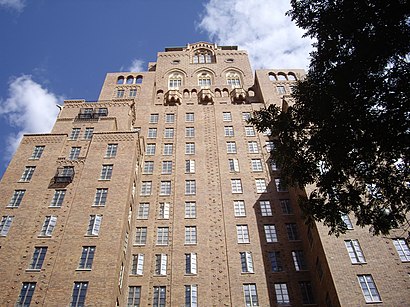
Barbizon 63 Address: 140 E 63rd St (at Lexington Ave.) street in Manhattan
Attractions near Barbizon 63
Lexington Av/63 St,Lexington Avenue 63rd Street Station,63rd & Lexington,Mta - Lexington Avenue - 63rd Street Station,A & A Discount ,Citi Bike - Lexington Avenue & East 62nd Street,160 East 64th Street,Lexington Ave 62nd St,64th 64th St / Lexington,Thomas Poole MD (Poole Thomas, MD),Armando Pina Hair Salon (Japanese Hair Straightening),65th & Lexington Avenue,Dm Salon (Dm Salon Lexington),Bulgarian Consulate General,Lexington Avenue–63rd Street,E 63rd St (east 63rd and 3rd),E 63rd St (63rd street and 3rd avenue),Ithaka Harbors,Central Presbyterian Church,Tony's Di NapoliHow to get to popular attractions in Manhattan with public transit
Smith Haven Mall, Lake Grove, Ny,Wingate by Wyndham Manhattan Midtown, Manhattan,Great Lawn, Manhattan,Norwalk, CT, Norwalk, Ct,Mission Dolores,LIRR - Huntington Station, Huntington Station, Ny,Grimaldi's Pizzeria,Rubirosa Ristorante, Manhattan,SoHo, Manhattan,The Stanton Social, Manhattan,The Grey Dog, Manhattan,MTA Subway - 30th Ave (N/W), Queens,Dinosaur Bar-B-Que, Manhattan,Freehold Raceway Mall, Freehold Township,MTA Subway - 42nd St / Bryant Park (B / D/F / M/7), Manhattan,Mad Dog & Beans Mexican Cantina, Manhattan,MTA Subway - Coney Island / Stillwell Ave (D / F/N / Q),Red Rooster, Manhattan,Gramercy Tavern, Manhattan,Caesars Atlantic City Hotel and Casino, Atlantic City, NjGet around Manhattan by public transit!
Traveling around Manhattan has never been so easy. See step by step directions as you travel to any attraction, street or major public transit station. View bus and train schedules, arrival times, service alerts and detailed routes on a map, so you know exactly how to get to anywhere in Manhattan.
When traveling to any destination around Manhattan use Moovit's Live Directions with Get Off Notifications to know exactly where and how far to walk, how long to wait for your line, and how many stops are left. Moovit will alert you when it's time to get off — no need to constantly re-check whether yours is the next stop.
Wondering how to use public transit in Manhattan or how to pay for public transit in Manhattan? Moovit public transit app can help you navigate your way with public transit easily, and at minimum cost. It includes public transit fees, ticket prices, and costs. Looking for a map of Manhattan public transit lines? Moovit public transit app shows all public transit maps in Manhattan with all subway, bus or train routes and stops on an interactive map.
Manhattan has 3 transit type(s), including: subway, bus or train, operated by several transit agencies, including MTA Subway, Metro-North Railroad, LIRR, PATH, Shore Line East, MTA Bus Company, MTA New York City Transit - Express routes, MTA Bus, NJ Transit, NYC Ferry, NICE bus, Bee-Line Bus, NJ Transit Rail, NJ Transit Rail and Norwalk Transit District