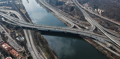
See Barrandovský most, Praha 4, on the map
Directions to Barrandovský most (Praha 4) with public transportation
The following transit lines have routes that pass near Barrandovský most
 Bus:
Bus: - Train:
- Subway:
- Light Rail:
How to get to Barrandovský most by bus?
Click on the bus route to see step by step directions with maps, line arrival times and updated time schedules.
How to get to Barrandovský most by train?
Click on the train route to see step by step directions with maps, line arrival times and updated time schedules.
How to get to Barrandovský most by subway?
Click on the subway route to see step by step directions with maps, line arrival times and updated time schedules.
Bus stations near Barrandovský most in Praha 4
- Přístaviště,7 min walk,
- Pobřežní Cesta,8 min walk,
- Hlubočepy,9 min walk,
- Serpentina,16 min walk,
Light Rail stations near Barrandovský most in Praha 4
- Přístaviště,8 min walk,
- Pobřežní Cesta,8 min walk,
- Hlubočepy,9 min walk,
Bus lines to Barrandovský most in Praha 4
- X17,Kublov - Kublov,
- X27,,
- X92,Pražského Povstání - Podolská Vodárna,
- 118,Smíchovské nádraží - Depo Kačerov - Sídliště Spořilov,
- 170,Pražská čtvrť - Jižní Město,
- 196,Smíchovské nádraží - Kačerov - Kloboučnická,
- 197,Smíchovské nádraží - Sídliště Písnice - Roztyly,
- 901,Anděl - Skalka,
- 190,Smíchovské Nádraží,
- 120,Na Knížecí,
- 128,Hlubočepy,
- 105,Filmové Ateliéry Barrandov,
What are the closest stations to Barrandovský most?
The closest stations to Barrandovský most are:
- Přístaviště is 509 meters away, 7 min walk.
- Pobřežní Cesta is 610 meters away, 8 min walk.
- Hlubočepy is 668 meters away, 9 min walk.
- Serpentina is 1241 meters away, 16 min walk.
Which bus lines stop near Barrandovský most?
These bus lines stop near Barrandovský most: 118, 120, 170, 191, 196, 197.
Which train line stops near Barrandovský most?
R26
Which subway line stops near Barrandovský most?
B
Which light rail lines stop near Barrandovský most?
These light rail lines stop near Barrandovský most: 17, 2.
What’s the nearest light rail station to Barrandovský most in Praha 4?
The nearest light rail stations to Barrandovský most in Praha 4 are Přístaviště and Pobřežní Cesta. The closest one is a 8 min walk away.
What’s the nearest bus stop to Barrandovský most in Praha 4?
The nearest bus stop to Barrandovský most in Praha 4 is Přístaviště. It’s a 7 min walk away.
What time is the first light rail to Barrandovský most in Praha 4?
The 94 is the first light rail that goes to Barrandovský most in Praha 4. It stops nearby at 3:03 AM.
What time is the last light rail to Barrandovský most in Praha 4?
The 92 is the last light rail that goes to Barrandovský most in Praha 4. It stops nearby at 3:43 AM.
What time is the first bus to Barrandovský most in Praha 4?
The 901 is the first bus that goes to Barrandovský most in Praha 4. It stops nearby at 3:21 AM.
What time is the last bus to Barrandovský most in Praha 4?
The 901 is the last bus that goes to Barrandovský most in Praha 4. It stops nearby at 3:22 AM.
See Barrandovský most, Praha 4, on the map
Public Transit to Barrandovský most in Praha 4
Wondering how to get to Barrandovský most in Praha 4, Czech Republic? Moovit helps you find the best way to get to Barrandovský most with step-by-step directions from the nearest public transit station.
Moovit provides free maps and live directions to help you navigate through your city. View schedules, routes, timetables, and find out how long does it take to get to Barrandovský most in real time.
Looking for the nearest stop or station to Barrandovský most? Check out this list of stops closest to your destination: Přístaviště; Pobřežní Cesta; Hlubočepy; Serpentina.
Bus:Train:Subway:Light Rail:
Want to see if there’s another route that gets you there at an earlier time? Moovit helps you find alternative routes or times. Get directions from and directions to Barrandovský most easily from the Moovit App or Website.
We make riding to Barrandovský most easy, which is why over 1.5 million users, including users in Praha 4, trust Moovit as the best app for public transit. You don’t need to download an individual bus app or train app, Moovit is your all-in-one transit app that helps you find the best bus time or train time available.
For information on prices of bus, subway, light rail, train and Trolleybus, costs and ride fares to Barrandovský most, please check the Moovit app.
Use the app to navigate to popular places including to the airport, hospital, stadium, grocery store, mall, coffee shop, school, college, and university.
Barrandovský most Address: Barrandovský most street in Praha 4
Attractions near Barrandovský most
Branicka Cukrarna,Tiptera s.r.o. - Kuželková Helena MUDr.,Tiptera,Husa Platnérská s.r.o.,tram 52,Parkoviště,Mgr. Milan Racek,Splanch,Epado,Přístaviště,Nataliya Dzyurak,Bytové Družstvo pod Dobeškou,Mai Thai Massage,Keramika Maříž,Cz30480 Dpdczs.R.O.,United Arts,Wedo Point / Wedo CZ,Moravska Vinoteka s.r.o.,Xum Aviation s,United DrinksHow to get to popular attractions in Praha 4 with public transit
Skleník Fata Morgana, Praha-Troja,Sportovní hala TJ JM Chodov, Praha 11,Restaurace Marjana, Praha - Západ,Brechtova (bus), Praha 11,Aula ČZU, Praha-Suchdol,Janovská, Horní Měcholupy, Praha 15,Hlubočepy, Praha 5,Hotel DAP, Praha 6,Blatiny (tram), Praha 17,Tupolevova (bus), Praha 18,Aquapark Děčín, Děčín,Bořislavka (tram), Praha 6,Modřanská škola (tram), Praha 12,Centrum Pivovar, Děčín,Panda, Praha 5,Ostrčilovo náměstí (tram), Praha 2,Disco Ballagio, Praha - Východ,Restaurace Dvan, Praha 12,Rezidence Topolova, Praha 10,U Staré pošty (bus), Praha 4Get around Praha 4 by public transit!
Traveling around Praha 4 has never been so easy. See step by step directions as you travel to any attraction, street or major public transit station. View bus and train schedules, arrival times, service alerts and detailed routes on a map, so you know exactly how to get to anywhere in Praha 4.
When traveling to any destination around Praha 4 use Moovit's Live Directions with Get Off Notifications to know exactly where and how far to walk, how long to wait for your line, and how many stops are left. Moovit will alert you when it's time to get off — no need to constantly re-check whether yours is the next stop.
Wondering how to use public transit in Praha 4 or how to pay for public transit in Praha 4? Moovit public transit app can help you navigate your way with public transit easily, and at minimum cost. It includes public transit fees, ticket prices, and costs. Looking for a map of Praha 4 public transit lines? Moovit public transit app shows all public transit maps in Praha 4 with all bus, subway, light rail, train or Trolleybus routes and stops on an interactive map.
Praha 4 has 5 transit type(s), including: bus, subway, light rail, train or Trolleybus, operated by several transit agencies, including Dopravní podnik měst Liberce a Jablonce nad Nisou, a.s., Dopravní podnik měst Liberce a Jablonce nad Nisou, a.s., BusLine jižní Čechy s.r.o., Railway Capital a.s., Dopravní společnost Ústeckého kraje, příspěvková organizace, DPP, DPP, DPP, DPP, Dopravní podnik hl. m. Prahy, akciová společnost, České dráhy, a.s., KŽC Doprava,s.r.o., ARRIVA vlaky s.r.o., KAD BUS spol. s r.o. and ARRIVA PRAHA s.r.o