Directions to Bassin de la Villette (Paris) with public transportation
The following transit lines have routes that pass near Bassin de la Villette
How to get to Bassin de la Villette by bus?
Click on the bus route to see step by step directions with maps, line arrival times and updated time schedules.
How to get to Bassin de la Villette by train?
Click on the train route to see step by step directions with maps, line arrival times and updated time schedules.
How to get to Bassin de la Villette by metro?
Click on the metro route to see step by step directions with maps, line arrival times and updated time schedules.
Metro stations near Bassin de la Villette in Paris
- Riquet, 4 min walk,
- Jaurès, 8 min walk,
Bus stops near Bassin de la Villette in Paris
- Riquet, 5 min walk,
- Curial - Archereau, 8 min walk,
- Jean Jaurès - Lorraine, 9 min walk,
- Jaurès, 11 min walk,
Bus lines to Bassin de la Villette in Paris
- 54, Gabriel Péri - Métro,
- N42, Le Bourget RER,
- 45, France - Asie,
- NEY-FLA, Porte D'Aubervilliers - Oberlé,
- 60, Gambetta - Japon,
- N13, Mairie D'Issy,
- N41, Villeparisis - Mitry-Le-Neuf,
- N45, Bobigny - Pablo Picasso,
- 48, Romainville - Vassou,
What are the closest stations to Bassin de la Villette?
The closest stations to Bassin de la Villette are:
- Riquet is 286 meters away, 4 min walk.
- Curial - Archereau is 545 meters away, 8 min walk.
- Jaurès is 584 meters away, 8 min walk.
- Jean Jaurès - Lorraine is 671 meters away, 9 min walk.
Which train line stops near Bassin de la Villette?
H
Which metro line stops near Bassin de la Villette?
7
Which bus lines stop near Bassin de la Villette?
These bus lines stop near Bassin de la Villette: 45, 54, 71.
What’s the nearest metro station to Bassin de la Villette in Paris?
The nearest metro station to Bassin de la Villette in Paris is Riquet. It’s a 4 min walk away.
What’s the nearest bus stop to Bassin de la Villette in Paris?
The nearest bus stop to Bassin de la Villette in Paris is Riquet. It’s a 5 min walk away.
What time is the first metro to Bassin de la Villette in Paris?
The 7 is the first metro that goes to Bassin de la Villette in Paris. It stops nearby at 5:32 AM.
What time is the last metro to Bassin de la Villette in Paris?
The 7 is the last metro that goes to Bassin de la Villette in Paris. It stops nearby at 1:13 AM.
What time is the first bus to Bassin de la Villette in Paris?
The N42 is the first bus that goes to Bassin de la Villette in Paris. It stops nearby at 3:00 AM.
What time is the last bus to Bassin de la Villette in Paris?
The N41 is the last bus that goes to Bassin de la Villette in Paris. It stops nearby at 3:51 AM.
See Bassin de la Villette, Paris, on the map
Public Transit to Bassin de la Villette in Paris
Wondering how to get to Bassin de la Villette in Paris, France? Moovit helps you find the best way to get to Bassin de la Villette with step-by-step directions from the nearest public transit station.
Moovit provides free maps and live directions to help you navigate through your city. View schedules, routes, timetables, and find out how long does it take to get to Bassin de la Villette in real time.
Looking for the nearest stop or station to Bassin de la Villette? Check out this list of stops closest to your destination: Riquet; Curial - Archereau; Jaurès; Jean Jaurès - Lorraine.
Train: H.Metro: 7, 2, 5, 7B.Bus: 45, 54, 71, N42, NEY-FLA, 60, N13, N41, N45, 48.
Want to see if there’s another route that gets you there at an earlier time? Moovit helps you find alternative routes or times. Get directions from and directions to Bassin de la Villette easily from the Moovit App or Website.
We make riding to Bassin de la Villette easy, which is why over 1.5 million users, including users in Paris, trust Moovit as the best app for public transit. You don’t need to download an individual bus app or train app, Moovit is your all-in-one transit app that helps you find the best bus time or train time available.
For information on prices of metro, bus and train, costs and ride fares to Bassin de la Villette, please check the Moovit app.
Use the app to navigate to popular places including to the airport, hospital, stadium, grocery store, mall, coffee shop, school, college, and university.
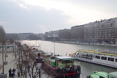
Bassin de la Villette Address: Bassin de la Villette, 61 Quai de la Seine, 75019 Paris, France street in Paris
Attractions near Bassin de la Villette
Péniche Anako,35 Quai de l'Oise,61-63 Quai de la Seine,Le Hang Art,Hang' Art,Péniche Antipode,Port de la Villette,CLCF,Chez Dav Et Jo,Subway,14 Rue de Rouen,84 Quai de la Loire,Le Pavillon des Canaux,Le Duo,Paname Brewing Company,Top Clean Pressing,Alimentation Générale,La Renaissance,15 Rue de la Moselle,Cbd ShopHow to get to popular attractions in Paris with public transit
McCann Paris, Clichy,Palais Des Congrès de Paris, Paris,Residence Orangerie, Le Chesnay,SFR Rive Défense, Nanterre,Moutarde Street, Puteaux,MRM Paris, Clichy,Musée D'Orsay, Paris,Creche Des Berceaux, Guyancourt,Tour Pacific, Puteaux,Pullman Roissy CDG, Roissy-En-France,Tour Kupka C, Puteaux,Orange Vallée, Chatillon,Théâtre du Rond-Point, Paris,Le Cube, Issy-Les-Moulineaux,Cergy, Cergy,McDonald's, Tremblay-En-France,Heineken France, Rueil-Malmaison,Café Chérie, Boulogne-Billancourt,Informatique CDC, Arcueil,Meudon, MeudonGet around Paris by public transit!
Traveling around Paris has never been so easy. See step by step directions as you travel to any attraction, street or major public transit station. View bus and train schedules, arrival times, service alerts and detailed routes on a map, so you know exactly how to get to anywhere in Paris.
When traveling to any destination around Paris use Moovit's Live Directions with Get Off Notifications to know exactly where and how far to walk, how long to wait for your line, and how many stops are left. Moovit will alert you when it's time to get off — no need to constantly re-check whether yours is the next stop.
Wondering how to use public transit in Paris or how to pay for public transit in Paris? Moovit public transit app can help you navigate your way with public transit easily, and at minimum cost. It includes public transit fees, ticket prices, and costs. Looking for a map of Paris public transit lines? Moovit public transit app shows all public transit maps in Paris with all Bus, Train, Metro, Light Rail, RER and Funicular routes and stops on an interactive map.
Paris has 6 transit type(s), including: Bus, Train, Metro, Light Rail, RER and Funicular, operated by several transit agencies, including RATP, RER, RER Bus de remplacement, Train, Train Bus de remplacement, Tramway Bus de remplacement, TER, Tramway, ADP, Noctilien, Magical Shuttle, Apolo 7, Argenteuil - Boucles de Seine, Autobus du Fort, Autocars Dominique