See Baxter Ave, Jefferson, on the map
Directions to Baxter Ave (Jefferson) with public transportation
The following transit lines have routes that pass near Baxter Ave
 Bus:
Bus:
How to get to Baxter Ave by bus?
Click on the bus route to see step by step directions with maps, line arrival times and updated time schedules.
Bus stations near Baxter Ave in Jefferson
- Castlewood @ Tyler Park,6 min walk,
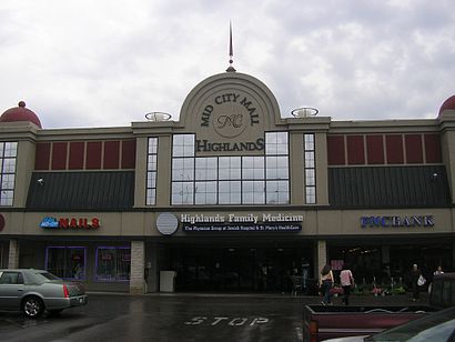
- Bardstown @ Mid City Mall,6 min walk,
Bus lines to Baxter Ave in Jefferson
- 21,Shawnee Park,
- 17,Fern Creek,
- 23,Shawnee Park,
- 40,Downtown 8th & Jefferson,
What are the closest stations to Baxter Ave?
The closest stations to Baxter Ave are:
- Castlewood @ Tyler Park is 430 yards away, 6 min walk.
- Bardstown @ Mid City Mall is 475 yards away, 6 min walk.
Which bus lines stop near Baxter Ave?
These bus lines stop near Baxter Ave: 17, 23, 25, 29.
What’s the nearest bus stop to Baxter Ave in Jefferson?
The nearest bus stops to Baxter Ave in Jefferson are Castlewood @ Tyler Park and Bardstown @ Mid City Mall. The closest one is a 6 min walk away.
See Baxter Ave, Jefferson, on the map
Public Transit to Baxter Ave in Jefferson
Wondering how to get to Baxter Ave in Jefferson, United States? Moovit helps you find the best way to get to Baxter Ave with step-by-step directions from the nearest public transit station.
Moovit provides free maps and live directions to help you navigate through your city. View schedules, routes, timetables, and find out how long does it take to get to Baxter Ave in real time.
Looking for the nearest stop or station to Baxter Ave? Check out this list of stops closest to your destination: Castlewood @ Tyler Park; Bardstown @ Mid City Mall.
Bus:
Want to see if there’s another route that gets you there at an earlier time? Moovit helps you find alternative routes or times. Get directions from and directions to Baxter Ave easily from the Moovit App or Website.
We make riding to Baxter Ave easy, which is why over 1.5 million users, including users in Jefferson, trust Moovit as the best app for public transit. You don’t need to download an individual bus app or train app, Moovit is your all-in-one transit app that helps you find the best bus time or train time available.
For information on prices of bus, costs and ride fares to Baxter Ave, please check the Moovit app.
Use the app to navigate to popular places including to the airport, hospital, stadium, grocery store, mall, coffee shop, school, college, and university.
Baxter Ave Address: Louisville, KY 40204 street in Jefferson
Attractions near Baxter Ave
Movies & More,Carteck Auto Service,Deangelis Consulting Inc,Mueller Constance CPA,Redneck Rosewood Pool,Car Tek,Carteck,Sleep Medicine Specialists,Bazo's Fresh Mexican Grill,Highlands Family Medicine,Mid-City Mall,Mesquite Tree Press LLC,Home Quarters,Bazo's,Baxter Avenue Filmworks,Jar Express,Young Adult Outpost Branch Library Louisville Free Public Library,Louisville Free Public Library-Highlands / Shelby Park,Highlands Shelby Park Branch Library Louisville Free Public Library,The Back DoorHow to get to popular attractions in Jefferson with public transit
BBC Four Roses Bourbon Barrel Loft, Louisville,Dal-Tile Corporation, Jefferson,Nichols Bus Compound, Jefferson,Nationwide Insurance, Jefferson,GE Appliance Park, Jefferson,Robley Rex VA Medical Center 800 Zorn Ave Louisville KY, Jefferson,UPS Guard Shack, Jefferson,Kentucky Driving School, Jefferson,Norton Healthcare - Brownsboro - OBC / NBH, Jefferson,KFC RSC Garden Level, Jefferson,Preston Hwy Louisville Ky, Jefferson,Atlas Machine & Supply, Jefferson,Richard B Truex Foundation, Jefferson,Nufood Consultants, Jefferson,Bonnie's Massage & Happy Ending Emporium, Jefferson,Sunny Lane, Jefferson,GE Appliance Park Bldg. 1, Jefferson,Encore Adult Day Health Center, Jefferson,Beth Minton Od, Jefferson,Sullivan University, JeffersonGet around Jefferson by public transit!
Traveling around Jefferson has never been so easy. See step by step directions as you travel to any attraction, street or major public transit station. View bus and train schedules, arrival times, service alerts and detailed routes on a map, so you know exactly how to get to anywhere in Jefferson.
When traveling to any destination around Jefferson use Moovit's Live Directions with Get Off Notifications to know exactly where and how far to walk, how long to wait for your line, and how many stops are left. Moovit will alert you when it's time to get off — no need to constantly re-check whether yours is the next stop.
Wondering how to use public transit in Jefferson or how to pay for public transit in Jefferson? Moovit public transit app can help you navigate your way with public transit easily, and at minimum cost. It includes public transit fees, ticket prices, and costs. Looking for a map of Jefferson public transit lines? Moovit public transit app shows all public transit maps in Jefferson with all bus routes and stops on an interactive map.
Jefferson has 1 transit type(s), including: bus, operated by several transit agencies, including Transit Authority of River City, Greyhound-us and FlixBus-us