How to get to Bcysa by bus?
Click on the bus route to see step by step directions with maps, line arrival times and updated time schedules.
From Sedesol, Aguascalientes
39 minFrom Claustros de Loma Dorada, Aguascalientes
43 minFrom Fraccionamiento Jardines De La Cruz, Aguascalientes
39 minFrom Paseo de la Biznaga, Aguascalientes
47 minFrom Fraccionamiento Camino Real, Aguascalientes
61 minFrom C.B.T.i.s. 195, Aguascalientes
36 minFrom J. Jesus Gomez Portugal, Aguascalientes
46 minFrom Santuario del Divino Niño Jesus, Aguascalientes
61 minFrom Escuela Secundaria Tecnica #37, Aguascalientes
69 minFrom Cbtis 284, Aguascalientes
44 min
Bus stops near Bcysa in Aguascalientes
Bus lines to Bcysa in Aguascalientes
What are the closest stations to Bcysa?
The closest stations to Bcysa are:
- Avenida Guadalupe Gonzalez, 614 is 250 meters away, 4 min walk.
- Avenida Aguascalientes Poniente, 139 is 472 meters away, 7 min walk.
- Uaa Segundo Anillo is 514 meters away, 7 min walk.
Which bus lines stop near Bcysa?
These bus lines stop near Bcysa: RUTA 19, RUTA 28, RUTA 40.
What’s the nearest bus station to Bcysa in Aguascalientes?
The nearest bus station to Bcysa in Aguascalientes is Avenida Guadalupe Gonzalez, 614. It’s a 4 min walk away.
What time is the first bus to Bcysa in Aguascalientes?
The RUTA 40 is the first bus that goes to Bcysa in Aguascalientes. It stops nearby at 6:08 AM.
What time is the last bus to Bcysa in Aguascalientes?
The RUTA 45 is the last bus that goes to Bcysa in Aguascalientes. It stops nearby at 10:10 PM.
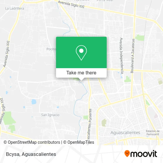
See Bcysa, Aguascalientes, on the map
Public Transit to Bcysa in Aguascalientes
Wondering how to get to Bcysa in Aguascalientes? Moovit helps you find the best way to get to Bcysa with step-by-step directions from the nearest public transit station.
Moovit provides free maps and live directions to help you navigate through your city. View schedules, routes, timetables, and find out how long does it take to get to Bcysa in real time.
Looking for the nearest stop or station to Bcysa? Check out this list of stops closest to your destination: Avenida Guadalupe Gonzalez; Avenida Aguascalientes Poniente; Uaa Segundo Anillo.
Bus: RUTA 19, RUTA 28, RUTA 40, RUTA 30, RUTA 18, RUTA 35, RUTA 45.
Want to see if there’s another route that gets you there at an earlier time? Moovit helps you find alternative routes or times. Get directions from and directions to Bcysa easily from the Moovit App or Website.
We make riding to Bcysa easy, which is why over 1.5 million users, including users in Aguascalientes, trust Moovit as the best app for public transit. You don’t need to download an individual bus app or train app, Moovit is your all-in-one transit app that helps you find the best bus time or train time available.
For information on prices of bus, costs and ride fares to Bcysa, please check the Moovit app.
Use the app to navigate to popular places including to the airport, hospital, stadium, grocery store, mall, coffee shop, school, college, and university.
Location: Aguascalientes
- Hospital Veterinario UAA,
- Dra. Mascotas,
- Avenida Guadalupe Gonzalez,
- Bachillerato En Artes Y Humanidades,
- Papeleria Yolis,
- Primo Verdad,
- 304,
- Centro Crecer Primo Verdad,
- Decoves Persianas y Cortinas,
- Iglesia de San Pio X,
- Templo San Pio X,
- Col. Primo Verdad,
- Federal Emiliano Zapata,
- Bach Artes y Humanidades,
- Residencial Campestre Club de Golf Norte,
- Noviciado de Los Siervos de Maria,
- WESTERN UNION,
- Res Campestre Club de Golf Sur,
- Centro Educativo Termapolis,
- Muebles Esepcionales Exel
Places Near Bcysa (Aguascalientes)
- Aeropuerto de Aguascalientes S.A. de C.V., Aguascalientes,
- Ciudad industrial, Aguascalientes,
- Jesús María, Aguascalientes,
- Blvd. Luis Donaldo Colosio, Aguascalientes,
- Nuevo Hospital Hidalgo, Aguascalientes,
- Parque Las Tres Centurias, Aguascalientes,
- La Isla San Marcos, Aguascalientes,
- Central De Autobuses, Aguascalientes,
- Centro Comercial Altaria, Aguascalientes,
- Hospital Imss No. 3, Aguascalientes,
- Centro, Aguascalientes,
- Isla San Marcos, Aguascalientes,
- clinica 3 uaa, Aguascalientes,
- Imss Clinica 1, Aguascalientes,
- Universidad Autónoma de Aguascalientes, Aguascalientes,
- Villasuncion, Aguascalientes,
- Agropecuario, Aguascalientes,
- Terminal De Combis, Aguascalientes,
- Villas de Nuestra Señora de la Asunción, Aguascalientes,
- ESPACIOS, Aguascalientes
How to get to popular places in Aguascalientes with public transit
Get around Aguascalientes by public transit!
Traveling around Aguascalientes has never been so easy. See step by step directions as you travel to any attraction, street or major public transit station. View bus and train schedules, arrival times, service alerts and detailed routes on a map, so you know exactly how to get to anywhere in Aguascalientes.
When traveling to any destination around Aguascalientes use Moovit's Live Directions with Get Off Notifications to know exactly where and how far to walk, how long to wait for your line, and how many stops are left. Moovit will alert you when it's time to get off — no need to constantly re-check whether yours is the next stop.
Wondering how to use public transit in Aguascalientes or how to pay for public transit in Aguascalientes? Moovit public transit app can help you navigate your way with public transit easily, and at minimum cost. It includes public transit fees, ticket prices, and costs. Looking for a map of Aguascalientes public transit lines? Moovit public transit app shows all public transit maps in Aguascalientes with all bus routes and stops on an interactive map.
Aguascalientes has 1 transit type(s), including: bus, operated by several transit agencies, including Coordinación General de Movilidad